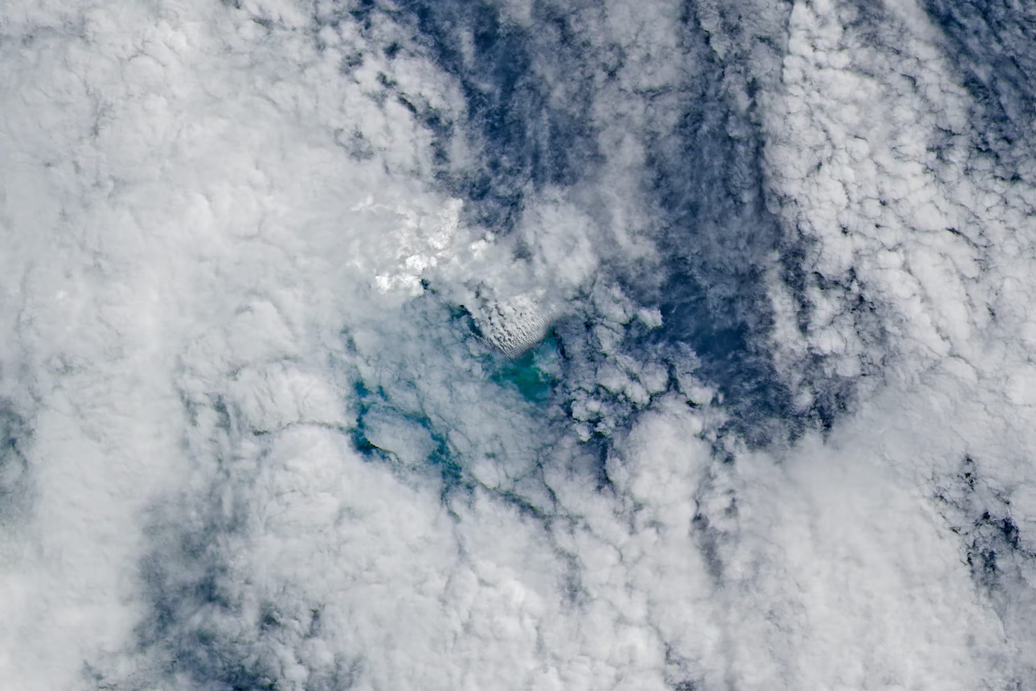
A underwater volcano until now unknown erupted in May 2026 off the Papua New Guineaalong the Titan RidgeIn the Sea of Bismarcka geologically very complex area whose seabed has not yet been mapped in detail. The eruption produced vapours, ashes and pumiceobserved thanks to NASA satellite images, arousing the interest of volcanologists who hoped to be able to witness the birth of a new islandhad the volcano continued to emit material to the surface. Today, however, volcanic activity in the area has decreased significantly.
The early stages of the underwater eruption in Papua New Guinea
The first clear signs of an imminent eruption came onMay 8, 2026when seismometers at the Rabaul Volcanological Observatory, in East New Britain, Papua New Guinea, detected a seismic swarm with epicenters located approximately 82 km south of Rambutyo island. The maximum magnitude recorded was approximately 4 on the Richter scale. In reality, some seismic events of lower intensity had already been recorded on March 31st and the April 25th of the same year. The rapid increase in the number and frequency of earthquakes observed on May 8 was the clear symptom that volcanic activity was about to begin in the area.
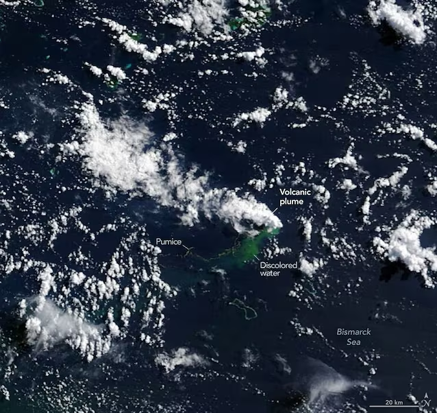
The May 9th the satellites Aqua And Earth from the NASA they immortalized white fumes that rose from the surface of the water, while the infrared sensor of the satellite PEACE has identified a marked one discoloration in the waters surrounding the eruptive site. Suddenly, therefore, volcanologists found themselves faced with the eruption of a unknown volcano in the middle of the Bismarck Sea.
Where is the unknown volcano located: Titan Ridge area in the Bismarck Sea
Contrary to what one might think, not all of the Earth’s ocean floors have been mapped with the same level of detail. Paradoxically, today we have maps of the surface of the Moon and of Mars more detailed than those of large portions of the Earth’s ocean floor. The Bismarck Sea falls precisely among these areas. There complex morphology of its seabedcharacterized by faults, volcanic systems and buildings of different nature, oceanic trenches, slopes, ridges and subduction zones, often located at depths greater than 2,000 metres, makes high-resolution mapping using sonar still particularly difficult.
From satellite images, experts were however able to locate the volcano in the region Titan Ridgeone oceanic ridge located along the border between the South Bismarck Plate and the surrounding microplates. The last documented eruption in this area occurred in 1972 from a vent located about 16 km north-west of the current eruptive area and lasted only 4 days.
The peak phase and the potential birth of a new island
Between the 10 el‘May 11th the satellites Sentinel-1 of ESA And NASA/USGS Landsat 9 they immortalized volcanic activity near the sea surface. The May 12th, instead, the instrument VIIRS (Visible Infrared Imaging Radiometer Suite), installed on the satellite Suomi NPP, he noted thermal anomalies extended over an area of approximately 7 km². Analyzing the data, the scientists concluded that a significant amount of high-temperature material must be found there near the sea surface to justify these anomalies.
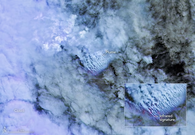
Satellite images acquired in the following days showed intense volcanic activity, characterized by a wide band of greenish water due to the discoloration caused by volcanic products, by abundant emissions of steam and ash, by extensive pumice floating rafts and from a volcanic plume which rose a few kilometers into the atmosphere.
The scientific director of Goddard Space Flight Center of NASA, Jim Garvinstated:
We are waiting with great interest to see if a new island is about to be born, a phenomenon that we have only rarely been able to observe in real time thanks to satellites.
If the eruption, in fact, had continued its development with the same intensity, according to experts, an eruption could have formed volcanic cone emerging from the seaprovided that it had not previously been eroded by the waves.
The current state of volcanic activity
In the following weeks, however, the intensity of the volcanic activity gradually increased reduced. Between 21 and 25 May, vapor emissions from the sea surface significantly decreased, as did the quantity of pumice and ash produced. On May 22, a was recorded earthquake of magnitude 5.7 and, between May 22nd and 24th, they were detected new thermal anomalies superficial, reopening the possibility of a resumption of eruptive activity.
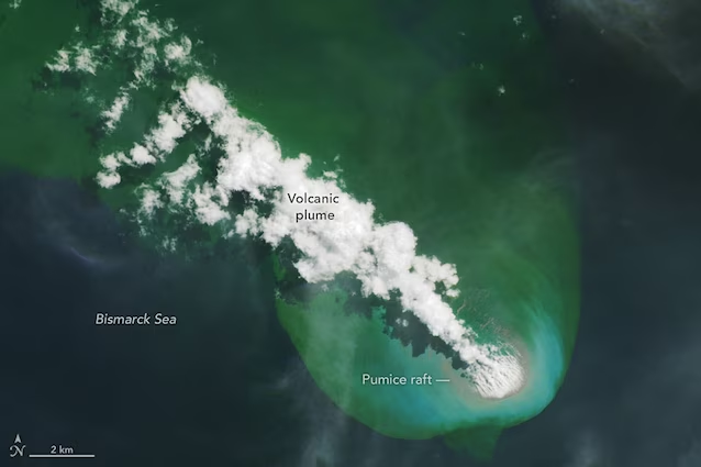
Between the 25 and 28 May the signs of the eruption weakened further, although a modest quantity of pumice and vapor continued to be produced. Between June 15 and July 3, the Titan Ridge eruption continued at very low levels. No seismic activity has been detected for over a month. A modest area of discolored water continues, however, to persist and move south and southwest. According to experts at the Rabaul Volcanological Observatory, at the moment the volcanic activity seems to follow its natural coursereducing the chances of witnessing the birth of a new island.
