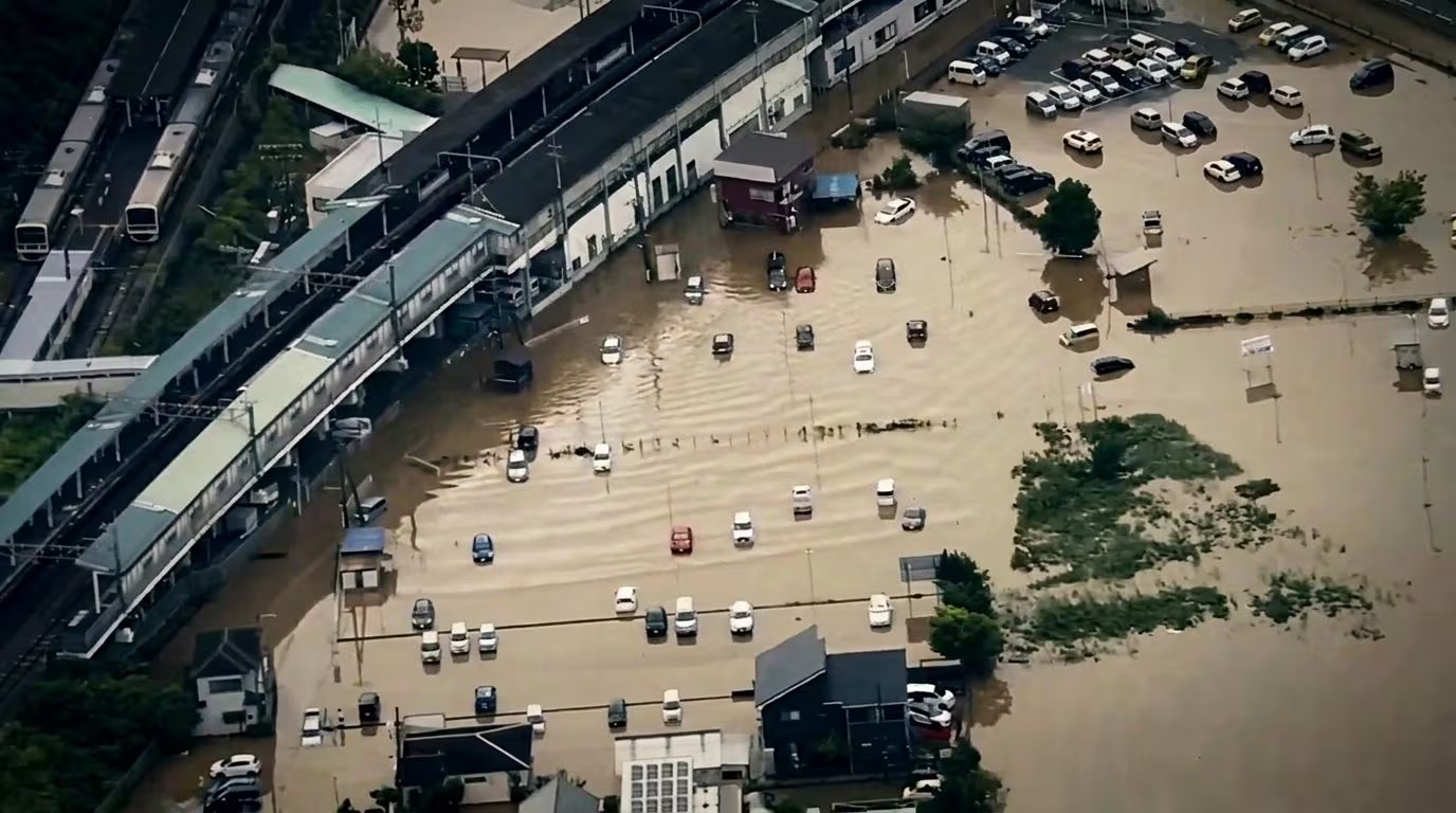
In the last hours the prefecture of Chibathe area of Ibaraki and the metropolitan hinterland east of Tokyo were overwhelmed by a strong wave of unprecedented bad weather. The temporary budget of the news is dramatic: they are counted at least 8 confirmed victimsseveral missing, dozens injured and over 10,000 people evacuated as a precaution. They registered in Chiba record rainfall with peaks exceeding 300 mm in just 6 hoursa quantity that significantly exceeds the average rainfall for an entire summer month. As reported by Ansa, triple the average of normal rainfall in August, with over 100mm per hour.
The violence of the water caused theflooding of several waterways secondary and hundreds of landslides, paralyzing transport: the international airport of Narita had to cancel over 100 flights and halt ground operations due to the flooding of runways and terminal areas, while the circulation of high-speed trains Shinkansen along the eastern route has been temporarily suspended. In Chiba Prefecture there were power outages in more than 20,000 homes. But from a scientific and meteorological point of view, what exactly happened above the skies of Japan? And how the global warming is exacerbating these phenomena?
Flood in Japan: self-healing storms
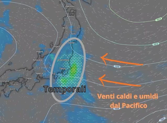
To understand the violence of the event we must look at how summer precipitation forms in the Far East. This time of year, the air hot and dense with humidity coming from the Pacific Ocean it encounters the complex Japanese orography and slightly cooler currents descending from the north to those latitudes.
When this enormous amount of water vapor rises, it quickly condenses, giving rise to storm clouds. In extreme cases like that of Chiba, the so-called Lines of Convergence of the Air Mass. These are real ones highways of thunderstorms which continuously self-regenerate (self-healing thunderstorms) and remain stuck on the same portion of territory for many hours. This means that, instead of seeing a short-lived transient storm, they fall in the same area hundreds of millimeters of rain within a few hours, equaling the values that would normally be recorded over an entire summer month.
The effects of torrential rains: from the saturation of the earth to the blocking of infrastructures
When such a large quantity of water falls on an anthropized territory or on hill slopes, the soil’s response is immediate. First occurs the soil saturationwhich absorbs water up to its physical limit; once this threshold is exceeded, the excess water begins to flow violently to the surface through the phenomenon of run-offtransforming streets and urban centers into veritable raging rivers.
At the same time, the weight of the accumulated water and the increase in pressure between the pores of the earth reduce the cohesion of the soil, triggering a strong risk of hydrogeological instability with landslides and sudden mudslides that overwhelm homes and communication routes. This dynamic inevitably leads to one infrastructure paralysis: the flooding of Narita airport’s runways and terminals, along with the suspension of high-speed trains Shinkansendemonstrates how even a country at the forefront of risk management like Japan can find itself in extreme difficulty when faced with volumes of water of this flow rate. Let’s remember that Japan is very similar to Italy from an orographic point of view.
The role of global warming: extra energy in the atmosphere
The key ingredient of these disasters is the energy present in the atmosphereand it is precisely here that climate change plays a decisive role. According to the physical law of Clausius-Clapeyronfor every degree Celsius (°C) increase in global temperature, the atmosphere is able to retain approximately 7% more water vapor.
The increasingly higher surface temperatures of waters of the western Pacific they cause greater evaporation, creating a vastly larger reservoir of potential water available to storms. When this warm, super-humid air rises to altitude and condenses, it releases a gigantic amount of latent heat which further fuels the violence of the updrafts, transforming the storm into a very powerful heat engine. Global warming does not create a single storm event alone, but it does it exaggerates intensity and stationaritytransforming extreme rainfall phenomena that once rarely occurred into increasingly frequent seasonal events.
