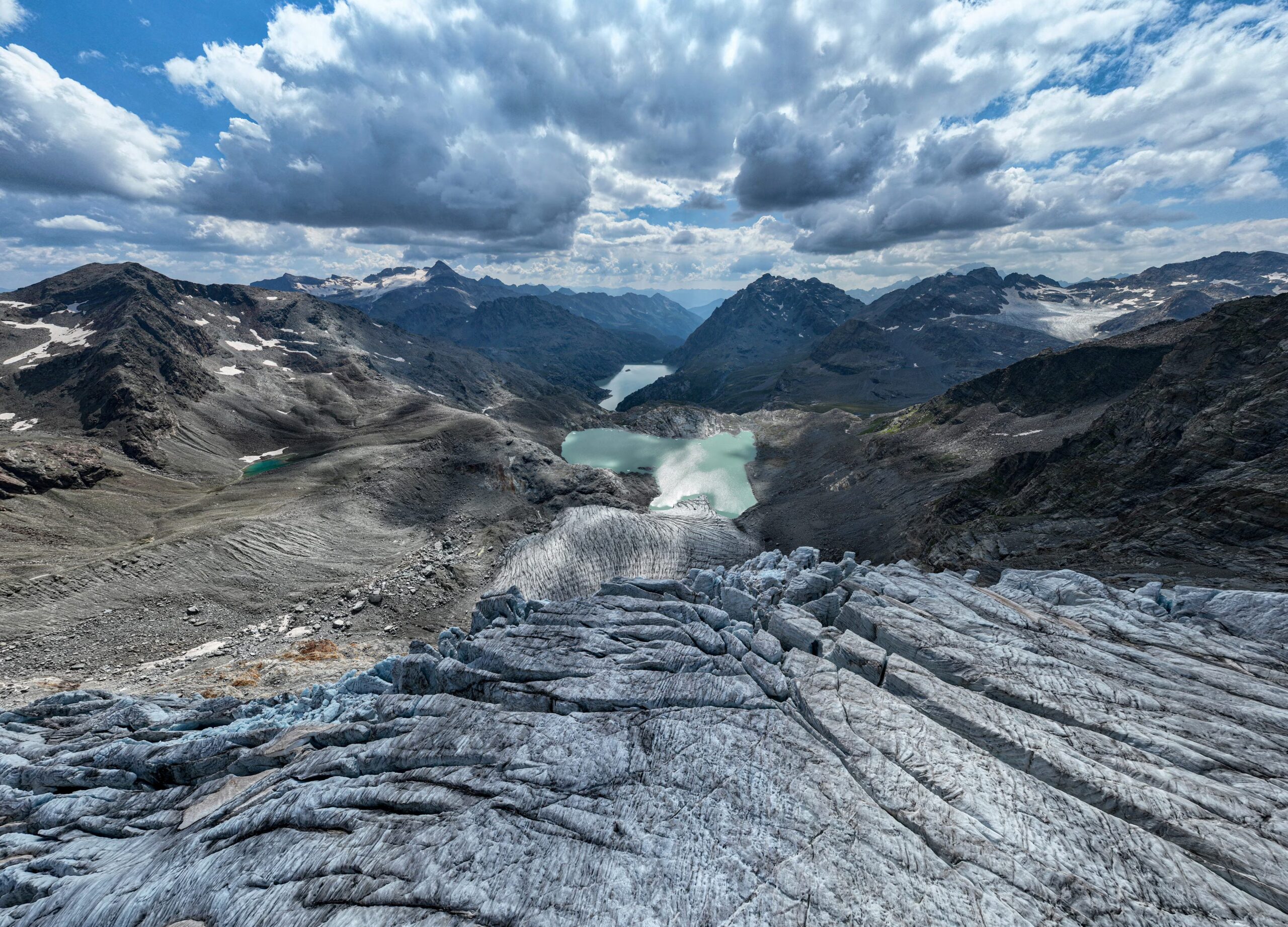
THE’INGV (National Institute of Geophysics and Volcanology) has started the new one iCEALP research project (ice-Climate-solid Earth coupling driving ALPine uplift), which aims to understand and quantify the impact of climate change (between melting glaciers, drought and extreme hydrogeological events) on earth’s crustparticularly on Alps. The variation in the distribution of water and ice masses that climate change brings influences the stresses to which the crust is subjected. This results in effects on stability of the slopes mountainous andseismic activity local.
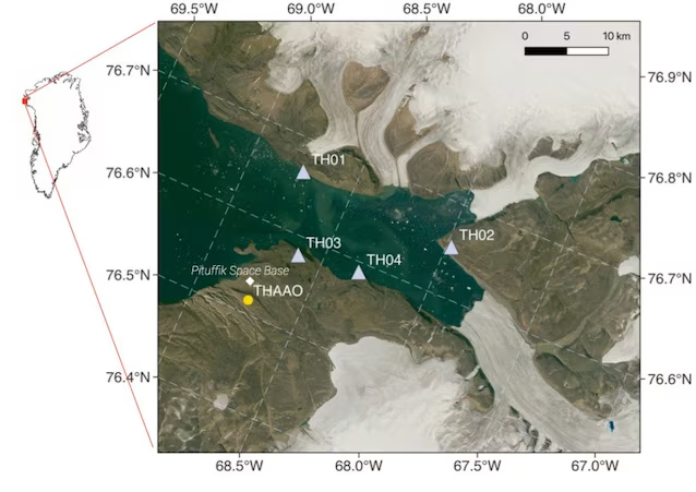
The iCEALP project, launched in July, will integrate all observations for simulate future scenarios up to 2050 and beyondthanks to aDigital Twin“, or “digital twin” of the Alpine system. The data will be acquired thanks to two observersone, “AMIGHO”, on Alpsin the Monte Rosa area, and one, “HySO”, in Greenland, in the Wolstenholme Fjord. The project, which is part of the Dynamic Planet program 2026-2029is coordinated by INGV and involves numerous Italian and international universities and research institutes.
The study on the link between climate and the earth’s crust
The Earth is a systemthat is, a set made up of different components that interact with each other. Changes that affect one of these components have repercussions on the others. In the context of current climate change, the interactions between the atmosphere and liquid and solid water are the subject of countless studies. On the contrary, the dynamics affecting the lithosphereparticularly from a tectonic point of view, are often studied separately.
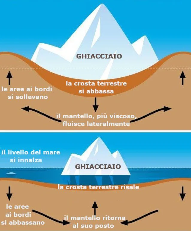
The new INGV project instead provides one integrated study which considers the effects of climate change also on the earth’s crust. Landslides due to permafrost melting they are only the most superficial effect that rising temperatures have on the solid Earth. What also makes the slopes of the reliefs unstable is the uplift of the earth’s crustdue to the melting of the ice that covers it. THE glaciers they exert enormous pressure on it, which decreases as they melt. Consequently, the solid lithosphere, which floats on the underlying more viscous mantle, rises under the area where the ice melts, with a sort of “rebound”. This vertical movement, which is called “isostatic adjustment” allows the crust to reach an equilibrium condition by floating above the mantle.
At the same time, however, it makes the slopes more fragile and unstable, causing landslides. Such readjustments can also reactivate pre-existing faults and consequently generate seismic movements; similarly also extreme weather events and the drought contribute to altering the internal pressures of the earth’s crust.
The “Digital Twin” of the Alpine system and the observatories in the Alps and Greenland
The iCEALP project intends to precisely measure these effects by integrating geodetic, seismological, hydrological and satellite data into three-dimensional numerical models. To do this, a “Digital Twin” (“digital twin”): a digital replica of a physical object that allows us to know and predict the effects that certain conditions cause on the object.
The “Digital Twin” of the Alpine system will be able to integrate information for simulate future scenarios up to 2050 and beyond. The project also includes the implementation inMonte Rosa area ofAMIGHO geophysical observatory (Alpine Mountain Integrated Geophysical High-altitude Observatory) which will monitor the Alpine areas where the effects of climate change are most intense. The Alps represent a context particularly vulnerable to climate change, where geodynamic, tectonic, climatic and hydrological processes interact.
Before applying the models to the Alpine system, it will be necessary to calibrate them on another environment, that of the Greenland. That’s because the Greenland ice sheet is leaking about 200 billion tons of ice per yearan enormous loss which determines a more marked crustal uplift compared to the Alps. To obtain more precise data on this context, theHySO polar observatory (Hydro-Seismological Observatory), already operational in northwestern Greenland.
Thanks to the iCEALP project you will have a greater understanding of effects of climate change on crustal deformation terrestrial and above associated geological risks. The new information that these studies will provide will be used to improve the monitoring of our mountains and for risk prevention.
