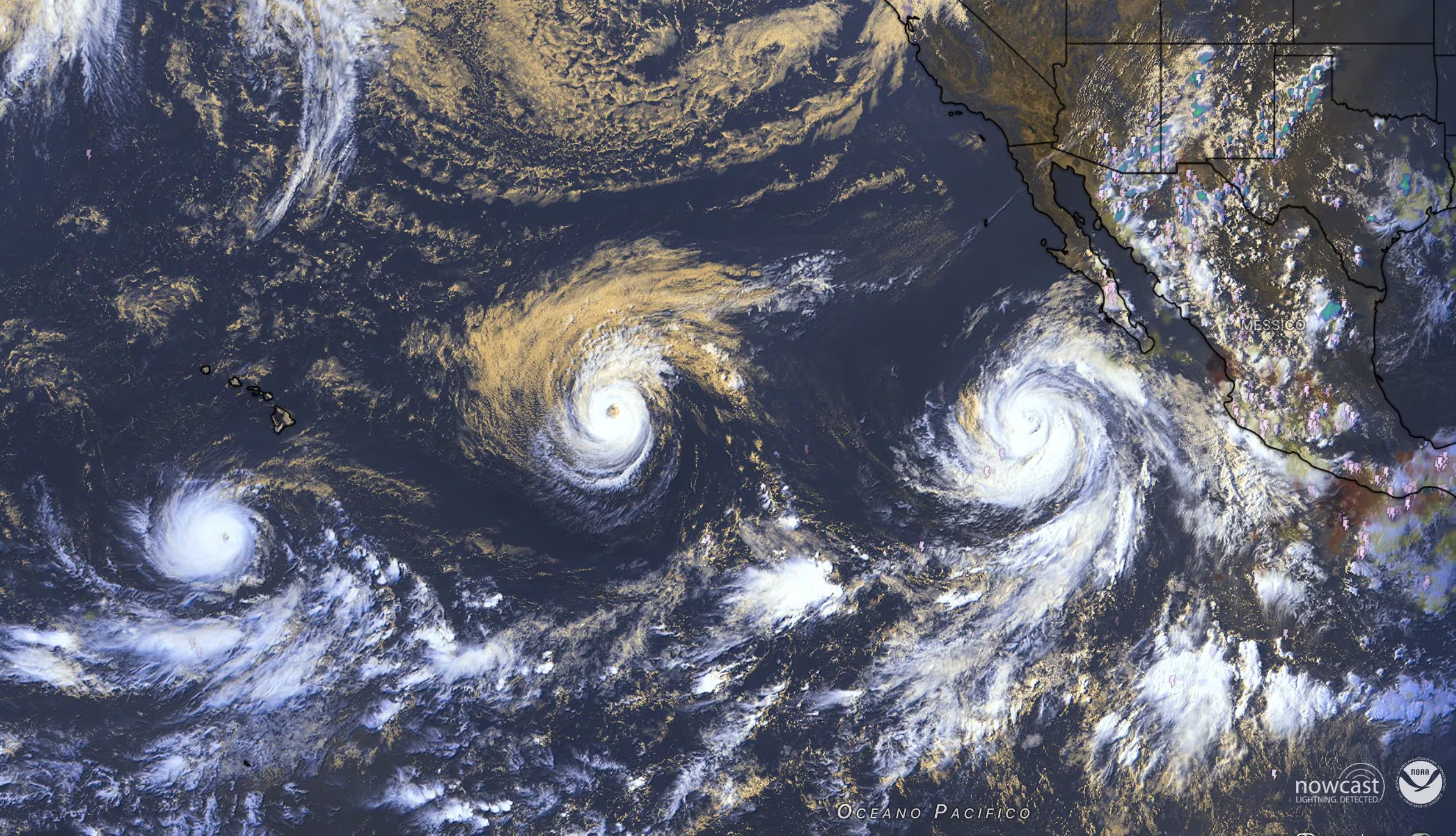
Tking hurricanes I am active at the same time in the heart ofPacific Oceanwhere nature is staging a show as fascinating as it is disturbing: renamed Lowell, Karina and Marie, they now head towards the Hawaii.
This is an extraordinary synchrony event that was not recorded for over ten years. In fact, the last precedent dates back to 2015a year that coincides not by chance with one of Super El Niño most powerful ever documented in recent history, when the protagonists were Kilo, Ignacio and Jimena who all three reached category 4.
This coincidence is not a simple coincidence, but the very first and tangible one empirical confirmation that the new cycle of El Niño It’s entering its phase more aggressivestarting to discharge the immense quantity of energy accumulated in tropical waters into the atmosphere.
The trajectories of Lowell, Karina and Marie: the real-time map
The three hurricanes that are crowding the Pacific have been named Lowell, Karina and Marie. They are moving serially along the east-central Pacific routes, following a trajectory that takes them to point openly towards the Hawaiian archipelago. Their route can be followed in real time on the website Central Pacific Hurricane Center of NOAA (the US agency that studies climate, atmosphere and oceans), available at this link. More specifically:
- Hurricane Lowell: it is the closest and most threatening to the archipelago. It has reached the frightening power of Category 5with winds around 250 km/h. Located a few hundred kilometers south of Hawaii, fortunately it is parading without touching the ground directly. However, its enormous size is rearing its ugly head waves over 4-5 meters high on the coasts facing south, causing strong storms and very dangerous rip currents.
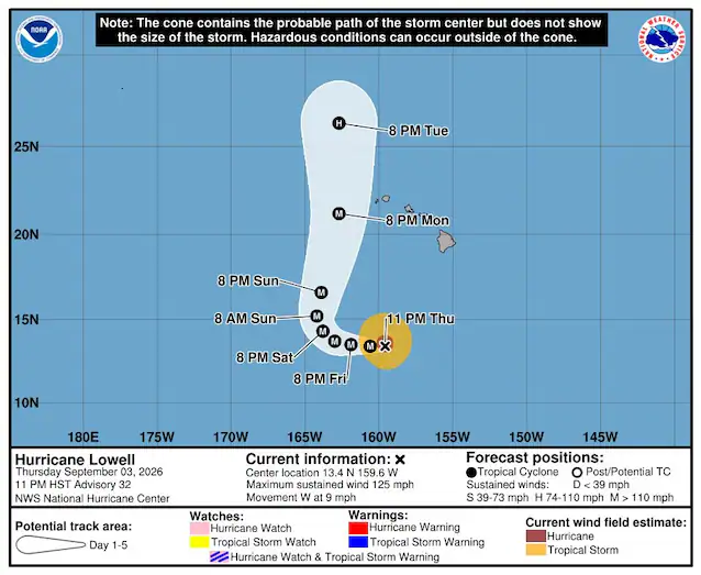
- Hurricane Karina: it strengthened up to Category 4bringing twenty to 230 km/h in the middle of the ocean. It is traveling west-northwest and pushing massive storm surges towards the coasts of Mexico and California.
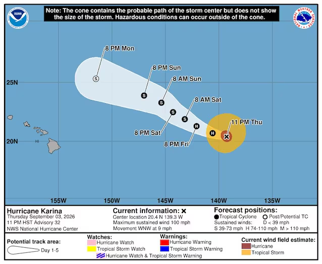
- Hurricane Marie: He is the youngest of the trio. Starting as a simple storm, it quickly grew into a Category 2 hurricane with winds exceeding 130 km/hmoving up the Mexican coast and bringing heavy rains headed towards the Southwestern United States.
The link of the three hurricanes in the Pacific to El Niño: why did the ocean explode?
From an atmospheric physics perspective, the simultaneous formation of three cyclones of this magnitude requires two key ingredients: surface waters above 28-29°C and a low wind shear (i.e. the little variation in winds at different altitudes, which would otherwise break the vortices).
This is exactly the “meltagun” loaded by El Niño. By modifying the equatorial atmospheric circulation, the phenomenon causes a strong warming of Pacific waters and breaks down wind shear, creating the ideal terrain for the birth of continuous cyclones. Compared to the 2015 event, the fundamental difference today is that this El Niño is grafted onto a global ocean temperature already at historic highs due to the anthropogenic warmingproviding the atmosphere with a boundless supply of potential energy.
