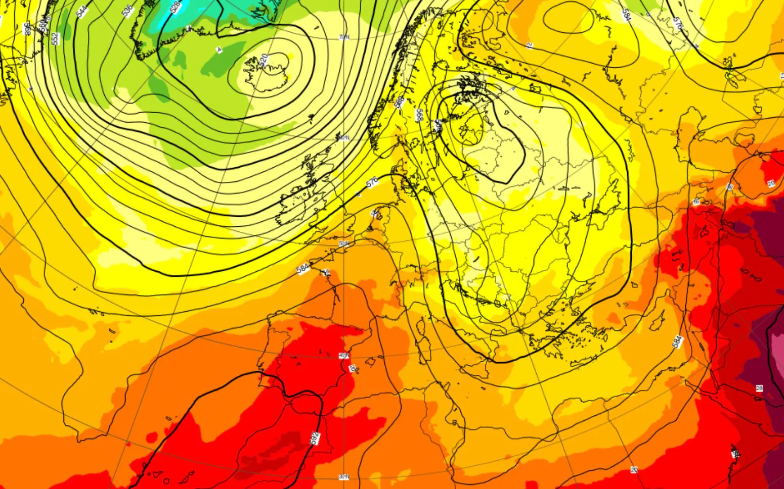
The awakening on Thursday 24 September made it clear to everyone that the atmosphere in our country has definitely changed, trying to give us a first taste of autumn. The thermal values recorded at dawn recorded a clear and widespread collapse of minimumsa real refinement of the heat of recent days. In Po Valley the thermometers dropped sharply until they reached values between 10°C and 13°Cwhile even along the coasts of Liguria values were recorded around 16°C. The early morning cold was also strongly felt along the Adriatic side, with the Marche and Abruzzo coasts dropping to 13°Carriving in the internal areas of the Center, such as in the province of Florenceto go down locally also below 10°C.
All this is the result of one meteorological scenario split in two on a continental scale. On the one hand we have the presence of a vast and robust field of high pressure positioned over Western Europe, which acts like a wall blocking the way to classic Atlantic disturbances. On the other side, along the eastern edge of this large anticyclonic figure, significantly more airflow flows fresh descending from the Balkans, heading towards the Mediterranean basin.
When and where bad weather starts: the forecast
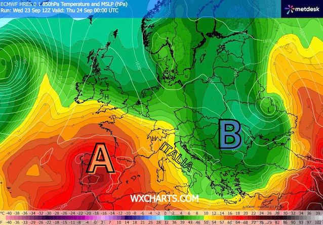
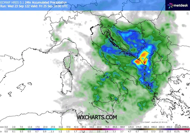
This first influx from the north-east has already shown its effects with the crisp lows of these hours, but it is only a taste. The most dynamic and penetrating phase of this configuration is in fact expected between Thursday night and the morning of Friday 25 Septemberwhen a second pulse colder and more unstable will make its full-strength entry into Italian territory.
This new worsening will be rapid but incisive. The first ones strong thunderstorms they will be triggered during the night hours starting from Triveneto and along the coasts of medium-upper Adriatic. Subsequently, between dawn and early morning on Friday, the front will slide at great speed towards the South, directly affecting the Centre-South and the lower Tyrrhenian Sea. At this juncture even large cities such as Rome and in particular Naples they will see the passage of short but locally intense thundershowers. It will be a quick weather blitz, destined to leave the country almost completely dry North-Westprotected by the Alpine arc and by the greater proximity to the high pressure shield.
Heat and high pressure return to Italy
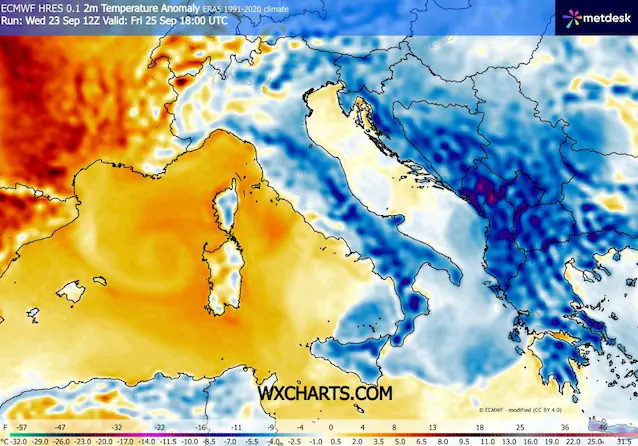
Following this second storm passage we will observe a further heat drop which will involve practically the whole country. The drop in temperatures will be felt more decisively along the way Adriatic strip and on the regions of South. On Friday, in fact, the maximum values will have a very difficult time exceeding 25°C on the Adriatic plains and coasts as well as in the far South. Along the Tyrrhenian coast the thermometers will be approximately between 24°C and 27°Cwhile the latest tips of 30°C will remain confined almost exclusively indoors Sardinia. The minimum temperatures will drop to 14-16°C even in large cities such as Ancona, Pescara, Bari, Rome and Naples.
Looking at the overall picture from a climatological point of view, this step will favor a general return to the averages of the period on a national scale. The Adriatic regions and part of the South will temporarily even fall below the typical values of the end of September, balancing out the slight positive anomalies that will continue to be recorded on the Tyrrhenian sides and on the Major Islands.
Who hopes that this episode represents the definitive “season break” and the start of the real autumn, however, will be disappointed. We are not faced with a permanent change of pace in the continental climate. Already during the weekend high pressure will in fact return to expand and take over the central-western Mediterranean, restoring conditions largely stable weather and favoring a new, gradual rise in temperatures as early as Monday 28th, with peaks of 30°C in Cagliari, Aosta, Terni, Benevento, Florence and Rome.
The final phase of September will therefore continue to show an anomalous face and without the large autumn rains. To attend a real change of scenery with extensive disturbances and a lasting temperature drop we will most likely have to wait until the first days of October.
