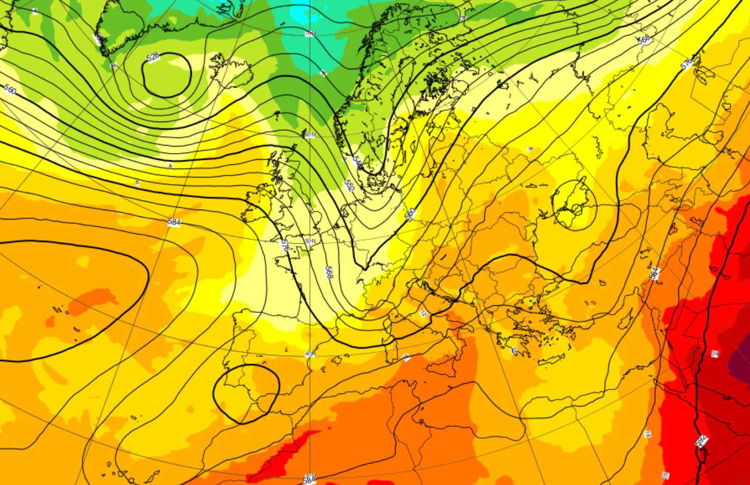
After a long period characterized by a decidedly anomalous and typically summer meteorological phase more than autumnal, here as announced in the “October trend”, after an anti-cyclonic and hot start to the month, autumn really seems to want to start getting serious in Italy, starting from this week, already from Tuesday 6 October.
The bell of high pressure that for days held the central Mediterranean basin hostage, instead helping to block the disturbances in Spain and France, is about to give way to a change in configuration on a continental scale. The failure of the anticyclonic shield it will allow the Atlantic currents to lower in latitude, pushing the first truly organized fronts of oceanic origin towards our Peninsula.
Two disturbances in the heart of the week, autumn 2026 tries to take center stage
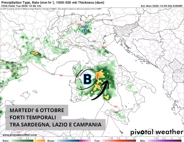
The day of Tuesday 6 October will see it as being under special surveillance central Tyrrhenian belt. The models show the depth of a particularly narrow but vigorous low depressioncapable of triggering marked atmospheric instability. This vortex, fueled by strong local thermal contrasts, will generate intense upward motions with the development of extensive storm systems.
It stands out among the cities at greatest risk Romein pole position for the transit of violent storms. The capital, together with the coastal and plain sectors of Lazio, could record strong rainslightning strikes and related local gusts of wind. As the hours pass, the system will tend to move progressively southwards, involving Campania and the city of Naples by the eveningalways with phenomena a stormy character and potential flash flooding in urban sections at greatest hydrogeological risk. Sardinia is also under special surveillance.
However, this first unstable step will represent only one appetizers of what awaits our country in the following days. In fact, it will be the trailblazer for the real disruptionthe structured front capable of definitively breaking down and undermining the residual high pressure structure over the Mediterranean.
Between Wednesday evening and Thursday 8 Octobera classic Atlantic perturbed front it will make its entry starting from the western sectors, advancing from west to east. The disturbance will distribute widespread showers and organized thunderstorms over a large part of the national territory, starting from the regions of the North-West and Sardinia, and then rapidly extending to the rest of the North, to the Center and finally to the South. maximum attention will remain focused once again on Tyrrhenian areaspositioned along the direct collision line between the humid currents of Libeccio and Scirocco.
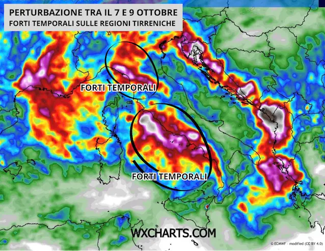
What makes the meteorological situation potentially delicate is thehigh energy content accumulated by Italian sea basins during the long phase of unseasonal heat. Currently, the surface temperatures of our seas are still registering values around 25°Cthat is to say 2-3°C above the climatological average of the period. The impact between the first significantly cooler air at altitude and such a warm sea surface will provide an enormous amount of water vapor and latent heatacting as a real fuel for the development of self-healing storm systems.
Following the perturbed front, however, there will be a general and marked decrease in temperature: it will go down by Friday even 6-7 °C compared to the values recorded at the beginning of this month. The significant decrease in temperatures will remove the last hot anomalies, bringing the thermal values back up more autumnal standards than summer from north to south, although in a context that is always rather mild.
The outlook for the weekend between 10 and 11 October 2026
The worsening, however energetic and widespread, may not, however, translate into a lasting crisis for the season. The latest projections of the mathematical models indicate that the cyclonic vortex will tend to move rapidly towards the east already on Friday, with the latest storms only in the Adriatic regions and in the South.
Consequently, in view of the weekend between Saturday 10th and Sunday 11th Octobera progressive and decisive outcome is expected improvement in weather conditions. The expansion of a new anticyclonic promontory will guarantee a phase of regained atmospheric stability over much of Italy, but with thermal values more suited to the period.
