There is an old popular saying according to which after a scorching summer there always comes a winter of times gone by, with frost and lots of snow. But what is the truth behind this belief? As the cold season approaches, the curiosity to understand whether we will go back to skiing like we used to or whether the usual subdued season awaits us inevitably grows. To answer these questions on a scientific basis and without falling into the usual alarmism, the Central European for Medium-Range Weather Forecasts (ECMWF) released his first seasonal projections for winter 2026-2027outlining the trend for the months of December, January and February. Before finding out what the models indicate, there is a fundamental assumption to clarify: Seasonal projections are not weather forecasts in the classical sense. They don’t tell us if it will rain at Christmas or if it will snow in our city on January 15th, but they represent probabilistic calculations designed to estimate the average anomalies of temperature and precipitation compared to the last thirty years.
What the maps say about temperatures, rain and snow in Italy
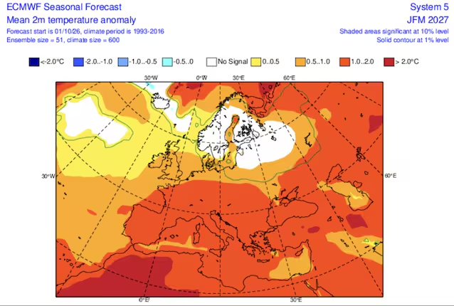
Despite the popular idea that links a hot summer to a harsh winter, the ECMWF supercomputer simulations trace a different path: for central-southern Europe the trend still sees temperatures above the climatological average. The maps show a positive thermal anomaly ranging on average between +0.5°C and +1.5°C over much of the Mediterranean basin, including Italy. This data fits into the broader context of global warming, which for years has made European winters overall milder than in the past. However, a positive average anomaly does not exclude the arrival of cold phases: it simply means that, averaging the entire quarter, there will be statistically more days that are warmer than normal. The outbreaks of freezing air from the East or the North Pole are in fact rapid events (5-7 days) that seasonal models cannot detect months in advance.
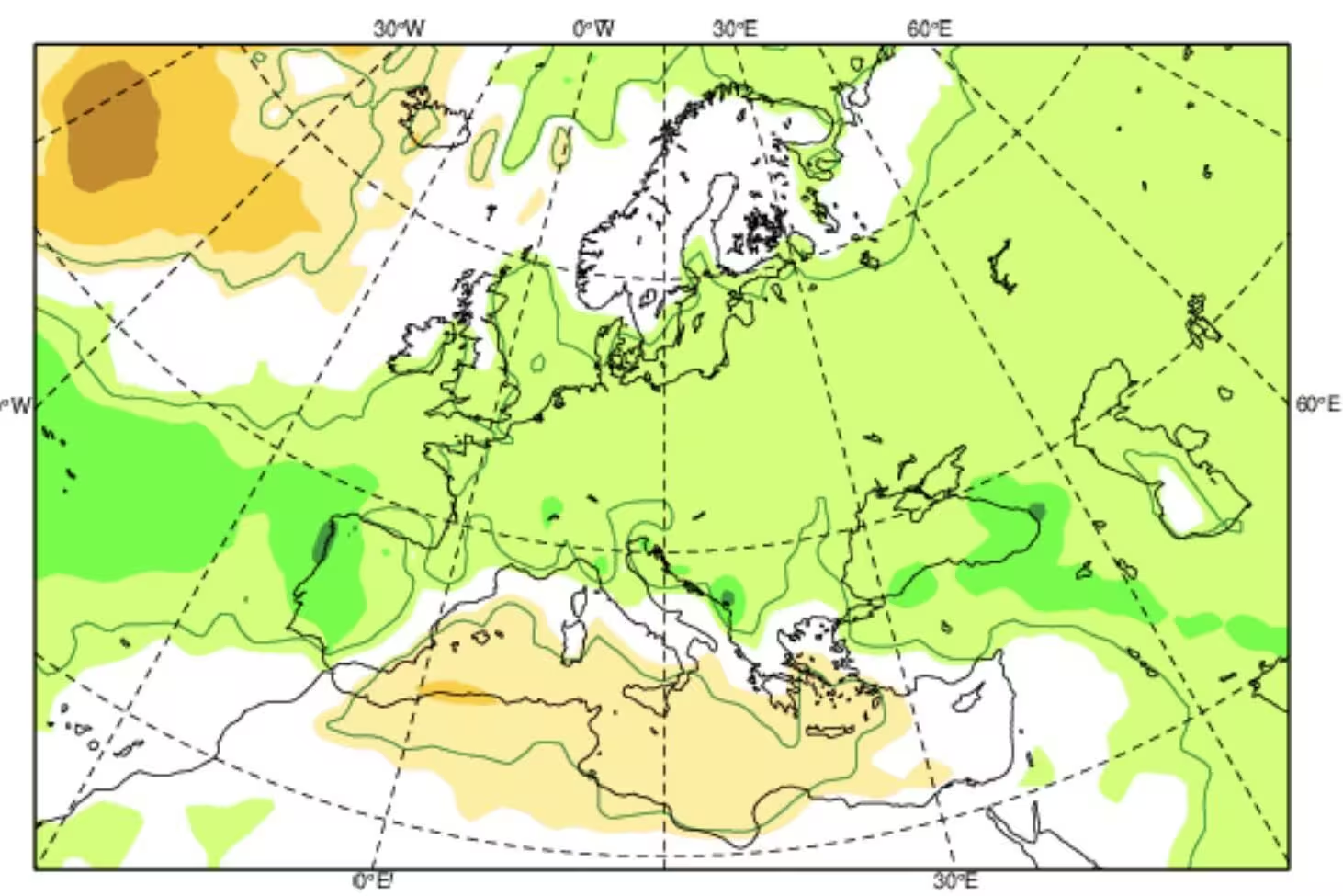
On the front of rain and snowthe European model outlines a panorama for Italy with probabilities oriented towards a regime in line or slightly above seasonal averagesin particular along the Tyrrhenian coast and on the reliefs. This scenario suggests the regular transit of Atlantic disturbances. To the delight of ski enthusiasts, the determining factor will be the share of temperatures during individual worsening: in the Alps and the high Apennines, the supply of abundant precipitation could guarantee good snow accumulations at medium-high altitudeswhile on the plains the presence of above-normal temperatures reduces the probability of lasting snowfall on the plain, relegating them to isolated and temporary episodes.
The major climate factors and the necessary scientific prudence
To understand the origin of these trends we need to look at the major “drivers” of global climate that influence supercomputer calculations. Among the key factors we find the state of variability of the equatorial tropical Pacific Ocean (ENSO) watersthe trend of North Atlantic Oscillation (NAO)or the pressure swing between Iceland and the Azores that pushes the disturbances towards the Mediterranean, and finally the stability of the Polar Vortexthe giant cyclonic structure of freezing air over the North Pole. If the vortex remains compact, the cold remains confined to high latitudes; if, on the other hand, it undergoes ruptures or “splits”, the freezing air can suddenly slide southwards, distorting the regional patterns.
In conclusion, it is necessary to reiterate nature exclusively probabilistic of these maps. The margin of uncertainty at this temporal distance remains high: a change in the disposition of high pressures in the Atlantic or a sudden warming of the stratosphere above the Pole is enough to change the trajectory of the air masses in the space of a few weeks. ECMWF projections for Winter 2026-2027 provide a very useful bottom trend linebut to have an operational and safe picture of the real weather of our peninsula it will be necessary to wait for the short and medium range bulletins.
