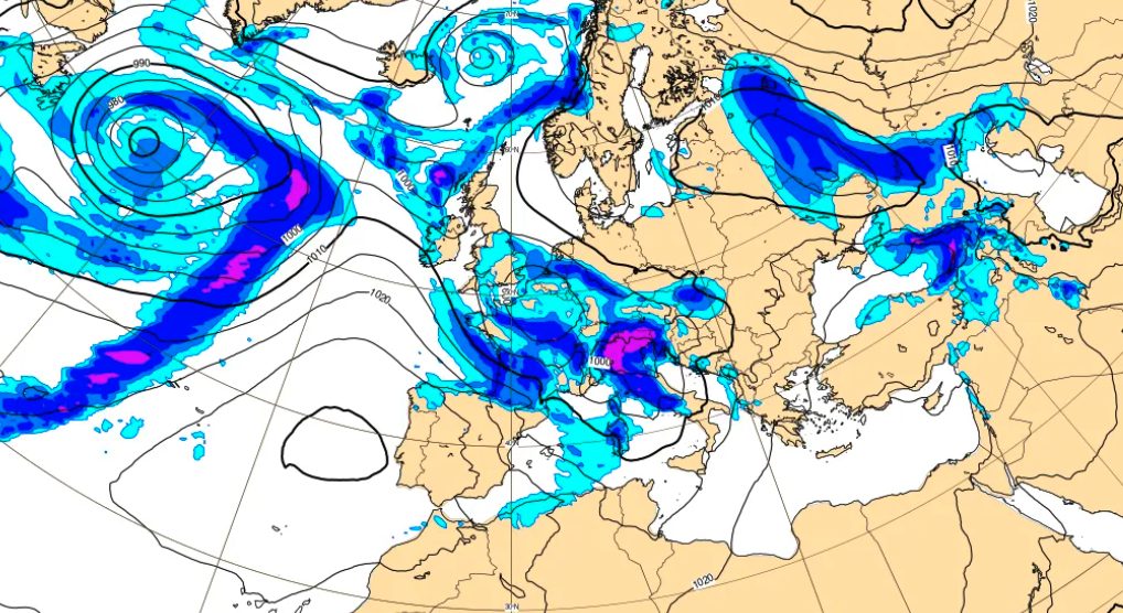
A new Atlantic disturbance is affecting Italy: it is the storm Pedroa cyclone originating in the waters of the‘North Atlantic – now fallen off the coast of Liguria – which will bring widespread rain, snowfall and winds of up to 100 km/h today 19 February and tomorrow 20 February. The bad weather will initially hit the Central-North (especially the Liguria and part of the Tyrrhenian side), and then moved southwards: to Genoa 52 people they were evacuate after the collapse of a wall due to bad weather, while the Civil Protection issued theyellow alert for hydrogeological risk in nine regions (Abruzzo, Calabria, Emilia-Romagna, Friuli-Venezia Giulia, Lazio, Lombardy, Molise, Tuscany and Umbria). They are expected in the Alps heavy snowfallwith accumulations of up to 40-50 centimeters in just 24 hours above 1,000 metres.
Storm Pedro, among other things, has already caused a lot of disruption and flooding in some regions of France and Spain. But have you ever wondered who gives names to these storms, including the Cyclone Harry which last January caused huge damage in Southern Italy? This is not a random choice, but part of one strategy designed to attract the attention of citizens: assigning simple and easily recognizable names to the cyclones with the greatest impact facilitates communication between the media, institutions and the population, making the perception of the risk and potential damage to come more immediate.
Why this storm was renamed Pedro: who decides?
There storm Pedro belongs to that category of high-impact meteorological phenomena to which it comes assigned a name: this is not a random choice, but the idea is linked to the population’s perception of risk.
The inhabitants, in fact, tend to lend greater attention to the atmospheric phenomenon if it is given a real name, rather than a generic name (such as, in this case, it could be “Atlantic Depression”). This is why from 7 October 2025 to today, another 15 storms of great intensity in Europe have been given a proper name, as can be seen in the post by X below from AEMET, the Spanish Meteorological Agency.
Naming a weather event can also be helpful for facilitate communication between media and institutionsmaking the message more immediate, direct and perceptible, exactly as happens with hurricanes in the United States.
But who assigns these names? Since 2017, the names of high-impact storms are established by mutual agreement by the official meteorological services of Spain, France, Portugal, Belgium, Luxembourg and Andorra. At the start of the season, on 1 September 2025, the list of around 20 names (male and female, in alternating order) to be used for particularly intense storms arriving in south-western Europe had already been presented.
And if the origin of the name “Pedro” may be curious, equally interesting are the numbers related to season in progress (2025-2026). So far, in fact, a total of have been renamed 16 storms (Pedro included): a high number, but not an absolute record, which remains in the hands of the 2023-2024 season, with 17 storms. Unlike that year, however, in which it took six months to reach the total, the 16 current storms have followed one another in just four months.
Storm Pedro forecast: where it will hit
So, what should we expect in Italy from Cyclone Pedro? According to forecasts, Liguria and the Tyrrhenian side will be among the most affected areas today, 19 February, while in the Alpine arc pretty heavy snowfallwith accumulations of up to 40-50 cm in just 24 hours. However, the low pressure center responsible for the storm will move rapidly, allowing for a gradual improvement of the weather on Central-North starting tomorrow, Friday 20 February. In the South, however, instability will persist longer, with rain, thunderstorms and snowfall. The winds will remain strong, in particular on the major islands and along the central-northern Adriatic: in Sardinia Gale winds are expected which could cause storm surges along the coasts.
More specifically, the forecast for February 20 indicates that:
- In the North rainfall will be intense especially in Lombardy, Veneto, Friuli-Venezia Giulia and Emilia-Romagna.
- At the Center the rains will mainly affect Tuscany, Umbria and Lazio, as well as Sardinia. The weather will remain unstable along the Adriatic and up to the Apennines.
- In the South widespread instability is expected, with showers and thunderstorms alternating with brief sunny spells, particularly in Sicily.