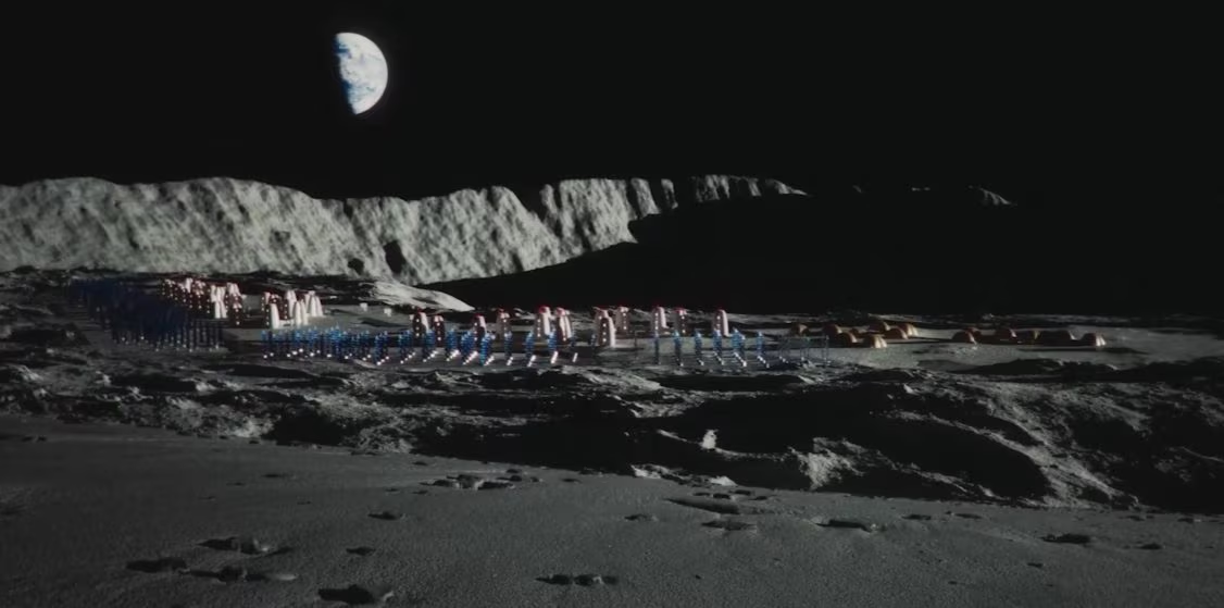
The Moon is slowly contracting as its core cools: by analyzing thousands of faults identified in images from NASA’s Lunar Reconnaissance Orbiter, researchers have estimated a radius reduction of about 44 meters in 400-800 million years, with implications for future human settlements in the Moon’s south pole.
A study on The Planetary Science Journal provided the most comprehensive assessment of the phenomenon of the recent contraction of the lunar radius through the census of compressional faults scattered all over the lunar surface. Analyzing the probe images Lunar Reconnaissance Orbiter (LRO), the authors estimate that the observed tectonic structures correspond to a decrease in the Moon’s radius of approximately 44 metres.
By analyzing images of the lunar surface, the researchers carried out a census of one particular category of tectonic structures. They identified further 10,000 surface geological structures attributable to compressional faults and estimated that the decrease in lunar ray occurred in last 400-800 million years. The average radius of the Moon is approx 1,737 kilometersso a contraction of a few tens of meters is very small compared to its overall size.
This small decrease, however, has a non-negligible effect on the dynamics of lunar faults and ha a concrete consequence for future human space exploration of the lunar south pole. In fact the Apollo missions they had already collected seismic data proving the existence of shallow lunar earthquakes. The research therefore highlights the need to better understand where lunar surface faults are located and under what conditions they might generate earthquakes for the choice of landing sites and for the design of infrastructure on the lunar surface.
The risk is relevant right at the south polewhere interest in water ice leads to exploration of steep-walled lunar craters and the interior of permanently shadowed areas, such as those of Shackleton Crater. Regolith landslides could in fact be generated following weak shaking and earthquakes caused by the tectonic structures identified in this research and still active on the lunar surface.
Ancient and recent cooling of the Moon
There Moon formed about 4.5 billion of years ago from the debris of the collision between the proto-Earth and a body the size of Mars (called by scientists Theia). This was a highly energetic event that made the proto-Moon a completely molten body.
In the first million years following this event (estimated between 150 and 200 million years) the primordial heat and the decay of radioactive elements maintained very high temperatures throughout the mantle and core. Over the next billion yearsThe Moon slowly cooled and contracted.
The residual heat of training and the slow decay of radioactive elements they fueled its thermal evolution with the interior (the core and mantle) which gradually cooled and contracted and the external layers which instead had solidified long before.
The authors of the research hypothesize that in the primordial phases of the Moon’s cooling there was not widespread faulting of its surface as we see it today. A thick and porous crust it would have insulated the hot interior, slowing down its cooling and therefore its contraction. According to their hypothesis, the heat would have remained trapped for a long time and the contraction would have only recently become evident on the surface.
In the last hundreds of millions of years, however, faults have begun to appear distributed across the entire surface. The lunar surface is practically made up of a single plate. According to the authors, the growth of existing faults and the formation of new ones continues today, a phenomenon that would cause the continuous generation of possible lunar earthquakes scattered throughout its surface.
Lobate scarps and lunar ridges: how to estimate the 44 meter narrowing
The mission LRO of NASA has collected since 2009 millions of images of the lunar surface and allowed us to identify and analyze the tectonic structures present on its surface. The research team focused on observing two particular categories of geological structures.
The first consists of what are called lobed scarpsor elongated reliefs, similar to small steps, which are formed when a reverse fault pushes a portion of crust over the adjacent one. They generally have a steep slope and a gentler side and are found mainly in the mountainous regions of the moon.
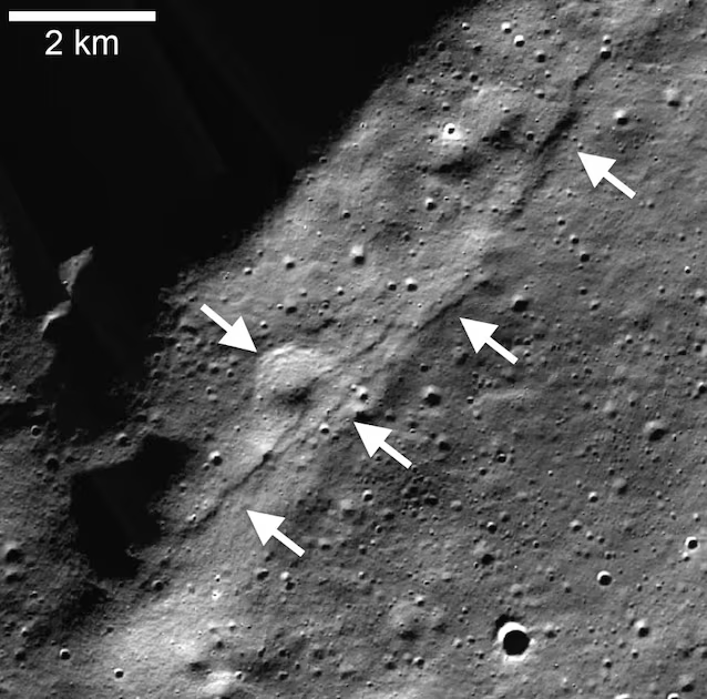
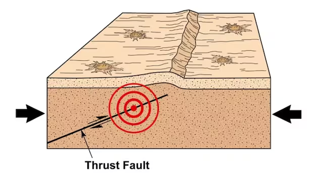
When the lunar interior contracts, the crust is subjected to compressive stresses that can cause fractures and displacements along faults. The rock can break and a portion of the crust can be pushed onto the adjacent one. The lobate slopes are thus formed.
The second is found in lunar seas (i.e. the large dark plains visible from the Earth formed mainly by solidified basaltic lavas), made up of small dorsalssaid small sea ridgesassociated with compressional faults. They are made up of small mountain ranges or folds that form in the basaltic seas of the Moon.
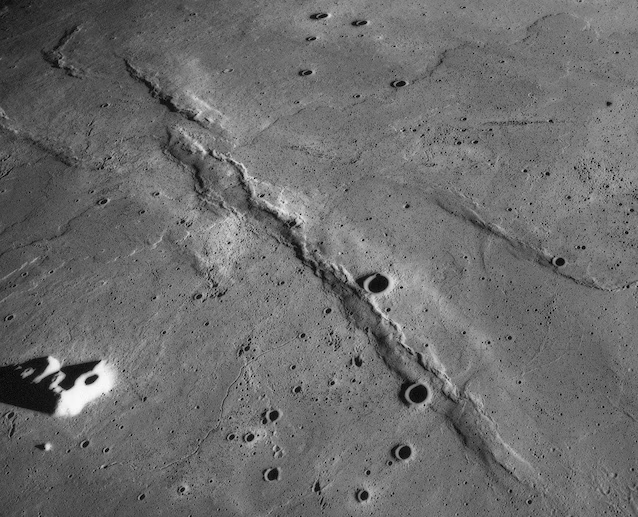
The escarpments of the mountainous regions and the ridges of the seas represent different surface manifestations of a deformation associated with the contraction of the lunar surface due to its recent slow cooling.
The research team examined images acquired by the LRO spacecraft and mapped further 8,900 lobed slopes. Their tracks were divided into approximately 127,800 segments to measure their length and orientation. To these structures the authors have added approximately 2,600 small backbones of the seas already cataloged in previous studies. The geometry of the faults and the deformation models allow us to estimate the displacement and shortening of the lunar surface (and therefore the radius).
By combining data from mountainous regions and seas, the researchers estimated a contraction of approximately 44 metres. According to the model, if the contraction had occurred uniformly over the last 400 million years, the radius would have decreased on average up to about 11 centimeters per million years.
Mapping the 10,000 young faults will help predict the satellite’s earthquakes
On Earth, many earthquakes are linked to interactions between moving lithospheric plates. The Moon does not have a tectonic system similar to the Earth and the its crust forms a solidified unitary shell. However, due to the cooling of the lunar surface, a contraction is generated which contributes to the compression of the surface geological structures. The generation of these faults is distributed in numerous lunar regions, however forming more active regions and leaving other lunar areas less affected by the phenomenon.
When the efforts exceed the resistance of the moon rock, an existing fault can slip and the sudden movement releases energy and causes a shockin the same way as what happens on Earth. The distribution of lunar faults, rock properties, and local stresses generated by compression will be important parameters for determine the risk and possible prediction and intensity of a seismic event on the Moon.
Assessing seismic risk for future human bases on the Moon
Faults are an element to consider in choice of sites for future human bases on the Moonespecially at the south pole, where NASA is evaluating possible areas for the future establishment of a first space base. The edges of the large lunar craters which hide within them permanently shadowed areas that could preserve water ice are in fact among the sites of greatest interest to the American space agency.
A study published in 2024 modeled the stability of the slopes of the craters of the lunar south pole. The results indicate that some areas may be subject to landslides of the regolith even following relatively weak shakingincluding some internal walls of permanently shadowed craters, such as those of Shackleton Craterone of the most popular regions for the lunar base of Artemis program.
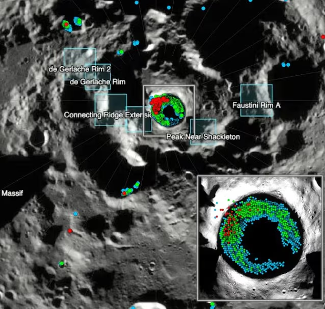
Mapping the seismic risk of the lunar surface will therefore become extremely important to understand where in the future the precise places where the inhabited modules and other infrastructure of the lunar bases will be landed are chosen.