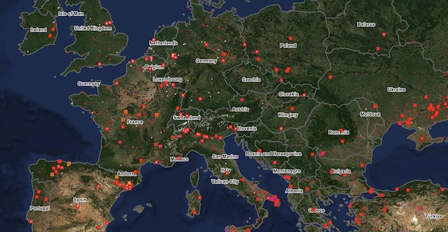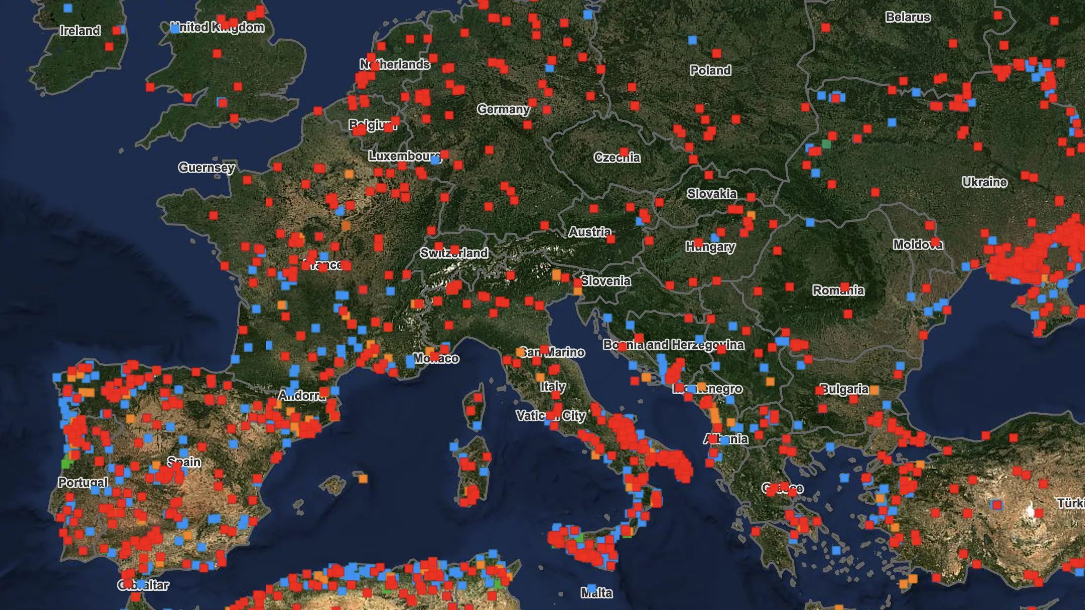
Another summer, another fire emergency for Europe. After the record heat wave in June which brought temperatures up to 44 degrees in France, the flames are devouring hectares and hectares throughout the South of the continent: from Sardinia al Laziocome on French Pyrenees at the Spainuntil Portugalwhere the European Civil Protection Mechanism was activated. Overall, they have already been lost in the EU since the beginning of the year 155,569 hectares, approximately 57,000 hectares more than the 2006-2025 average for the same period.
Thousands of people have been evacuate in the last few weeks and the seasonaccording to Copernicus data, it already is above average of the last twenty yearswith the most critical period, between July and August, still to be experienced. Here’s what’s happening and how much territory has already been lost.
The forest fire situation in Italy and the most affected EU countries
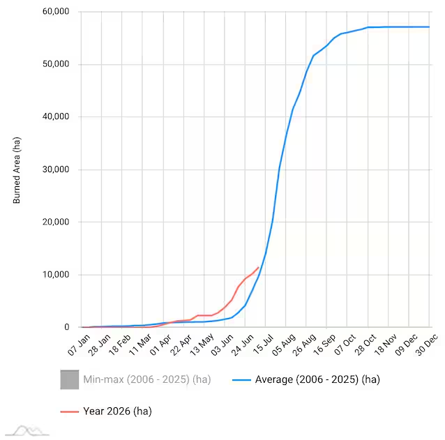
In Italy the situation remains patchy. According to ISPRA data, to June 9th they were already around 6,000 hectares burned at a national level, with Tuscany And Calabria such as the most affected regions; the picture has been ever since got worsewith hundreds of fires in Sardinia (over 900 since the beginning of the year, more than 4,200 hectares burned) and several outbreaks between Lazio and Campania in recent weeks. From January 1st to July 8th 2026 – latest available data – in our country are burned overall 11,566 hectareswith a difference of over 5,000 hectares in the June-July period alone.
But it is the rest of Europe that is most worrying.
- In Spainalready tested by the vast fires of 2025, are gone approximately 50,000 hectares lostwith June as the most destructive month of the year. In the last few hours, among other things, a large fire broke out in Almeriain southern Spain, which caused the death of at least 12 people, forcing 1,000 inhabitants to evacuate.
- In France fires in the Pyrenees Orientales have doubled the area burned compared to the same period in 2025, with over 10,000 evacuated;
- In Portugal the Vouzela fire has consumed approximately 13,000 hectares; Two Italian Canadairs also arrived on site.
- Greece is also involvedwith fires near Thessaloniki.
Risk maps and Copernicus data: how many hectares have already been burned
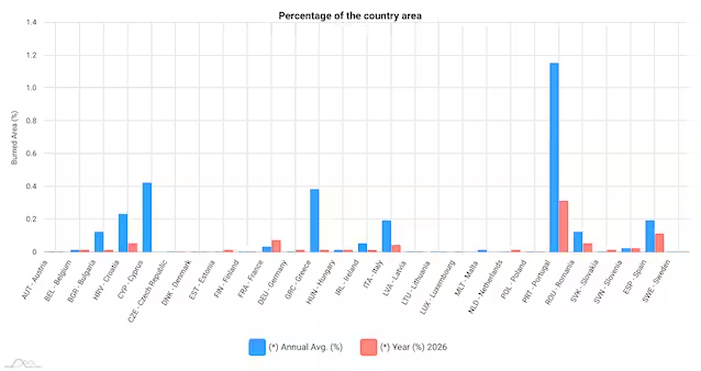
According to Copernicus EFFIS (European Forest Fire Information System) data, to July 8th the burned surface in the EU in 2026 exceeds 155,500 hectaresabout the 16% more than the historical average of the same period. However, this figure is lower than 2025, the worst year ever recorded since the EFFIS historical series existed (2006): last year in Europe over one million hectares burned in the EU alone, 2.2 million if we also count the neighboring countries that are not part of the Union.
The maps of the EFFIS statistical portal show 2026 above the multi-year average curve since the first weeks of the year, with Spain, France, Portugal, Slovakia and Estonia like the countries where the situation is particularly critical. The risk map, updated on July 9, reports extreme danger over much of France, the Iberian Peninsula and central Europe, with the most critical season still all to come.