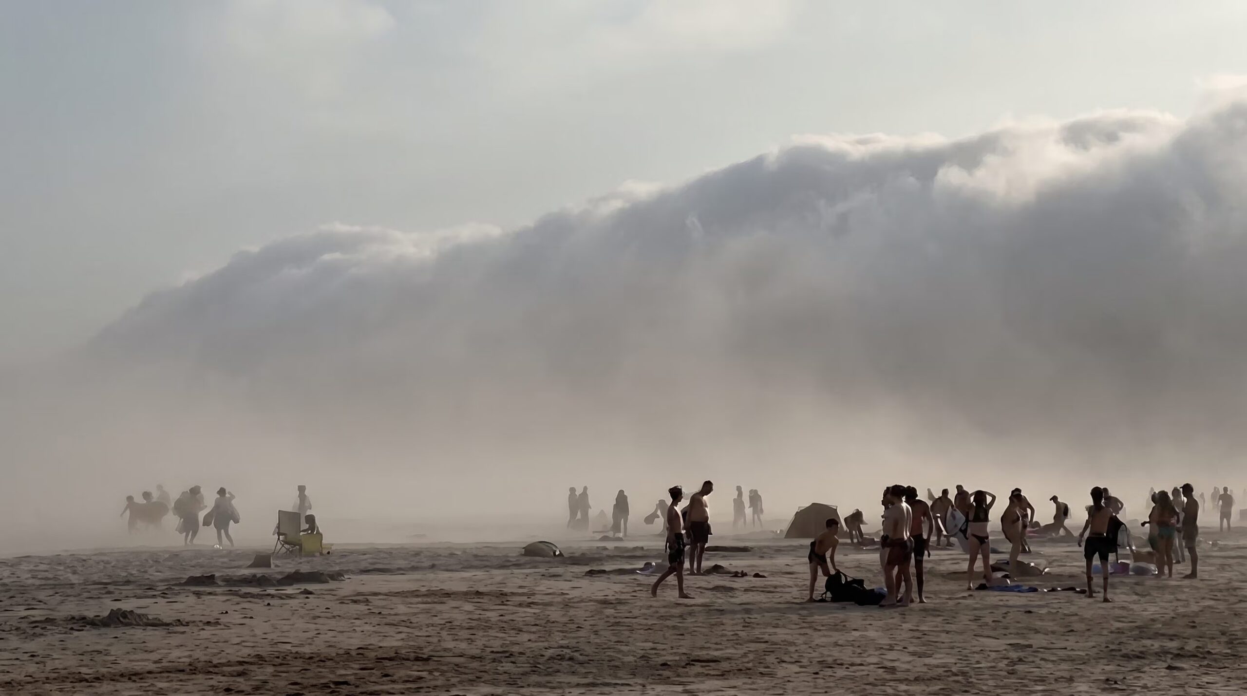
In Franceon the beach of Hendayein the department of Pyrenees-Atlantiques, a massive one struck roll cloud (or roller cloud), one cloud gray and cylindrical improperly renamed on social media as “tsunami cloud“and fell from the Bay of Biscay towards the coast. In just a few minutes, the sky darkened, putting swimmers to flight, with sand starting to fly strong gusts of wind until 60-80 km/h and the temperature it is suddenly dropped by 9° C, rapidly going from around 37° C to 28° C.
Faced with similar images, instinct suggests escape, but from a scientific point of view there is nothing catastrophic. It is a fascinating physical phenomenon, governed by precise thermodynamic laws and linked to the microclimatic dynamics of the Basque coasts.
The roll cloud in France: a “roller cloud” that travels without storms
Many media have caused confusion by defining the event as a shelf cloud (shelf cloud). However, there is one fundamental physical difference which disproves this classification and explains why we witnessed a spectacular event in Hendaye roll cloud (scientifically defined as volutus):
- The Shelf Cloud it is an accessory, wedge-shaped cloud that is located always attached to the base of a storm (the cumulonimbus). It moves with the storm and precedes the area of heavy precipitation.
- The Roll Cloud it is a low, shaped cloud very long horizontal tubewhich presents itself completely detached and independent from other cloud structures. It slowly rotates around its horizontal axis and that’s exactly what it is rotary motion which gives it that incredible “roll” or “sea wave” appearance in the sky.
The peculiarity of coastal roll clouds is precisely this: they can form even in the total absence of a storm behind us. They are generated simply by the collision of air currents with opposite temperatures and densities along the boundary of a sea breeze or surface cold front.
How this steam “pipe” is formed
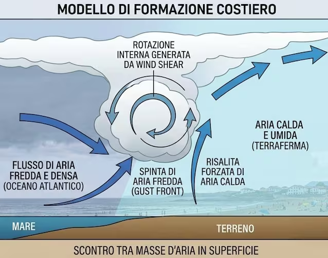
To understand how a roll cloud is generated we must imagine the atmosphere as a fluid in which different air masses interact according to the laws of density. It all begins when a flow of cold, dense air coming from the sea it rapidly advances towards the mainland, where it stays much warmer and lighter air.
Cold ocean air behaves like a fluid wedge which wedges itself under the warm continental air, lifting it violently. As hot air rises, it cools for adiabatic expansion (i.e. it cools due to the decrease in pressure with altitude).
Once the dew point is reached, the water vapor condenses instantly creating the cloud. But why does it take on that cylindrical and rotating shape? Because of the wind shear: Winds at high altitudes blow in a different direction or speed than surface winds. This speed difference create a horizontal axis air vortex (an invisible roller) that shapes the condensation, giving the cloud its characteristic tube shape rolling across the sky.
The local engine of the “tsunami clouds”: Galerna (or Enbata)
If roll cloud dynamics can theoretically happen anywhere in the world, in Bay of Biscayin France, manifests itself in a particularly violent and spectacular way due to a local meteorological phenomenon: the Galerna (also called Enbata in Basque or Brouillarta in French).
Galerna is a sudden change in maritime wind which typically occurs in summer along the Basque and Cantabrian coasts. When a warm and sunny day inland is interrupted by the passage of a small baric anomaly, the wind turns sharply recalling the cold and very humid air that sits over the Atlantic Ocean.
This pulse of cold oceanic air breaks over the coast a very high speeds (often higher than 60-80 km/h), displacing the pre-existing boiling air. The speed and intensity of this coastal thermal clash are such as to generate a massive, lightning-fast condensation in the lower atmospheric layers, creating the spectacular roll cloud that flows parallel to the beach as if it were one fog tsunamigiving chills to swimmers but without representing a real threat of a storm.
