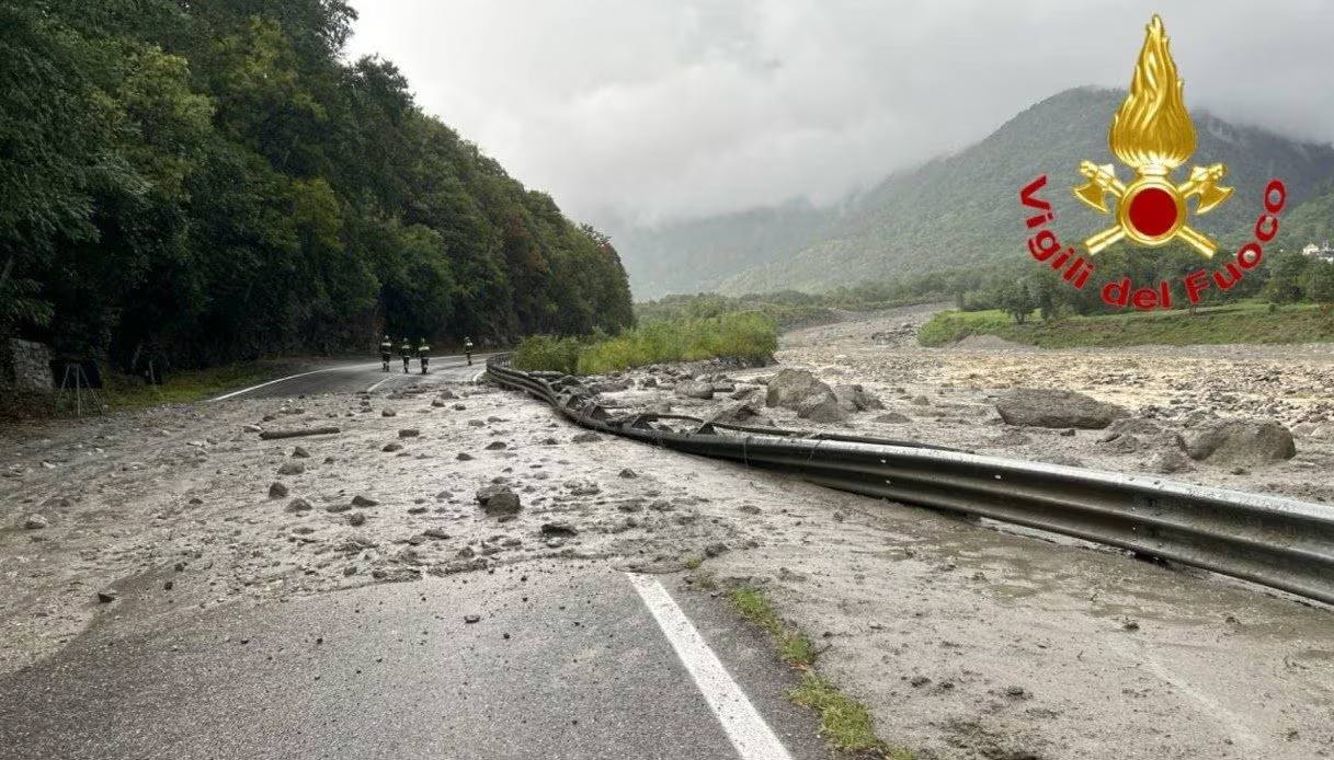
In the last 48 hours an intense phase of bad weather hit the regions of Northern Italy and the Tuscany. The phenomenon was triggered by the collapse of one Atlantic sagging towards the Iberian Peninsula. This atmospheric configuration triggered a lure of humid and warm currents from the south-west towards the central-western Mediterranean basin.
When this unstable, steam-laden flow collided with the freshest air present at altitude, the thermodynamic prerequisites for the development of systems have been generated thunderstorms of notable intensity.
The damage was numerous: heavy rains were recorded in the provinces of Massa Carrara, Lucca And Grosseto; in the area of Lunigiana, peaks of up to 300 mm . In the province of Bergamo, however, six villages remained isolated, with approximately 350 evacuated. The Fire Brigade carried out over 1000 interventions within 24 hours.
However, for tomorrow, Saturday 22 August, ample clearing is expected: however, according to the forecast, a new slight worsening in Northern Italy starting from Tuesday 25 Augustwhile in the South the weather will remain stable and sunny.
Bad weather, superstorm cells and strong winds: the role of the Ligurian Sea
During yesterday, Thursday 20 August, the first manifestations of strong instability affected the Liguria, in particular the Central-Levant area. Several have been formed on this region superstorm cells (as visible in the video above by Marco Mancini, which shows the beach of Chiavari): these are convective structures characterized by a rotating updraft (mesocyclone).
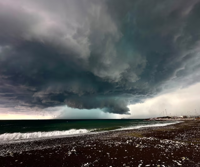
The determining factor for the power supply of these systems was the temperature of the Ligurian Seawhose surface waters recorded values between 28°C and 30°C. The high sea temperature provided a large amount of potential energy, allowing the storms to strengthen rapidly before impacting the coast.
In the hinterland of Chiavari And Boardthey fell 120 mm in one hourvalues that define the presence of actual storms, in addition to small/medium sized hail depending on the neighborhoods and gusts of wind exceeding 100 km/h.
In the lowland areas, the situation initially remained calmer in the first half of the day. Since the afternoon, however, the worsening has reached Lombardywhere the province of Bergamo it was hit by violent thunderstorms which caused flooding, landslides and floods. Six municipalities I am isolated in the Seriana Valley where they have been 350 people were also evacuated, while Brembo and Serio are in flood, as seen in the video below.
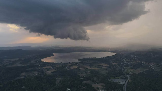
On the evening of Wednesday 19 August however, in Piedmontthe intense energy at play favored the formation of a storm structure of strong intensity near the area of Lake Viveronebetween the provinces of Turin and Biella, where a tornadoyet to be ascertained.
The passage of the front and rainfall peaks in Tuscany
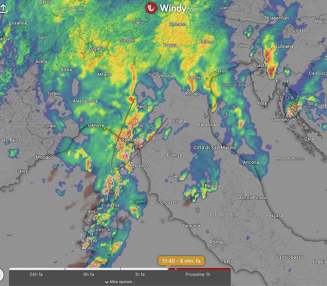
Today’s morning, Friday 21 August, the actual front passed through, resulting in widespread rain coverage over much of the North and a new and severe flare-up of the phenomena between the Eastern Liguria andUpper Tuscany. On the latter, in the province of Massin the area of Lunigiana, peaks of up to 300 mm of rain accumulated in a short period of time, just under 4 hours.
The trend: after the storms the sun returns
Friday 21 August will be the last day characterized by this intense disturbed phase. In the next few hours there will be a gradual movement of the system towards the East, leaving room for residual thunderstorms in Central Italy and the Triveneto between the afternoon and evening.
The day of Saturday 22 August will see a marked improvement in weather conditions across the country, with large clearings also on the regions hit by the storms of the last few days. The weekend truce could be temporary, however: the latest projections point to the possibility of a new slight worsening at the beginning of next week, concentrated mainly in the first part of Tuesday 25 August. Always very hot and sunny instead Noonwhere no type of change is visible.
The “new normal”: from prolonged drought to near-tropical storms
The event of the last 48 hours it does not represent an isolated anomalybut it is part of a climate trend that we will have to deal with more and more often. The progressive increase in average temperatures is transforming the Mediterranean into a real one thermal energy tank. The mechanism is purely physical: a warmer atmosphere and sea accumulate an enormous amount of water vapor and latent heat. This leads to long periods of stability, extreme heat and droughtin which 35-38 °C remain for weeks without a drop of rain falling.
When a cold drop or an Atlantic sac manages to pierce this hot bubble, the release of that accumulated energy occurs in a sudden and explosive way. The resulting storms take on almost tropical characteristics in terms of water intensitybut with an additional risk factor: thecomplex orography of our country. Mountain ranges such as the Alps and the Apennines, being close to the sea, block and interlock these storm systems (stau phenomenon or blocking orography), forcing them to discharge hundreds of millimeters of water always on the same areas. The result is an increasingly marked alternation between extreme drought and violent storms.
