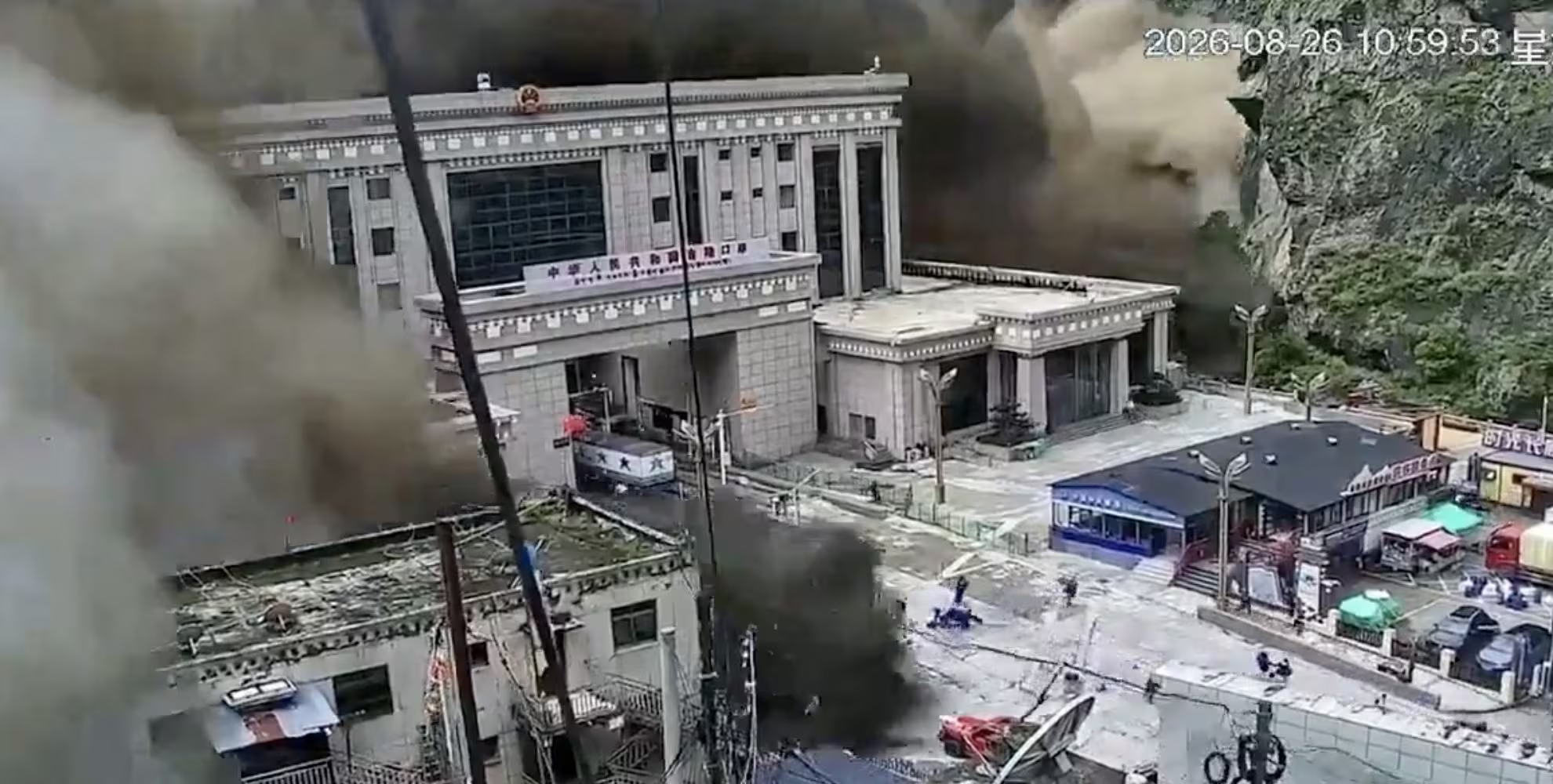
A violent one flash flood he overwhelmed Rasuwaa district on the border between Nepal and the Tibetdevastating entire villages in northern Nepal and causing the death of at least 95 peopleaccording to the latest police report, and more than 400 missing. Among them too 291 foreign citizens untraceable, from India, Australia, the Netherlands, South Africa and the United Kingdom.
There Farnesina has recently made it known that in the region there would be approximately 90 Italians registered: two of them remained blocked with their guide upstream from the landslide which blocked a road, but they are in good condition and in contact with the Ministry of Foreign Affairs.
The disaster, unfortunately, also hit hard Tibetan sidewhere Chinese state media spoke of possible serious losses among the population. The Chinese president Xi Jinping ordered «the maximum effort» to organize relief efforts in the affected areas, even if adverse weather is slowing down operations.
According to preliminary information provided by the Nepalese Foreign Minister Shishir Khanal to Parliament, the causes of the flash flood could be traced back to a earthquake of magnitude 4.4 occurred at 08:37 local time (04:52 in Italy), following which a landslide occurred which blocked the Bhote Koshi river.
The climatologist of the Lamma-Cnr Consortium, Tommaso Torrigiani, confirmed to ANSA that it was aflash flood, that concern in general smaller waterways and they can be dangerous because they are unexpected. The authorities announced that a second flood is not excluded.
An M 4.4 earthquake triggered a landslide that blocked the BhoteKoshi River
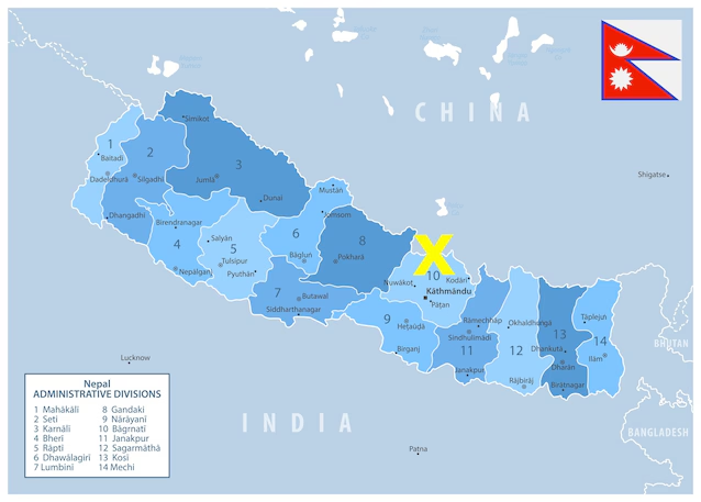
The origin of this episode, therefore, is not just the rain. As anticipated, the Nepalese Foreign Minister Shishir Khanal he actually declared in Parliament that around 08:37 in the morning there was a earthquake of magnitude 4.4with epicenter at Kodari and located at a depth of just 10kmas confirmed by data from the USGS (the United States Geological Survey).
The earthquake caused a large landslide: at that point, the landslide material would have blocked the Bhote Koshi River (which originates in Tibet) causing one sudden flood which subsequently caused the flood that engulfed the region.
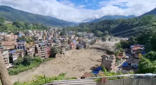
It is a different mechanism from the one we are used to when we think of a flood: in this specific case, it was the earth that moved first, detaching from the slopes a mass of debris large enough to block the river and transform it, in a very short time, into a flood wave coming from the Tibetan side which flowed downstream.
To understand the geographical scope of the phenomenon it is worth remembering that the Bhote Koshi originates in Chinese territory and descends towards Nepal, often flowing into deep throats (so much so that it is a popular destination for rafting), and then flows, through the Nepalese river system, up to the Ganges in India.
It is not the first time that this area has paid a very high price to the force of nature: the Rasuwa district had already been devastated by a earthquake of magnitude 7.8 which hit Nepal in 2015which caused more than 8,500 victims, including hundreds of people in Langtang National Park, buried by a landslide ee approximately 19,000 injured.
Over 400 missing: the damage and death toll
The toll of damage and victims, unfortunately, is dramatic: the still provisional rescue reports speak of at least 95 victims and over 400 missing, but the number is almost certainly destined to rise: overall, the region is home to around 50,000 people. The flood has swept away concrete bridges and dozens of houses, with extensive damage especially in the districts of Rasuwa and Nuwakot, as visible in the video below.
According to surveillance videos, the flood also overwhelmed customs facilities near the Rasuwa-Kerung border crossing, destroying vehicles and cutting off vital land trade routes. Emergency response teams and security forces remain actively deployed in the affected border regions, engaged in search operations.
Sixty workers engaged in the power plant project under construction Langtang Kholain the municipality of Rasuwa, are missing: according to the information reported by local newspapers, at the time of the flood they were carrying out concrete casting works inside a tunnel and the plant suffered very serious damage.
The affected area, moreover, is an area where different hydroelectric projects they exploit the rapid rivers that come down from the mountains and this makes it particularly exposed.
