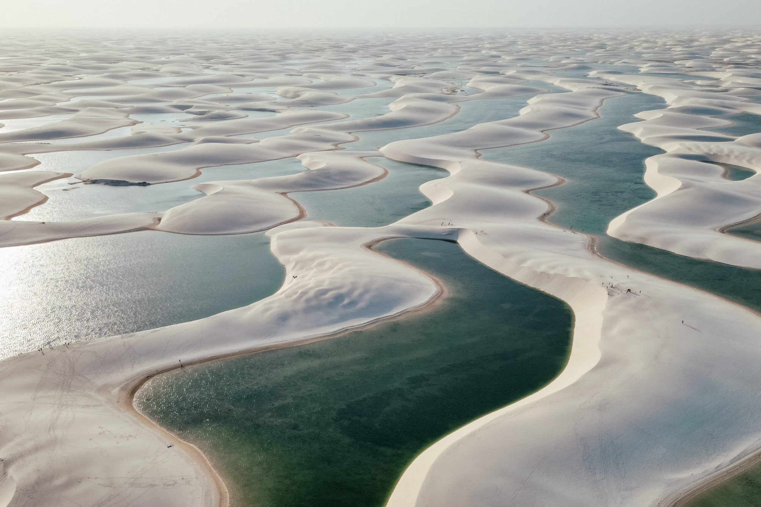
If you look at a satellite photo of northern Brazil, in an area near the equator, you will see a white spot that seems out of place: it’s about the Lençóis Maranhensesthat is, thousands of lagoons of crystal clear water nestled between white sand dunes. A landscape so vast that, of similar dimensions, it does not exist on the rest of the planet.
But why are they formed here? The answer lies in geology: they are needed four factorsfour incredible coincidences that all occurred in the same place.
The lagoons, however, are not permanent: they fill in the rainy season and then, in the dry season, many dry out and the dunes slowly begin to move again. The best time to see them is between June and Septemberwhen it has stopped raining but the lagoons are still full of water.
Why it looks like a desert but it isn’t: the 4 fundamental elements
But let’s go from the biggest misunderstanding. Seen from afar, this stretch of sand looks like a desert. From a geological point of view, however, it isn’t. A desert, by definition, receives less than 250 mm of rain per year: here instead they fall between 1,500 and 2,000 mm per yearconcentrated above all between January and June. NASA itself estimates around 1,250 mm per year, more or less double what it rains in London.
Let’s see the four fundamental elements that lead to the formation of Lençóis Maranhenses.
The first ingredient: a natural sand factory
To ensure that such a place is formed, the first thing that is needed is lots of sand. And here there is a real natural assembly line. The inland mountains the great ones crumble and erode rivers they transport enormous quantities of to the ocean white sand of quartz and the ocean currents they redistribute it along the coast. The result is immense beaches right in front of the Lençóis, which become the reservoir from which everything starts.
The second ingredient: the trade winds that push the dunes inland
Now that sand has to arrive inland and pile up in dunes. They are needed strong and constant winds that blow inwards and, coincidentally, right into this one equatorial band they blow trade windsthat is, regular winds that blow almost always from east to west.
They are the ones they collect sand from the coast and the push inwards even for tens of kilometers: the dune field extends for approximately 75 km along the coast and penetrates more than 20 km inland. They are born like this mega dunes up to thirty meters high, so much so that this is the largest coastal dune field in South America.
Third ingredient: water
AND the waterHowever, where does it come from? From the rain and this is where the previous data comes in handy. The region is located in a transition zone between the Amazon and the drier areas and every year, from January to June, it receives a massive amount of equatorial rainfall (up to 1,500-2,000 mm per year). So we have sand, we have dunes and now we also have water. But it’s still not enough.
The fourth piece: the waterproof layer that turns everything into a basin
Here’s the plus point counter-intuitive. In the sand you can pour everything the water whatever you want, but normally this It penetrates deeply and disappears: it doesn’t stay there to form lagoons that last months. Why does he stay in Lençóis? Why Under the sand there is a layer of rock and compact and impermeable sediments, which does not allow the water to sink further down.
Imagine the dunes resting on this waterproof “bottom”: it rains, the water penetrates the sand, but at a certain point he can no longer go down and occupies all the spaces between the grains. In fact, the area behaves like a gigantic basin full of sand and water together. When the water level exceeds the lowest points in the dunes, lagoons appear. It is no coincidence that this balance, in addition to the biodiversity of the area, led UNESCO to declare the World Heritage park in 2024.
