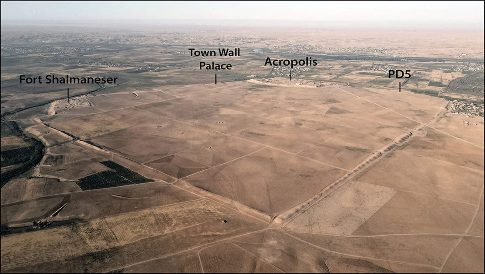
For almost two centuries, the archaeologists they studied Nimrudancient city Assyrian – capital from the 9th to the 8th century. to. C. – whose remains are today found near Mosulin Iraqespecially through its palaces, temples and monuments. Now a new project byUniversity of Udine is shifting attention to the lesser-known part of the city: the lower citythe large urban area that extended beyond theacropolisthe monumental part. The new study, published on Antiquitiesis by prof. Daniele Morandi Bonacossi and Dr Francesca Simi.
The Nimrud Lower Town Archaeological Project (NiLTAP) has begun to rebuild this vast industry using non-invasive techniques which allow the site to be studied without immediately resorting to excavations. The lower city, enclosed by almost 8 kilometers of fortifications and with a surface area of approx 340 hectareshas remained relatively preserved.
After the fall of the Assyrian Empire in 612 BCin fact, Nimrud it was not affected by significant reoccupationwhile even today the area is used mainly for agriculture, with superficial plowing that only reaches the first 20 centimeters of the ground, without irremediably damaging the buried archaeological heritage.
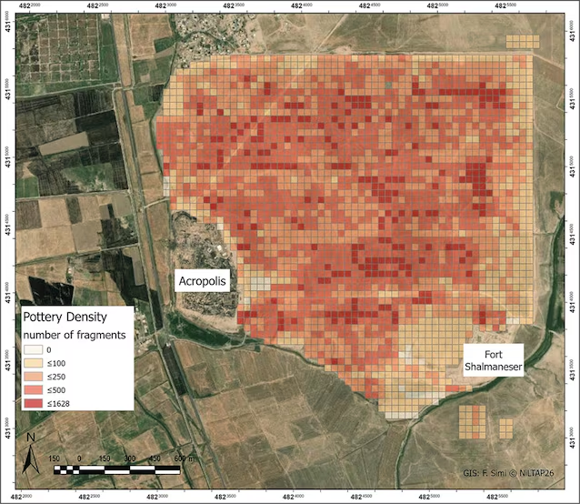
The project combined several non-invasive techniques, such as historical aerial photographs and satellite imagestopographic surveys with drones and differential GPS, systematic archaeological reconnaissance and geophysical prospecting. The images from previous missions, created between 1967 and 1974had already shown traces of roads, fortifications and areas with different occupation densities. The reconnaissance on the ground has now made it possible to verify and clarify this information.
The distribution of surface finds has also documented the occupation of the city in different periods, from the 3rd millennium BC until the Islamic era (7th century AD). The phases are particularly intense Middle Assyrian (14th-10th century BC), neo-Assyrian (X-VII century BC) and post-Assyrian. They were also collected fragments of inscriptionsincluding parts of five prisms (documents inscribed on multiple sides) attributable to kings Sennacherib (705-681 BC) e Ashurbanipal (668-631 BC).
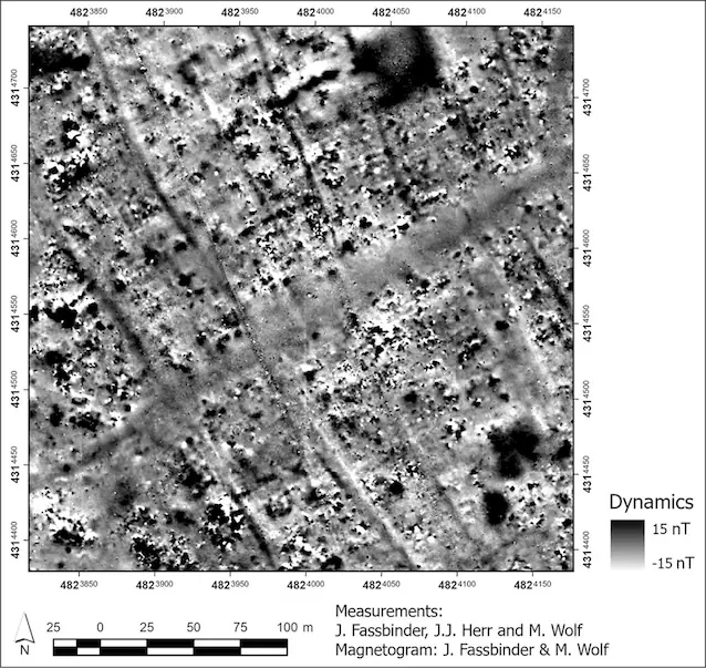
There magnetometry it added an extra layer of information, allowing you to pinpoint under the fields road systems organized, residential neighborhoods and larger complexes.
The project is also challenging some reconstructions of the city water system: New topographic data suggests that a canal further north may have played a more important role than the famous one Patti-Ḫegallitraditionally considered Nimrud’s main water source. The objective is therefore not only find new buildingsbut rebuild the daily functioning of the capital: roads, homes, production spaces, infrastructures and urban organisation.
In this way Nimrud can no longer be studied only as the center of Assyrian power, but as a city inhabited by a much larger population than just the royal court.
