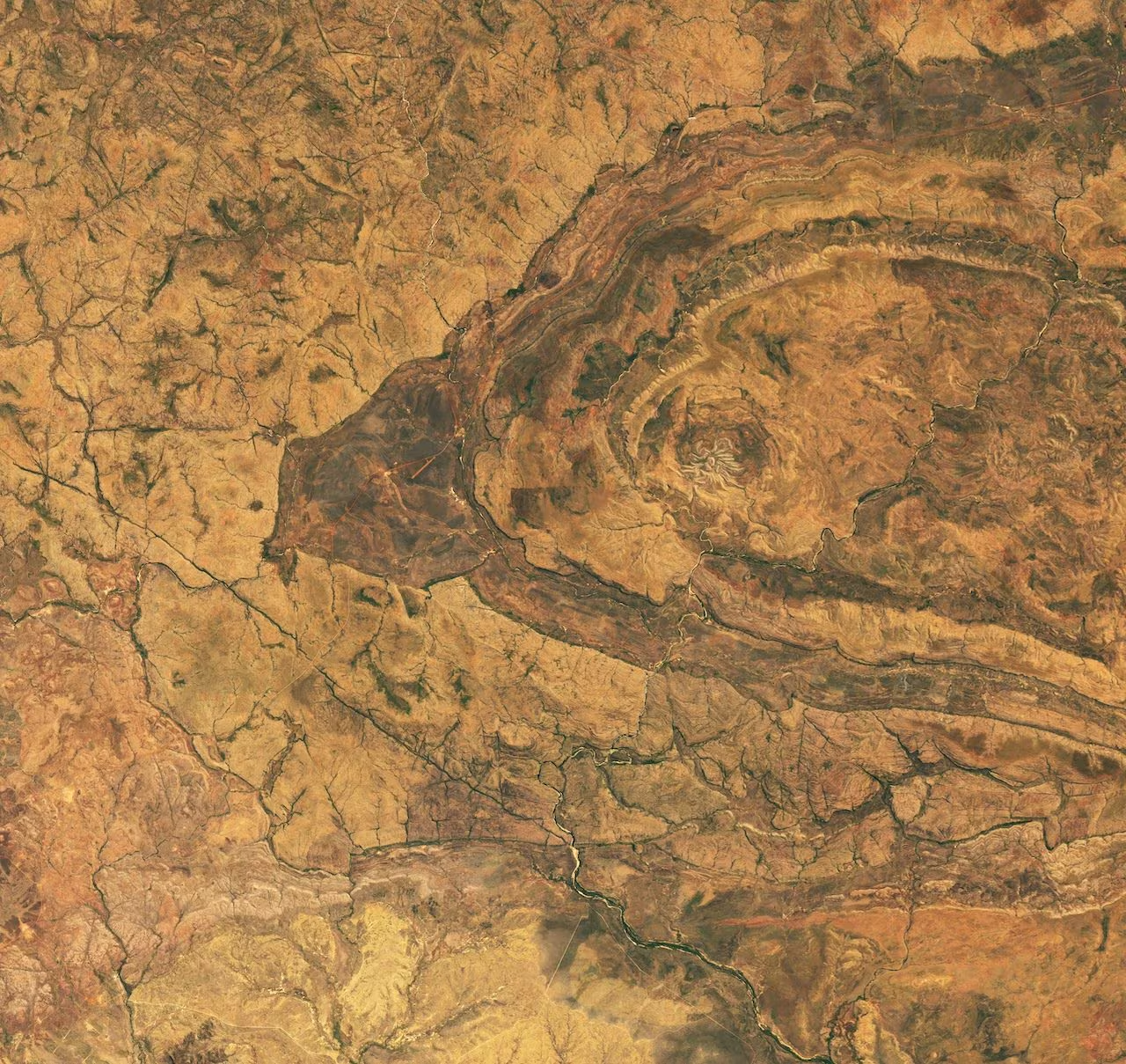
From orbit the Spider Crater it looks like a light-legged spider, crouching on the soil of the Kimberley, in Western Australia. Instead it is a rocky structure, a ancient crater shaped by the impact of a meteorite and sculpted by hundreds of millions of years of erosion. The structure was taken over on 20 September 2026 by OLI (Operational Land Imager), an advanced Earth observation instrument, mounted on the Landsat 9 satellite, managed by NASA and USGS. What remains today of the impact is an oval scar measuring approximately 13 by 11 km, while the actual spider, in the centre, has a diameter of approximately 4 km. The property is located in the interior of the region, along the Gibb River Road, 18 km east of Mount Barnett Roadhouse.
That arachnoid figure, according to geologists, is what remains of the central uplift of the cratercalled central uplift, the set of rocks which, in the center of the structure, the impact has pushed higher than their original position. Over time, erosion took away the more fragile rock layers and spared the more resistant sandstone ridges. It is precisely these ridges, lighter than the surrounding terrain, that design the long and articulated legs.
The first to notice the structure was JE Harms, an Australian geologist, around 1960. For a long time no one linked it to an impact and even twenty years later the most accredited hypothesis was that of a cryptovolcanic origin. The case was closed by field reconnaissance, which brought to light the shatter cones, cone-shaped geological structure imprinted in the rock, which are produced only when very intense shock waves pass through the rock. In the central dome of the Spider Crater, about 500 meters in diameter, they are found everywhere and this is the telltale sign of an impact that occurred in the past.
Later the investigations moved to the laboratory with one study conducted by a group led by Morgan A. Cox and Aaron J. Cavosie of the Space Science and Technology Center at Curtin University in Perthpublished in 2021, which searched minerals for traces of an oblique impact. Quartz and zircon crystals deformed by the shock were taken from the sandstone. Specifically, 453 zircon granules and several quartz crystals collected along a 1.6 km line were analyzed under the microscope, looking for the traces left by the shock wave. What emerged was that the most deformed zircons were not located in the center of the crater but about 400 meters further awayin the direction the asteroid was traveling.
Furthermore, as stated in the study, the age of the crater is not precisely known and, based on the geology of the area, it is estimated that it was formed between 900 and 610 million years ago. An age that was obtained by exclusion, comparing the crater with two nearby geological elements whose age is known, namely the Mount Barnett syncline, a fold of rocks that formed about 900 million years ago and which the impact deformed, and the glacial deposits, dating back to about 610 million years ago, which are located 25 km away.
The impact, according to estimates, dates back to late Proterozoic, during which our planet was enveloped several times by planetary glaciationsgo down in history with the name of Snowball Earth. This scenario was outlined in the first half of the 20th century by Douglas Mawson, an Australian explorer and geologist who hypothesized the most radical glaciation that the Earth has ever gone through, with an uninterrupted blanket of ice, stretching from one pole to the other until it enveloped the entire globe, and a planetary thermometer that dropped to an average of –50 °C.
