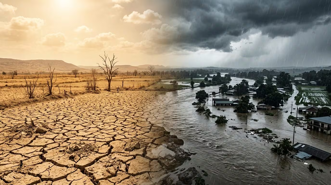
When it comes to global climate, few phenomena have equal media and scientific coverage ENSO (El Niño-Southern Oscillation), better known in its warm phase simply as El Niño. Every time the surface waters of the central-eastern equatorial Pacific Ocean experience anomalous warming, as this year, a chain of meteorological events on a planetary scale is triggered.
The question that arises spontaneously is purely physical: how is it possible that a single oceanic thermal event is capable of causing violent storms and floods in some regions of the globe and, at the same time, severe periods of drought in others? The answer lies in the circulation mechanisms of the atmosphere and the way in which thermal energy is redistributed at the equatorial level.
Why do these differences arise between one area and another?
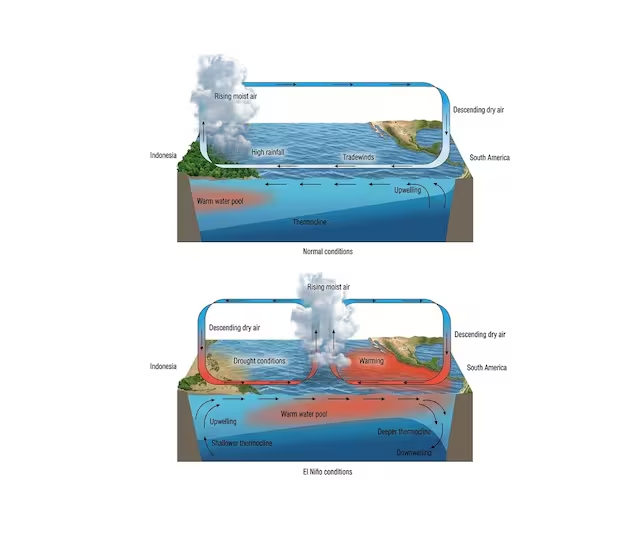
It all depends on how the heat of the ocean moves the large “gears” of the air above the Equator, the so-called Walker cell. Under normal conditions, the trade winds (constant winds from east to west) push warm water towards Indonesia and Australia, while deep, cold waters rise along the coasts of South America. The warm and humid air to the west rises upwards (ascensional motions), forms clouds and releases rain; then, now dry, it travels eastwards at high altitude and sinks back into the eastern Pacific, guaranteeing a stable and dry climate.
During El Niñothis gigantic circuit alters:
- The trade winds weaken or reverse, and the mass of warm water slides from the western Pacific towards the coasts of South America.
- The point where the warm, moist air rises towards the sky moves to the center and east of the ocean: this is where thunderstorms and water vapor are now concentrated, generating strong chances of floods and overflows between Peru, Ecuador and central-northern Chile.
- On the opposite side (Australia and Indonesia), the exact opposite happens: the air no longer rises, but sinks from top to bottom.
In meteorology, this movement of air descending from above towards the ground is called atmospheric subsidence. When the air mass descends, it compresses and heats; this process “crushes” the atmosphere, prevents the formation of clouds and completely blocks the vertical motions that generate rain. Essentially, where there is subsidence the skies remain clear, creating ideal conditions for long and severe phases of drought.
It is essential to clarify a key methodological aspect: the climate does not operate according to deterministic automatisms, but rather in probabilistic terms. Saying that a year is characterized by El Niño (or a Super El Niño event) does not mean that certain extreme events will occur with mathematical certainty, but that the statistical probabilities that such scenarios materialize increase significantly in specific macro-areas.
- Northern Australia and Indonesia: the deviation of the upward motions towards the center of the Pacific and the presence of subsidence remove the usual humidity and rainfall from the area. Precipitation chances drop dramatically, creating the ideal conditions for marked periods of drought and a strong drying of the soil.
- South America (Ecuador, Peru, northern Chile): the arrival of the warm anomaly off the coast generates massive evaporation. The warm, water-saturated air rises rapidly, fueling stationary storm systems, with a very high probability of flash floods, overflows and landslides.
- Horn of Africa and East Africa: the reorganization of currents at a tropical level tends to favor above-average rainy seasons, with an increase in hydrogeological risk.
- Southern Africa and parts of Southeast Asia: the odds clearly lean towards prolonged water deficits and consequent difficulties for the agricultural sector.
Teleconnections and the impact on Europe and Italy
While the correlation between El Niño and meteorological events in the tropical belt may appear more direct and well documented, the situation becomes much more complex when we move towards the middle latitudes, as in the case of the European continent andItaly.
The influence of El Niño in our latitudes does not occur through direct contact, but through a physical phenomenon known as atmospheric teleconnection. The strong heat released by the Pacific Ocean alters the circulation of the troposphere and stratosphere, triggering planetary-scale atmospheric waves (Rossby waves) that propagate for thousands of kilometers.
In the case of the Mediterranean basin and Italy, There are no certain answers or direct automatisms. The impact of the Pacific must in fact interact and clash with a series of other dynamic factors of equal or greater regional relevance:
- The state of theNorth Atlantic Oscillation (NAO – North Atlantic Oscillation).
- The strength and stability of Polar Vortex.
- Thermal anomalies of the surface of the Atlantic Ocean and of the Mediterranean Sea itself.
Scientific literature and climatological models highlight that during a winter dominated by El Niño, the odds lean slightly towards a Jet Stream positioned further south on the Atlantic. For Italy, this dynamic context tends to translate into greater variability: on the one hand, the probability of transit of Atlantic disturbances capable of bringing rainy phases in the Centre-South and snowy phases in the Alpson the other hand, periods of stability may alternate with temperatures above seasonal averages.
Being a chaotic and interacting system, El Niño does not determine the daily Italian weather, but it does modulates the probabilistic background. Understanding these dynamics allows the scientific community to increasingly refine seasonal forecast models, moving the analysis from the field of certainty to the rigorous one of risk assessment.
