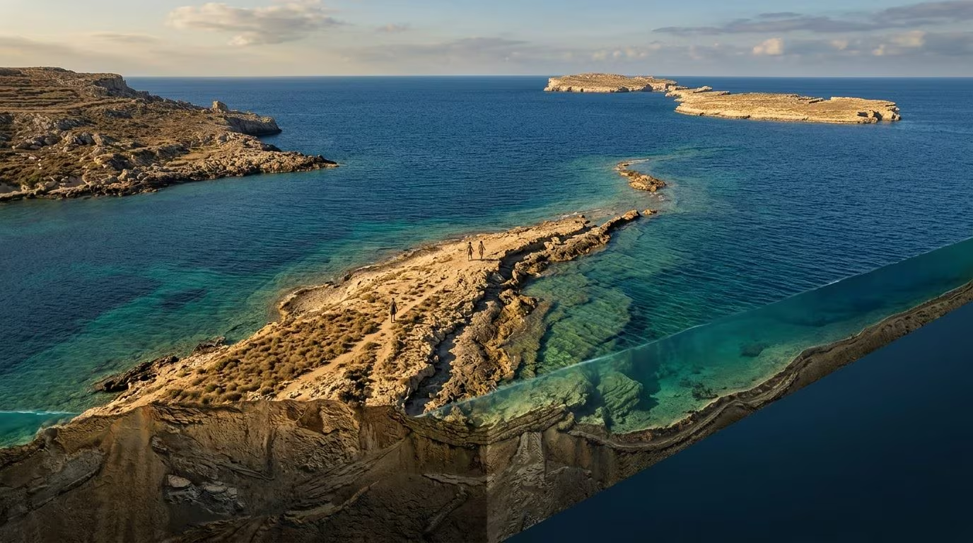
About 22,000 years ago, the lowering of sea levels by more than 100 meters caused a land corridor to emerge between Sicily and Malta. This natural bridge allowed the passage of animals and human communities, before being progressively submerged until it disappeared at the end of the Pleistocene.
About 22,000 years ago it was possible walk from Sicily to the Maltese archipelago. Between the two shores there was not an arm of open sea, but a wide one continental landscape now submergedcharacterized by hills, valleys, rivers and lagoons distributed over hundreds of square kilometers. The discovery of this ancient land bridge radically changes our understanding of prehistory in Central Mediterranean. In fact, it was not a simple strip of desolate rock, but a ecosystem flourishing and rich in water and plant resourcescapable of supporting life and offering shelter during one of the harshest phases of the Earth’s climatic history.
This paleolandscape clearly shows how the great climate changes of the past have redesigned the geography of the planet, also bringing out the natural ways of communication crossed by fauna and the first human communities. Knowing that Malta was not a separate island, but the southern offshoot of a vast continental plain connected to Sicily, allows us to reconstruct an important piece of the prehistoric migratory routes and the capacity for human adaptation to environmental transformations.
How the submerged paleolandscape between Sicily and Malta was reconstructed
To reconstruct this territory now hidden under the waters of the Sicilian Channel, a joint research was conducted from the Institute of Marine Sciences of the CNR (Cnr-Ismar), from the National Institute of Oceanography and Experimental Geophysics (OGS) e from the University of Malta analyzed it in detail Iblean-Maltese platform. The scholars made use of advanced techniques in geophysics and marine acoustics, including bathymetric surveys with multibeam echo sounders e seismic reflection high resolution. These tools made it possible to map the seabed with great precision and to restore the morphology of the area, identifying ancient river beds, slopes and freshwater basins.
There training of this land bridge is linked toLast Glacial Maximum (LGM), the coldest phase of the last glaciation which occurred approximately 22,000 years ago. With global temperatures significantly lower than today, enormous volumes of water remained trapped in polar ice caps and continental glaciers. As a result, sea levels dropped dramatically: the coastline was in the Mediterranean over 100 meters lower than todaytransforming large portions of the current seabed into dry land.
From the submerged corridor 13,000 years ago to the isolation of Malta
This corridor not only represented a geographical peculiarity, but at the time constituted a fundamental artery for the biodiversity. The presence of waterways and lagoon areas made the area favorable to Mesolithic vegetation, fauna and human groups in search of resources. With the next one heating of the planet and the progressive melting of icesea levels began to rise again. The corridor progressively narrowed until it was completely submerged 13,000 years agoisolating Malta and giving the Strait of Sicily the appearance we know today.