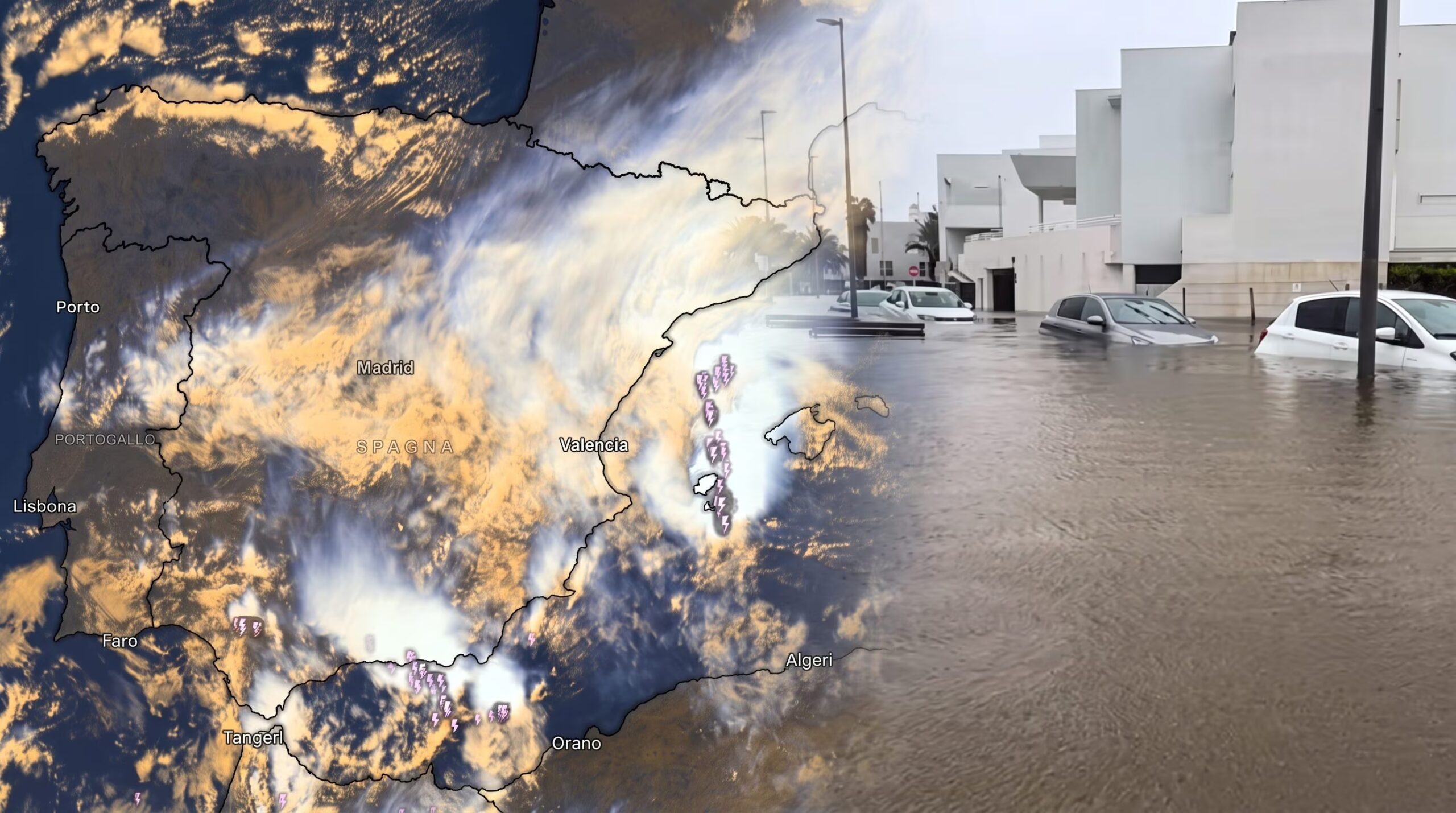
DANA Adam hit France and Spain, with 4 deaths and 700 mm of rain recorded on the Mediterranean side. The same system has organized itself and is now targeting Italy.
A’wave of bad weather intense affected the Mediterranean western, bringing flooding and heavy tolls between Spain and the south of France. The cause of this meteorological phase was initially an isolated depression structure at high altitude, known as “cold drop” or “DANA” (Depresión Aislada en Niveles Altos), which triggered stationary thunderstorms and heavy rainfall. The most affected areas were concentrated in Cataloniaa Valencia and in the province of Alicantewhere they registered 4 victimsover two thousand people evacuated and several inhabited centers ended up under water.
The link with our Peninsula is direct and immediate: this unstable air mass is not an isolated event, but represents the head of the same Atlantic perturbed system which is shifting its axis eastwards, directly affecting Italy between the day of today, Tuesday 20th, and tomorrow, Wednesday 21st October.
Data from DANA “Adam” in Spain
From the point of view of atmospheric dynamics, the DANA (call Adam on this occasion) was structured by recalling a large amount of humidity from the basin of Mediterranean western. The humid currents eastern countries have had an impact on the coastal reliefs Spanish, favoring the stationarity of storm systems over the same area for several hours.
The rainfall data recorded by the Valencian meteorological network AVAMET showed significant accumulations. In the province of Alicante and in the Safor comarca, in particular in the town of Ovenhave been surpassed 720 mm of rain in approximately 48 hourswhile a Pego they touched each other 700 mm. The flood of the Girona river and the flooding of several streams led to the partial flooding of the town of Olive (Valencia), where several homes were hit and a few hundred residents they were placed safe with the help of helicoptersas seen in the video below.
Uncomfortable situations due to flooding also occurred at Balearic Islandsin particular a Ibiza and Formenteraand in southern France between the departments of Hérault and Gard and in the city of Marseillewith temporary interruptions to road traffic and precautionary school closures.
From Spain to Italy: forecasts and most affected regions
Since it is a vast depression figure slowly moving towards the east, instability that featured DANA Adam is now moving out towards the central basin of Mediterranean. The ongoing worsening of theItaly in fact it represents the natural continuation of this atmospheric picture.
There disturbanceexpected to affect our country between Tuesday 20th and Wednesday 21st Octoberis compacting, calling for sustained ventilation of Sirocco with gusts up to 60-70 km/h on the Tyrrhenian regions. The first significant effects will appear in the North-West and on Liguriawhere the soil is already saturated due to recent rainfall.
Subsequently, between the Tuscany and the Laziothe passage of the front may favor the development of storm nuclei capable of discharging further 100 mm of rain in a couple of hours.
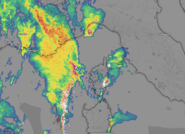
The disturbance will then cross the rest of the country by the morning of Wednesdayalso involving the Triveneto, Campania, Calabria and Sicily, sectors for which the Civil Protection has provided a specific weather alert. Winds of winds will then follow the front Libecciowhich will generate storm surges with waves between 3 and 5 meters between the Ligurian East and the Livorno coast.