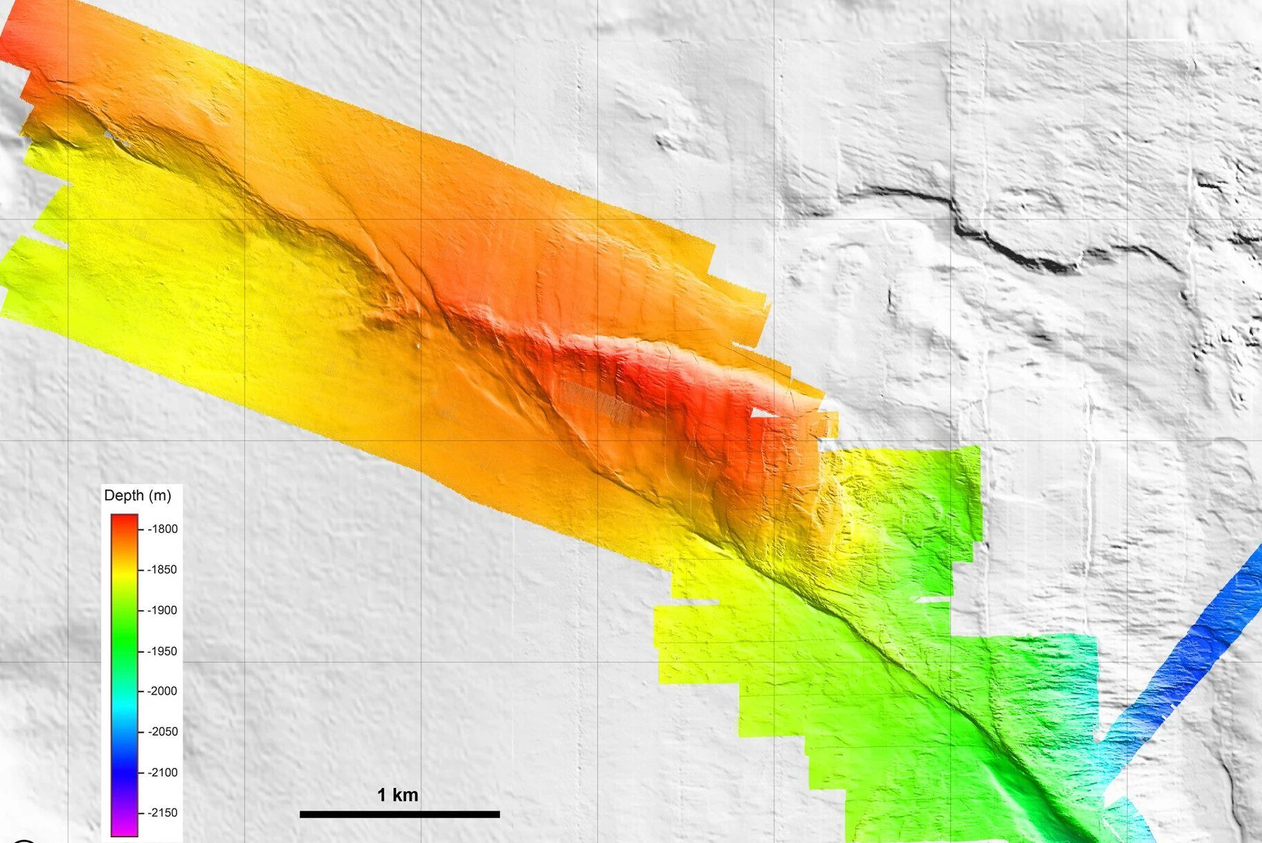
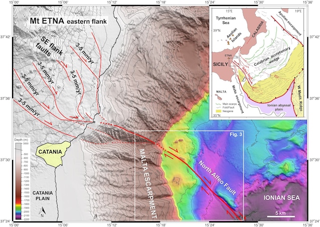
Researchers have succeeded for the first time in map at high resolution there North Alpheus fault on the bottom of the Ionian Man. The fault lies offshore Catania beyond 1500 km deep and extends for about 80 km. Thanks to specials underwater robots it was possible to observe it up close and reconstruct its geometry, and with laboratory experiments and core sampling to trace its history and movements. It turned out that rock blocks along the fault in the last 16,000 years they have moved 3-6 m. Research has confirmed that faulting in the past has caused some destructive earthquakes in southern Italy and that in the future it may generate others with a magnitude of around 6. Knowing the behavior of the fault is essential because not far away, in eastern Sicily, there are densely populated areas. The study, published in the journal Tectonicswas coordinated by French researchers from the Universities of Brest and Montpellier and Italian researchers from the University of Catania.
The study of the North Alpheus fault in the Ionian Sea
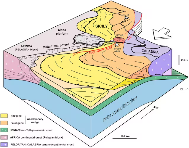
The North Alpheus fault is one active fault which is part of the larger one Alpheus-Etna fault systemlong 140km. This system developed in a tectonic context characterized by the convergence between the African and European plates. Along the fault, defined passing rightthe rock blocks slide horizontally relative to each other, similar to what happens on the San Andreas fault in California.
Although the existence of the fault has been known for some time, it has only now been possible to examine it in detail thanks to modern technologies. Undersea robots and advanced acoustic systems have made it possible to reconstruct its three-dimensional structure with one 1 meter resolution. The investigations, which interested 15 km of faultthey detected not only fractures, but also reliefs and depressions. The maps show one in particular triangular platform 100 m high where the fault deviates sharply, which constitutes a deformation of the seabed indicative of ongoing crustal movements. Secondary fractures And underwater landslides confirm that the fault system is active. The seabed observations were integrated with laboratory experiments in which the behavior of marine rocks and sediments was simulated. These confirmed the sense of movement of the fault and the mechanisms that drive its evolution. Further clues were obtained from cores in marine sedimentswhich preserve a layer of lapilli emitted by the very violent eruption dating back to 16,700 years ago of the Ellipticala gigantic volcano about 3600 m high that stood where Etna now stands. By analyzing the movements that the layer has undergone, the researchers verified that since it was formed it moved 3-6 m.
Why is it important to know the characteristics of the fault
According to the study, the North Alpheus fault is a manifestation of the lateral tearing of the Ionic plate that is sinking beneath Calabria, a process called subduction. This fault is defined STEP fault (Subduction-Transform Edge Propagator), a category of faults that develop at the edges of subduction zones. This tectonic context has similarities with the area where the South American plate sinks under the Caribbean one and where disastrous events occurred on 24 June earthquakes of magnitude 7.2 and 7.5 in Venezuela. Based on the fault’s dimensions and measured displacements, the researchers estimated that North Alpheus could generate earthquakes of magnitude 6-6.3. It is believed that in the past the fault has caused destructive earthquakes in this region which is characterized by a high seismic risk (think of the earthquakes in Val di Noto in 1693 and that of Messina and Reggio Calabria in 1908, which caused thousands of victims). Consequently, also taking into account the fact that it is densely populated areasknowing the seabed structures in detail is essential to prevent and mitigate the seismic risk of the area.
