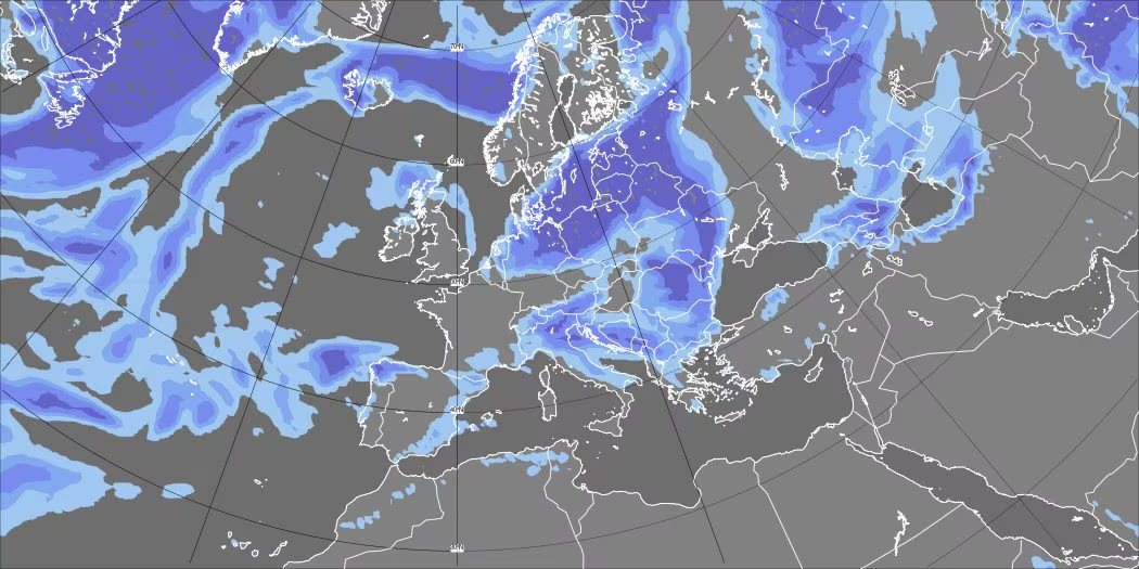
After weeks of almost absolute hegemony of thesubtropical anticyclone, the meteorological scenario over Italy is undergoing a metamorphosis important. THE‘high pressurewhich locked the Mediterranean atmosphere in a bubble of static, muggy heat, began to give in along its northern perimeter.
This first weakening has already triggered a series of extremely intense storms on the Northern regions (in particular between Lombardy, Veneto and Emilia-Romagna), culminating this morning with extensive and important damage between Mantua and Modena caused by hailstorms with stones of exceptional diameter, even greater than 10 centimetres.
These are not random events, but the direct physical consequence of collision between air masses with opposite thermodynamic characteristics. Let’s see in detail how atmospheric circulation will change in the next few days and why some areas of Italy will experience a clear change of air while others will remain temporarily on the sidelines.
How the scenario changes in the next few days: the most affected areas
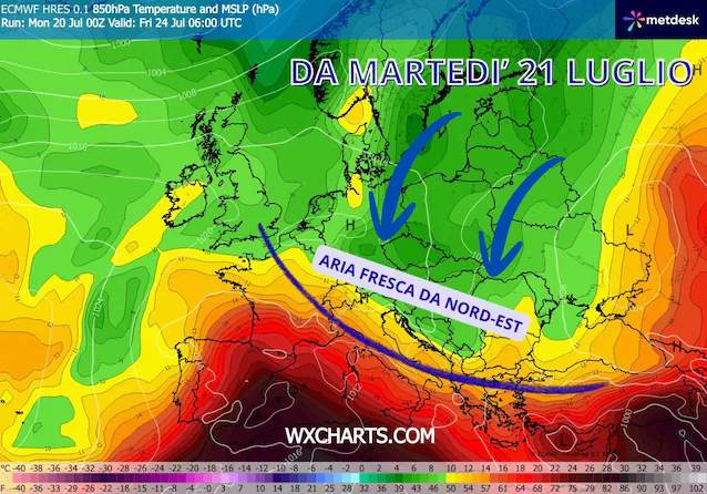
In the next few days we will see one clear change in circulation on a continental scale: currents definitely more air fresh they will penetrate decisively in the basin of Mediterranean and, with their push, they will force the subtropical air mass to partially retreat, leaving Italy at least partially for at least 7-8 days. The main access route for this flow will be the so-called Bora Gatethe Karst plateau to the North-East.
The areas most affected they will be those of Adriatic side and the Northern Plains: between Tuesday and Wednesday the fresh impulse will break out generating strong thunderstorms with associated hailstorms on the northern plains, the north-east and along the entire Adriatic strip, also pushing in part towards the southern peninsula. On these sectors the more marked temperature drop. City like Trieste, Venice and Ancona they will see minimum temperatures drop to around 19-20°C and maximums stabilize between 28 and 30°C. A clear improvement compared to the tropical nights (with fixed minimums above 22-23°C) and the suffocating maximums of 34-35°C of recent days. Elsewhere they temperatures will drop on average about 4-6 degreesreturning to more acceptable values close to the average for the period.
The areas that remain warm will be the North-West, Tyrrhenian and Islands: the Apennine chain and the very trajectory of the winds, which will blow Bora strains on the Adriatic, will leave the Tyrrhenian regions, the North-West and the two large islands (Sicily and Sardinia) decidedly more apart. Here the opportunities for refreshing thunderstorms will be very few; The heat will only partially fadehowever becoming drier (less sultry) and therefore more tolerable.
Possible definitive unlocking over the weekend
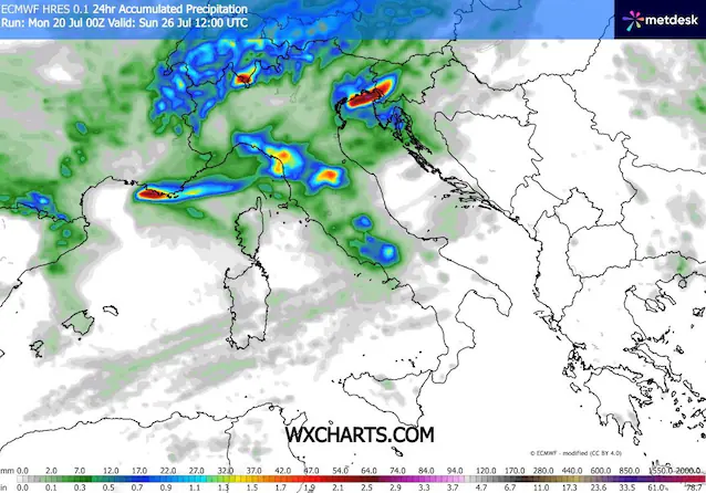
What could unblock the situation also for the regions left dry? The models show the possible entry of a Atlantic perturbed front on the weekend, approximately between Saturday 25th and Sunday 26th July. If this trend is confirmed, the disturbance will hit the Tyrrhenian areas and the Centre-North in a more structured way, giving a real and clear shock to temperatures on a national scale. The storms could therefore be felt higher this time Liguria, Tuscany and Lazio.
But why are these atmospheric phenomena so violent?
The answer is in stored energy from the atmosphere. For over two months, the strong summer solar radiation and the compression of the air linked to the subtropical anticyclone have accumulated enormous amounts of heat and humidity in the lower layers.
When cool air from the north reaches this boiling “buffer”, the thermal equilibrium is abruptly broken. The hot air on the ground, being much less dense than the cold air that arrives, shoots upwards very violently. This convective motion generates gigantic cumulonimbus clouds with updrafts (updraft) capable of exceeding 100-150 km/h.
Inside these clouds, water droplets are pushed to very high altitudes, well above the zero degree line, where they freeze instantly. More there current Ascension is strong and fueled by the earth’s heat, the longer it can maintain suspended the hailstone within the cloud, allowing it to accumulate successive layers of ice before gravity pushes it to the ground. It is exactly this exasperated mechanism that has generated the giant beans up to 10 cm recorded in Lombardy and Emilia-Romagna in the last 48-72 hours.

Despite this very dynamic week, we are still in the heart of summer. From a physical point of view, completely undermining such a vast mass of warm air is not an immediate process due to thethermal inertia.
The Mediterranean Sea and the atmosphere they behave like huge thermal tanks: surface waters are literally boiling after two months of absolute stability. This immense heat reserve will not only continue to mitigate surface cooling, but will constitute the fuel ideal for the development of new intense phenomena as soon as the fresh flow runs out and high pressure tries to regain ground towards the North.
