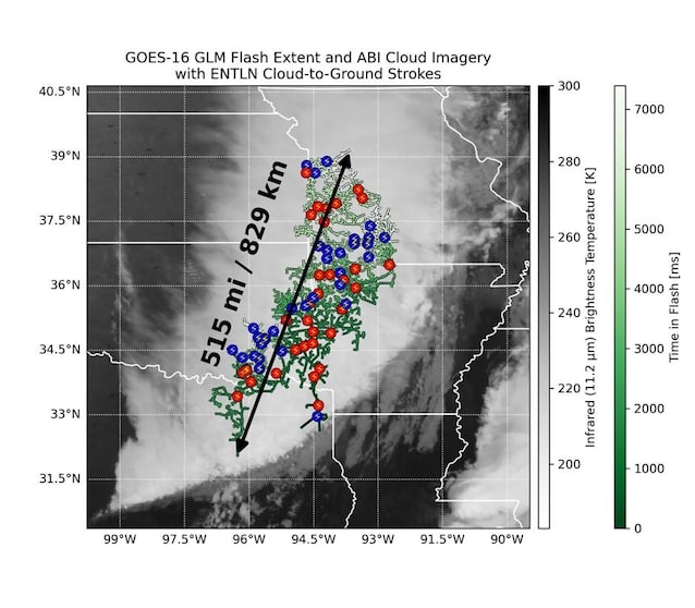
The newest lightning record ever measured is very recent: the World Meteorological Organization (WMO) has in fact recognized the primacy of a so -called on 31 July 2025 megaflash which has extended to the beauty of 829 km during a storm in the United States in 2017overcoming 61 km the previous record. A phenomenon that occurred a few years ago, therefore, but only recently identified following some data reviews and images produced by the geostationary mapping systems of lightning on board the satellite Goes-16 of the Noaa.
The megaflash the October 22, 2017 in the United States and covered a horizontal distance of 829 km ± 8 kmextending from Eastern Texas to Kansas City (Missouri). To be clear, this is the distance between Venice and Paris. The duration of the event was of 7,391 seconds.
The world meteorological organization (WMO) has included the event in the archive of extreme weather and climatic events, classifying it as The largest lightning ever measured. The details of the event and the measurements were published in a study in the magazine Bulletin of the American Meteorological Society last July 31, 2025.
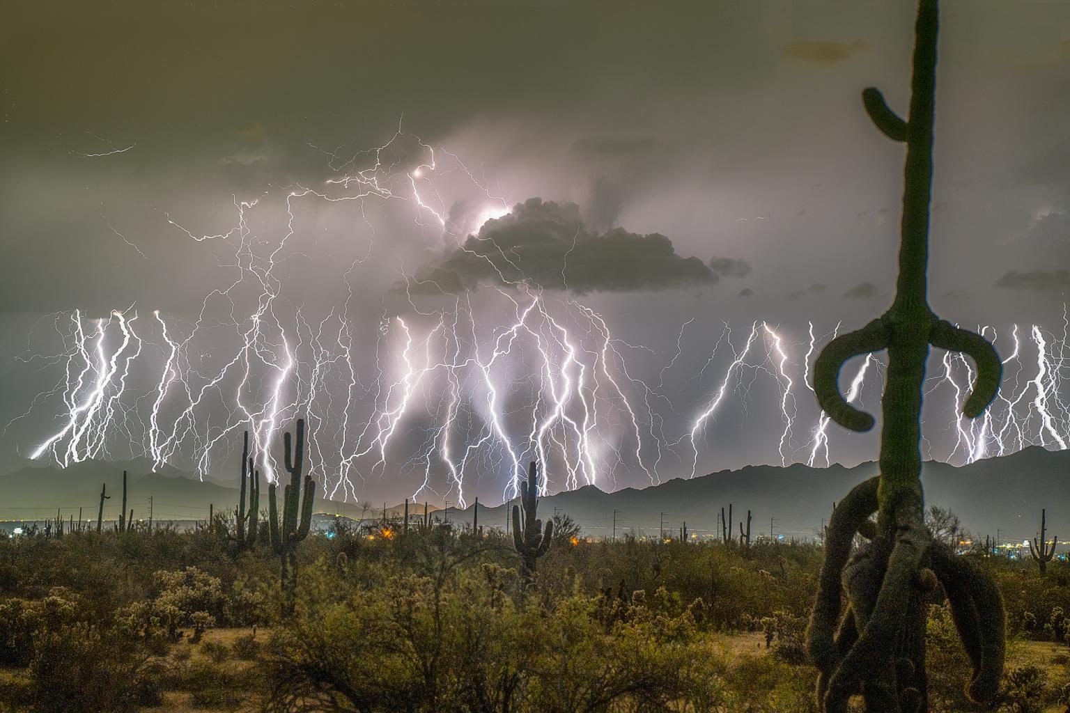
In the common imagination, lightning are seen as very meteorological phenomena localized And often visible only if you are close enough to the storm. However, megaflash differs from this vision. It is “megaofulmini“, or individual horizontal flashes continuous with a minimum length of 100 kmwho propagate through the clouds by releasing hundreds of Nube-Dorma discharges along their path. A megaflash is not in itself visible to the naked eye, while they are the discharges on the ground it generates. Sometimes, these mega-lames occur beyond 30 minutes After the last thunder perceived locally.
Clearly it is extreme weather phenomena and rather rare. Experts estimate that only the1% thunderstorms can produce megaflash. These occur within organized temporal systems, That is, aggregates of convective cells that interact with each other forming wider and more lasting structures than isolated thunderstorms. These systems, known as convective systems in Meso-Scalacan extend to beyond 1000 km away and last over 12 h.
Although these are rare phenomena, Megaflash attracted the interest of numerous researchers who, on the one hand, aim to understand their nature and, on the other, to evaluate the risks associated with their presence. In fact, although to date they are often located in areas that are not densely populated, the cloud-tone discharges generated by the megaflash represent a risk for safety still little understood.

The first detail studies on Megaflash date back to just under 20 years ago. In the 2007an event with an extension of 321 km It was identified in the sky ofOklahoma thanks to the use of Lightning mapping array (Lma), detection networks composed of antennas, GPS receivers and processing systems capable of registering the distribution of lightning. However, significant progress in identifying and studying these extreme phenomena have been made only from November 2016with the launch of geostationary meteorological satellites Goes-16 And Goes-17 of Noaa. Both are equipped with sensors Geostationary lightning maper (GLM)which allow the continuous monitoring of thunderstorms in the western hemisphere.
Thanks to data produced by the Goes-16 it was possible to map the 2017 record megaflash, which took place in Great plains of North Americaan area known for extreme temporal events. This lightning, in particular, had not been identified in the original analysis of the storm, but was discovered subsequently during a new data review. Previously, the primacy belonged to another event that occurred among the United States and the Gulf of Mexico The April 29, 2020with a length of 768 kmor 61 km in less than the new record.
Sources