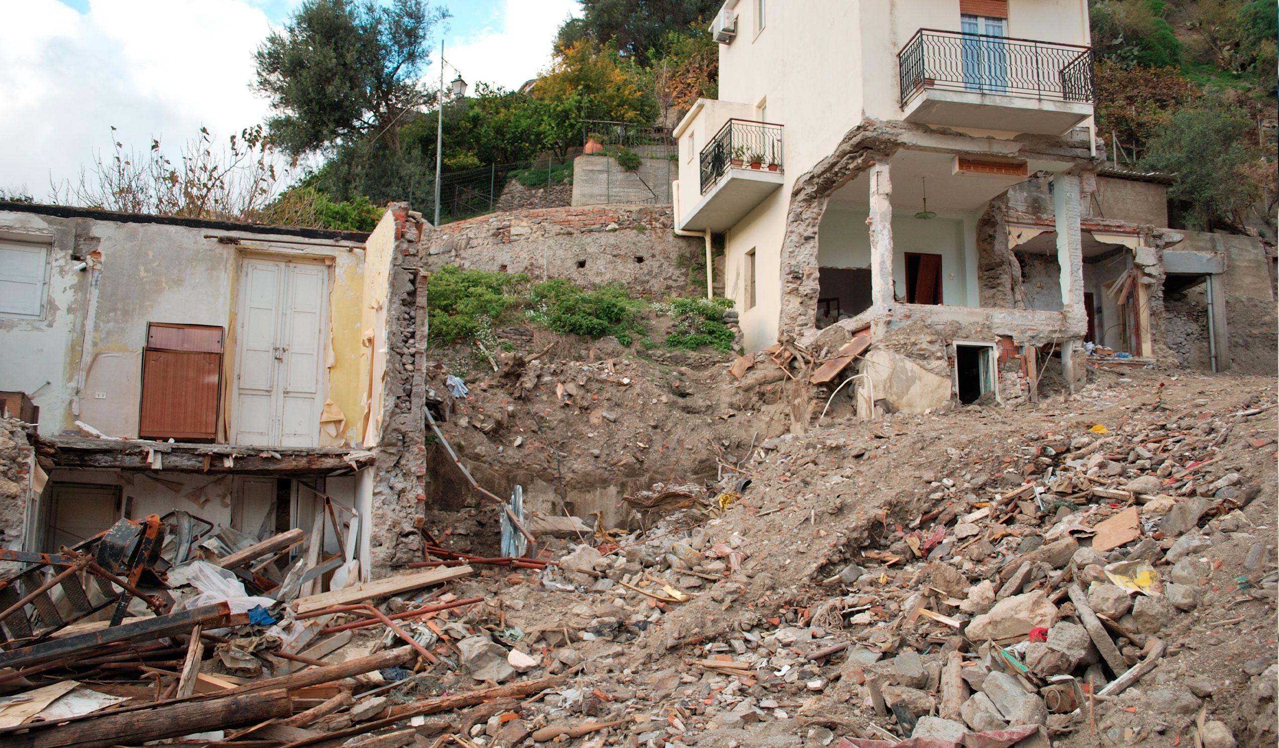
While the Niscemi landslide continues, with new failures and the recent collapse of a three-storey building, in Italy attention has been rekindled on the fragility of the territory compared to landslide phenomena. The natural tendency of soils to slide towards new conditions of equilibrium makes it essential to identify tools and strategies capable of re-establishing the safety, especially in high risk areas. The problem, however, is that the signs of a landslide are often invisible in the initial stages and become perceptible only when the movement has already reached speed such as to make the process substantially irreversible.
In this article we reflect on how this is possible predict and monitor landslide movements and which tools today allow us to evaluate them in advance risk conditions. In the meantime, in the town of Nisseno the schools have been reopened, also in the presence of a team of psychologists, while the Civil Protection has confirmed that the landslide it is still movingeven if the speed is slowing down.
What is meant by landslide
By landslide we mean the movement of an unstable volume of soil which, once certain limit conditions are exceeded, enters one collapse dynamicsthat is, it exhibits high displacements, such as to redesign the present geomorphological conditions. From a geotechnical point of view, we talk about landslides when they actually form sliding surfaces within the mass of land: therefore, not every deformation of the ground automatically represents a landslide. The movement becomes such only if the unstable mass moves because the driving forces exceed the resisting forces.
In simple words, a slope slides when the push towards the valley – due to the weight of the land and everything that weighs on it – becomes greater than the ability of the land itself to oppose the movement. A simplified representation of this principle is the classical physics problem of mass sliding down an inclined plane. The mass moves only if the component of the weight force along the plane exceeds the resisting force, which depends on the friction coefficient between the block and the plane. If the driving force is greater than the resisting force, the block slides inexorably. In reality, however, the behavior of a slope is much more complex, for several reasons:
- Soil is a material heterogeneous and stratifiedwith variable properties from one layer to another.
- Sliding surfaces can be curvesincreasing the physical complexity of the problem compared to the simple inclined plane.
- The ground can resist not only through friction, but also thanks to a cohesive componentpresent especially in fine lands.
- Stability is strongly influenced by hydraulic conditionsparticularly from pore water pressure, which can dramatically reduce soil resistance.
The most used scientific classification is that of Varnes (1978)which distinguishes landslide phenomena based on the type of movement and the material involved: the term landslide can in fact be declined in Collapse, Overturning, Scrolling (translational or rotational) e Colamento.
How do you monitor a landslide?
Monitoring the stability conditions of a slope can be approached in two complementary ways: geotechnical analysis with modeling and minstrumental monitoring of the site.
Analytical approach
It consists of geomechanical modeling of the slope, based on an accurate reconstruction of the stratigraphythe definition of the mechanical properties of soils and the analysis of hydraulic conditionsincluding groundwater levels and the possible presence of filtration movements. The main result of these evaluations is the Safety Factor (FS)a value that measures how stable a slope is under different loads, both natural (such as earthquakes or intense rainfall) and anthropogenic (such as the weight of buildings or infrastructures). A low FS indicates that the slope is close to the limit equilibrium condition and that this could evolve towards instability.
Instrumental monitoring
The on-site monitoring it is essential to identify even minimal movements and variations in hydrogeological conditions in advance. The main technologies used are:
- Inclinometers and strain gauges, which measure angular variations and depth displacements respectively. They allow the infamous sliding surfaces to be identified and the deformation rate to be monitored, which is essential for assessing the temporal danger of the landslide.
- High precision GPS, drones and photogrammetry, which allow the detection of millimetric movements over time, which is fundamental in slow or widespread movements.
- Interferometric satellite radar (InSAR), which compare satellite images acquired at different times to detect ground deformations with sub‑millimeter precision. They are very powerful tools for extensive or difficult to access slopes.
- Piezometers, they are instruments that record the interstitial pressure of the water, a crucial parameter in controlling the onset or acceleration of landslides.
In the advanced stages, however, a landslide can also manifest itself visually through bulges, depressions, anomalous inclinations of trees or poles and sudden releases of water.
NDE: here are some ispra infographics/maps > https://www.isprambiente.gov.it/it/Istituto-informa/comunicati-stampa/anno-2018/ispra-aggiorna-la-mappa-nazionale-del-dissesto-idrogeologico-nel-91-dei-comuni-italiani-oltre-3-milioni-di-famiglie-residenti-in-zone-a-rischi
What are ISPRA maps
In Italy, the national reference for the cataloging of landslide phenomena is the IFFI Project – Inventory of Landslide Phenomena in Italydeveloped by ISPRA in collaboration with the Regions. The IFFI maps they allow us to identify all the landslides recorded, know their type, extension and state of activity. Furthermore, these maps allow the geological and hydrogeological hazard to be assessed, supporting urban planning, design and civil protection. According to ISPRA, over 90% of Italian municipalities are exposed to hydrogeological risk, and on the national territory there are over 620,000 landslides.
Italy is one of the most vulnerable European countries, both due to its intrinsic geological conditions and human pressure and land use. Available online, IFFI maps represent a fundamental tool for citizens, technicians and administrations, as they allow them to evaluate the danger of an area in advance and guide informed choices in land management.