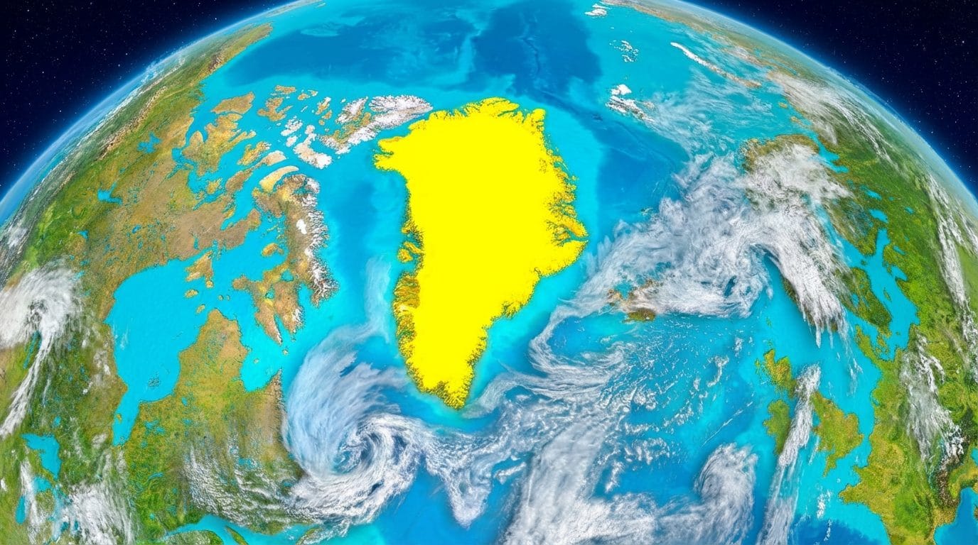
There Greenland was catapulted into the center of global interest after that Donald Trump tried to gain control of it: after the Davos forum, the US President said that the issue will be resolved with an agreement, which according to the New York Times it will involve the extraction of rare earths, new military bases and the organization of a NATO mission in the Arctic.
Looking at the maps to better understand where this island is located, many people’s eyes however fell on one detail: but is Greenland really that big? Spoilers: No.
Despite being the largest island on the globe, the dimensions Royals of Greenland appear on maps distorted: with its 2,166,000 km2 of surface, Greenland is about 7 times larger than Italy (which has approximately 302,000 km2 of surface).
So why does it seem as big as the whole of Africa? Because the maps we have been using for centuries, in fact, were designed by the Belgian cartographer Gerhard Kremer, known as Mercatorwho in 1569 managed to represent the spherical surface of the globe on a two-dimensional plane. The problem is that the surface of a sphere (like the Earth), being a 3D body, cannot be represented on a 2D plane without there being distortions, it is geometrically impossible.
More specifically, in the map created by Mercator the more we move towards the poles, the more the distortion amplifies, making countries exaggeratedly enlarged. In other words, the further you move from the projection center, the more the projected area will be deformed.
That’s why, in addition to distorting the size of Greenland and other landmasses in the Northern Hemisphere, this map makes it appear Antarctica as big as all the other continents combined when, in reality, it is smaller than Russia.
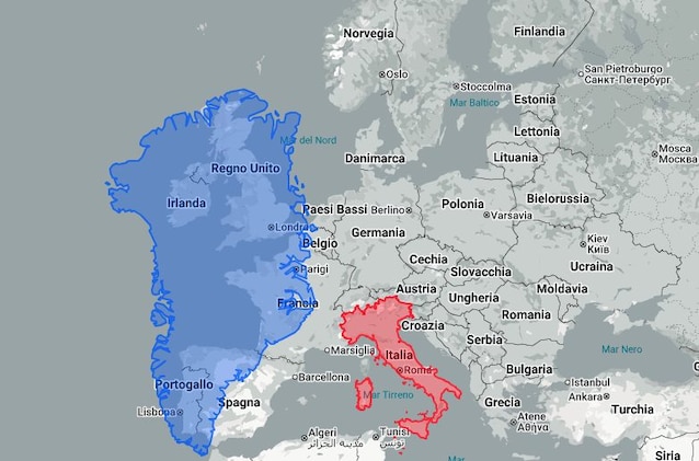
The distortion of Greenland is clearly visible in the maps below: Compared to Italy, the island seems huge.
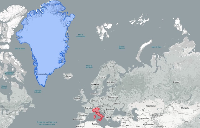
But if we compare the two territories more closely, we notice how the difference is significantly reduced.
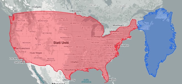
The distortion, perhaps, it is even more noticeable if we take into consideration the United States: With the Mercator projection, Greenland appears noticeably larger.
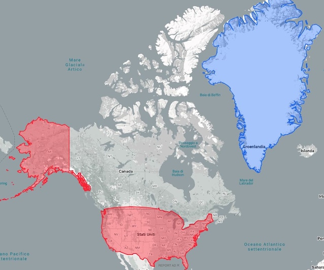
However, if we compare them closely, it changes everything. THE’islandin fact, is about 4 times smaller than the United Stateswhich have a surface area of 8,080,000 km2.
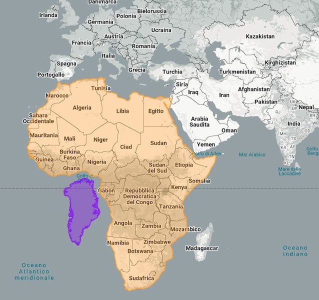
Last comparison, the most evident, the one with Africa: in real dimensions, the Greenland is 14 times smaller than the continent.
Despite these inaccuracies, the Mercator map still remains one of the most popular today practices for describing routes and, precisely for this reason, it is still used. To understand the real size of a state, however, we can always use a globe or consult the The True Size of website, which allows us to move the countries to compare them better.