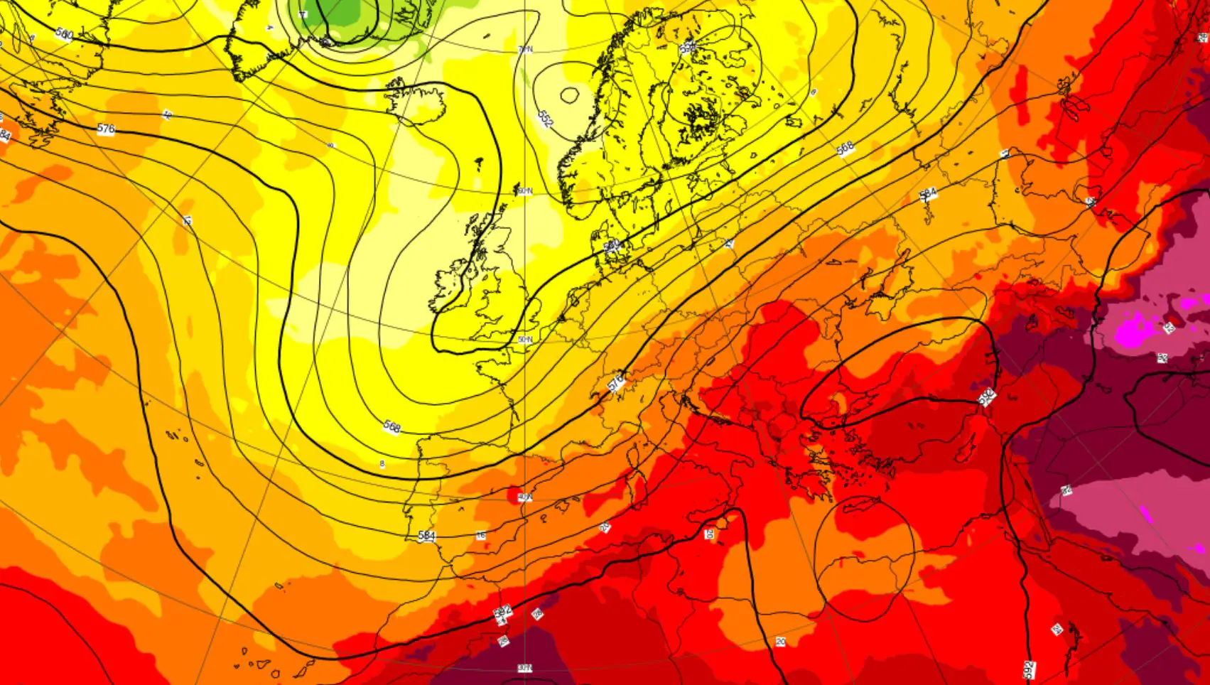
The week continues with a complex atmospheric dynamic. The recent passage of a ripple of cooler currents along the eastern sectors of the Peninsula has favored a slight temperature dropparticularly noticeable on the Adriatic side and in part of the Centre-North. However, this is a limited variation: temperatures remain widespread above the averages for the period over almost the entire national territory.
Temporary anticyclonic comeback between Tuesday and Wednesday, still warm
On the days of Tuesday 18th and Wednesday 19th August high pressure will guarantee a temporary stabilization of the weather over much of the country. Temperatures will undergo a limited increase or settle at stationary values, continuing to maintain a summer profile but without touching the heights reached in recent days.
Thermometers should no longer reach the thresholds of 37-38°C, remaining predominantly between 30°C and 35°C in the plains and in the geographically warmer internal areas. Values close to 34-35°C they can be registered in the internal areas of the Puglia (such as the Foggia plain and the Tavoliere), in the internal sectors of the Sicily oriented south-east, in Basilicata and in the valleys of Calabria. Even in the Tyrrhenian valley bottoms of the Center, among Tuscany and Laziothe maximum temperatures will fluctuate around 33-34°C.
The National Department of Civil Protection has issued a yellow weather warning for today for thunderstorms across all of Campania, Sicily, Calabria and Puglia, over much of Basilicata and Molise and on the coast of Abruzzo.
From Thursday the turning point: Atlantic trough, thunderstorms in the North and regions on yellow alert
Starting from Thursday 20 August the meteorological picture is destined to change in the northern and mid-upper Tyrrhenian Sea. The thrust of one Atlantic sagging towards the western Mediterranean it will trigger a flow of humid and unstable currents from the south-west towards Northern Italy and the upper Tyrrhenian Sea.
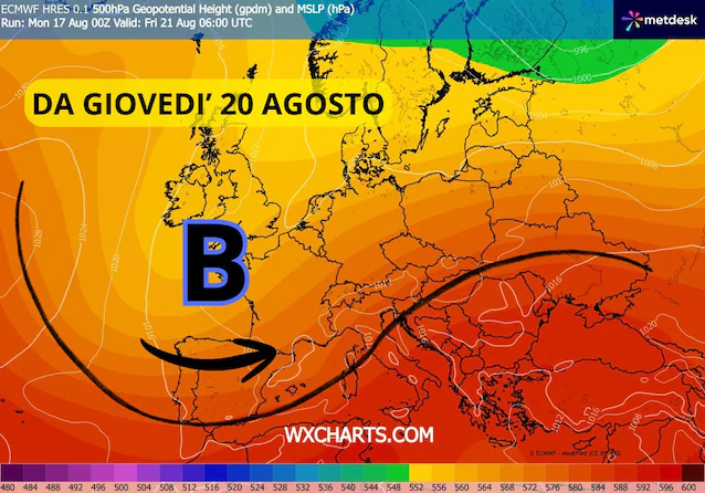
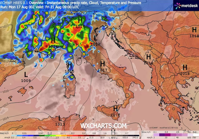
This configuration will bring widespread precipitation, showers and thunderstorms of strong intensity which will directly involve the North-West (Piedmont, Valle d’Aosta, Liguria, Lombardy), the Triveneto and the Tuscany. The unstable phase will continue on Thursday and Friday, lasting until the early hours of Saturday morning. In the North we will witness a sharp drop in temperatures of up to 8°C. In Turin, Milan and Genoa on Friday 21st the maximum values may not exceed 27°C.
The opposite effect in the South: the subtropical lure
While the northern regions will be affected by thunderstorms and temperature drops, the South will experience the opposite dynamic. In fact, the same Atlantic trough that sinks to the west will call back warm and humid currents of southern origin towards the southern regions and the Major Islands.
In these areas the weather will remain mostly dry, but there will be a temporary increase in temperatures and humidity rates. This phenomenon highlights the classic weather-climate contrast of the Peninsula, divided between the influence of North Atlantic currents to the north and the rise of subtropical air masses to the South.
First widespread warnings for bad weather?
The transition from a high thermal regime to the sudden entry of cooler air represents a primary source of energy for storm systems. The heat accumulated from the earth’s surface and from the sea increases evapotranspiration and water vapor available in the atmosphere.
When these factors meet the fresh currents at high altitude, the updrafts become particularly vigorous, increasing the probability of intense phenomena such as storms, violent gusts of wind and hailstorms. For this reason, the first ones will be evaluated in the next few days weather warning alerts for the hydrogeological risk in the northern and upper Tyrrhenian regions.
Prospects: towards a phase of strong thermal contrasts
Overall, the second half of August seems oriented towards a dynamic characterized by marked contrasts. Italy will find itself torn between the disturbed Atlantic passages, more likely in the North, and the temporary calls of warm subtropical air towards the Centre-South. This alternation will produce phases of marked instability on the North, in the face of extemporaneous ones temperature surges especially in the central-southern regions.
