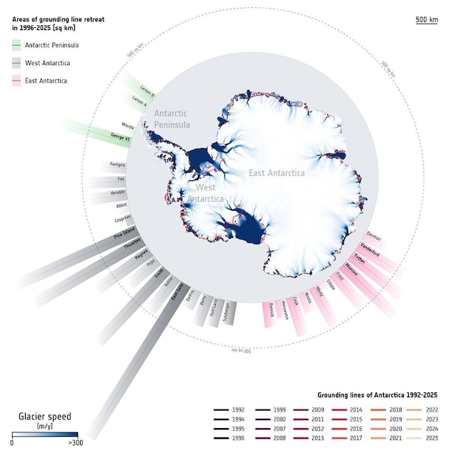
A study on Proceedings of the National Academy of Sciences has traced over 30 years of variations of grounding lines in Antarcticathat is, the boundaries where the Antarctic glaciers stop resting on the ground and begin to float on the water. The good news: on much of the Antarctic coast (the 77%) the ice line has remained stable since the mid-1990s. But in more fragile areas, such as West Antarctica, the ice line has retreated by tens of kilometers over the last three decades, making large ice surfaces (12,800 km2an average of over 420 km2 per year) more likely to melt and thus raise sea levels.
Data on the loss of ice resting in Antarctica: meaning and causes
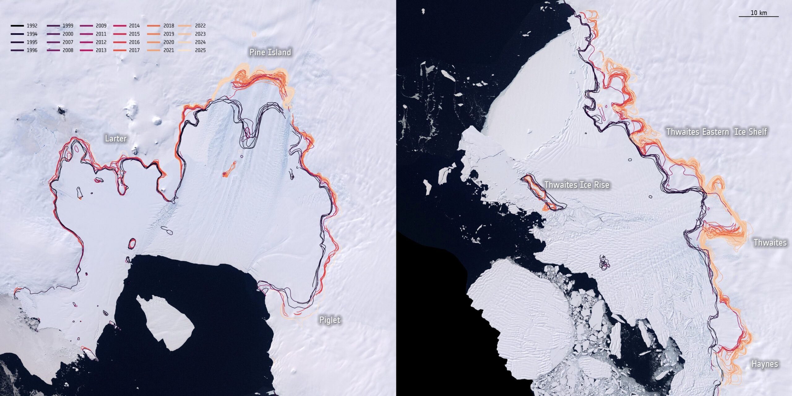
The study On the one hand, most of the Antarctic coast has remained relatively stable: approximately 77% of the coastline showed no significant changes over the last thirty years. In some areas, such as the Ross and Filchner-Ronne ice shelves, a balance is maintained between snow accumulation and ice loss to the ocean. On the other hand, there are regions, especially inWest Antarcticawhere i changes I am more evident. Here, some glaciers are retreating rapidly and the grounding line has moved inland by tens of kilometers. The Pine Island and Thwaites glaciers are among the most vulnerable.
In the period 1996-2025, theAntarctica has lost approximately 12,800 square kilometers of anchored ice. This doesn’t mean all that ice has melted; rather it indicates a transition to a floating state, making it more exposed to the action of the ocean. The main cause of these changes appears to be the interaction between ice and seawater.
In some areas the warm water currents from the deep ocean, in fact, they reach the base of the ice shelves, melting them from below and reducing their ability to slow the flow of glaciers towards the sea. Furthermore, the shape of the seabed marine plays an important role: in many areas of West Antarctica, the seabed becomes increasingly deeper inland, making the glacial system more unstable and accelerating the retreat of the grounding line.
How to study the grounding line, the key boundary of Antarctic glaciers
There grounding line it is crucial data because it regulates the flow of ice towards the sea. When the line retreats towards the interior of the continent, it means that a part of the ice, previously stable and well anchored to the seabed, is now in the floating phase. In this new condition, ice becomes more fragile And vulnerable to fusion and breakage.
To understand how these changes occur over time, scientists observe Antarctica from space using radar satellites such as the European Copernicus Sentinel-1. Thanks to a technique called radar interferometrythese tools can detect movements some ice too of a few millimetres. The principle is simple: the floating ice rises and falls following the tides, while the ice still anchored to the seabed remains stationary. By analyzing these small oscillations over time, researchers can pinpoint with great precision the position of the grounding line and how it moves over the years.