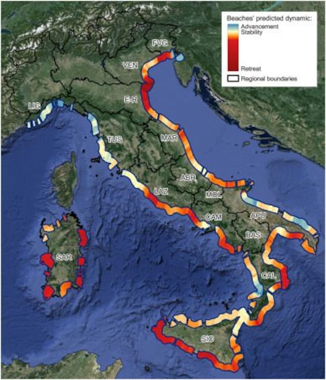
The climate change has had a dramatic impact on Italian coastsin particular at the mouths of the rivers, where currently they also retreat by 10 meters per year. About the 66% of the 40 main Italian rivers suffers the consequences of coastal erosion at the mouth, intensified by the increase in extreme weather events and rising sea levels. A new study, published in the journal Estuarine, Coastal and Shelf Scienceconducted by the Department of Earth Sciences of the University of Pisa. The research analyzed the changes in Italian sandy coasts between 1984 and 2024 using satellite imagery and identified the areas at greatest risk of erosion.
The areas most at risk of coastal erosion in Italy according to the new study
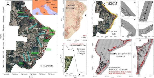
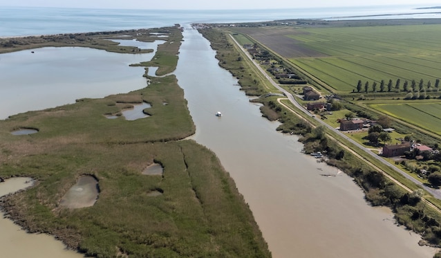
Research has highlighted that 66% of the 40 main Italian rivers are subject to coastal erosiona percentage that reaches 100% if areas protected by artificial defenses are excluded. According to the study, the areas most at risk of erosion are the Po delta, the Serchio, the Arno and the Ombrone in Tuscany and the Sinni delta in Basilicata. In these areas the retreat of the coastline and the reduction of sediment transport by the rivers are very significant. In particular, the mouths of the Arno and Serchio constantly retreat by 2-3 m per year, while the Ombrone delta retreats by up to 5-6 m per year. Even more serious is the situation of the Sinni delta in Basilicata, where the erosion rate is among the highest in Italy, with a retreat exceeding 10 m per year. The study provided a database for the entire national territoryessential for correctly planning future defense works of the most vulnerable coastal areas, such as river deltas.
The main causes of coastal retreat over the years
Over the last century in Italy, as in much of the Mediterranean, climate change has led to a decrease in total annual precipitation which, together with the withdrawal of material from the riverbeds and the construction of dams, has significantly reduced the ability of the rivers to transport sediments to the coast, thus feeding the beaches. At the same time, the frequency of extreme weather eventsfueled by the intense evaporation of warm marine waters. These events are associated with storm surges that can cause flooding capable of altering coastal morphology. These factors, together with sea level rise andurbanizationwhich resulted in the destruction of coastal vegetation, have contributed to accelerating the erosion of our coasts. In Italy, from the seventies to today, erosion has consumed more than 40 million square meters of beaches. The phenomenon puts the landscape and ecosystems are at risk, but also infrastructure, buildings and seaside tourism.
How coastal retreat is studied in Italy
The phenomenon of coastal erosion in Italy is carefully monitored, using cartography, aerial and satellite images, drones and GPS. The disadvantage of cartography high resolution is that it is not produced often enough to allow us to analyze in detail the variations of the coasts over time. GPS and drones they collect data with greater frequency and better resolution, but their use is relatively recent so they do not allow examining the evolution of the coasts in a more distant past. The satellite images instead, they allow us to observe large areas, with continuity over time and high definition, and their acquisition began over 40 years ago, making them ideal for studying the phenomenon. In the research in question, the following were used: satellite data to document i changes in Italian sandy coasts between 1984 and 2024.