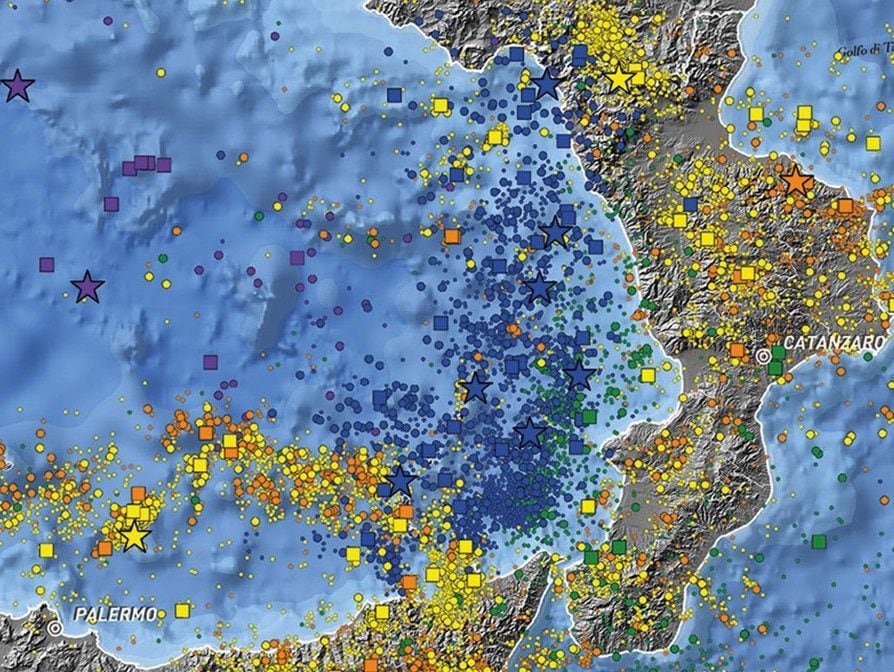
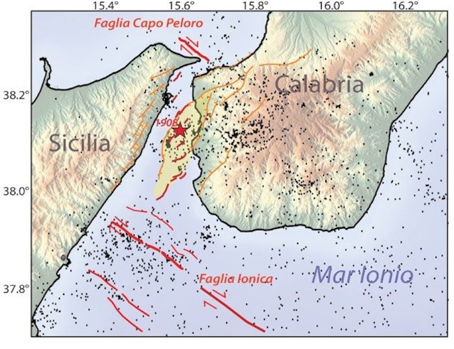
A new study by INGV (National Institute of Geophysics and Volcanology), published on the “ISI – Italian Seismic Engineering” portal, shows how seismicity has changed over time in southern Italy. Before 1908, the year of the Messina earthquake, they occurred few earthquakes but very strong and destructive. Afterwards, they are earthquakes increasedmostly of medium-low magnitude. This difference essentially depends on the progress of seismic monitoringas well as the variability of the ways in which energy can be released, and does not imply a reduction in the seismic danger of the area. Current earthquakes are concentrated along theCalabrian-Sicilian arc and in the Strait of Messinawhere the faults at the origin of past earthquakes are located.
More earthquakes but unchanged release of seismic energy: the differences
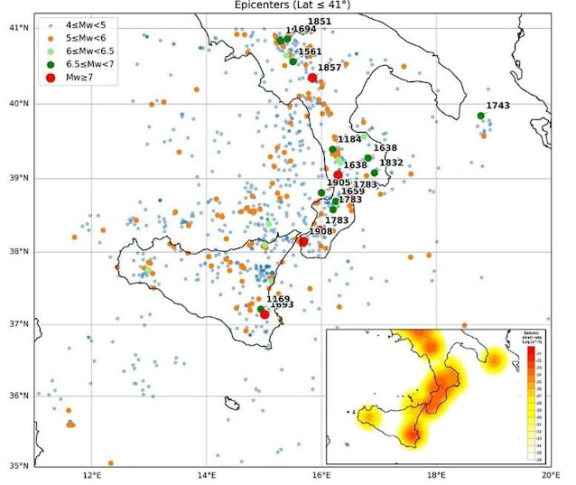
The researchers integrated historical and instrumental data to study the evolution of seismicity in southern Italy over time. It turned out that large destructive earthquakes occurred in the historical period, including that of 1908 in the Strait of Messina, of magnitude 7.1. In the recent one, however, there is a high frequency of events of moderate magnitude, less than 5, with the exception of 1980 Irpinia earthquake, magnitude 6.9. Even the earthquake of March 10, 2026 in the southern Tyrrhenian Sea between the Gulf of Naples and Capri, of magnitude 5.9 and with a hypocenter at 414 km depth, it released a large amount of energy without causing damage due to its great depth. Its origin can be traced back to the sinking of an oceanic lithosphere plate under the Tyrrhenian Sea.
Despite these differences, the overall energy release remained unchanged. The greater frequency of earthquakes observed in recent decades is mainly due to improvement of instrumental observationswith developed seismic networks. However, it does not mean that the seismic danger of the area has changed.
The seismic risk of southern Italy
Southern Italy constitutes one of the sectors with the highest seismic hazard in the Mediterraneandue to the tectonic context characterized by the convergence between the African and Eurasian plates. Historic events with a magnitude equal to or greater than 6.5 are concentrated along the southern Apennines and the Calabrian-Sicilian arc.
Seismic hazard, determined by the geology of the area, is not the only factor that defines seismic risk in Italy. In fact, other factors also contribute: exposed valuewhich refers for example to population density, and the vulnerabilitythat is, the predisposition of people, structures and economic activities to suffer damage. They have a high exposed value and a high vulnerability metropolitan areas of southern Italy (Catania, Messina, Palermo, Reggio Calabria and Naples), characterized by high concentrations of population, critical infrastructures and a building stock that is often dated and not adequate for recent anti-seismic standards. The greatest critical issues are found in the historic centers and Apennine villages, with particularly high vulnerability for strategic buildings, for example schools. Understanding how the release of seismic energy is distributed in time and space is essential for a correct assessment of seismic risk and to implement one adequate prevention.