After cyclone Deborah, the month of April opens with aintense wave of bad weather which is affecting a large part of Italy. The person responsible is cyclone Erminio – so renamed by EUMETNET, the organization that brings together 31 European meteorological services – which is bringing heavy rains, snowfall And gale force winds especially in the Central-Southern regions.
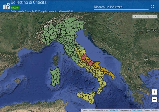
The Civil Protection has in fact issued the announcement the weather warning for 10 regions of central-southern Italy: in some areas ofAbruzzo was declared onalert red for hydraulic and hydrogeological risk, with the Molise region which has just raised the level from orange to redgiven that the rains have continued incessantly for about 36 hours. Orange alert for Puglia and yellow, however, for part of Umbria, Marche, Lazio and the entire territory of Campania, Basilicata, Calabria and Sicily. Meanwhile, the schools they were closed in numerous municipalities of Abruzzo, Molise and Puglia, while the Fire Brigade is carrying out hundreds of interventions to deal with flooding, fallen trees and to make people in difficulty safe.
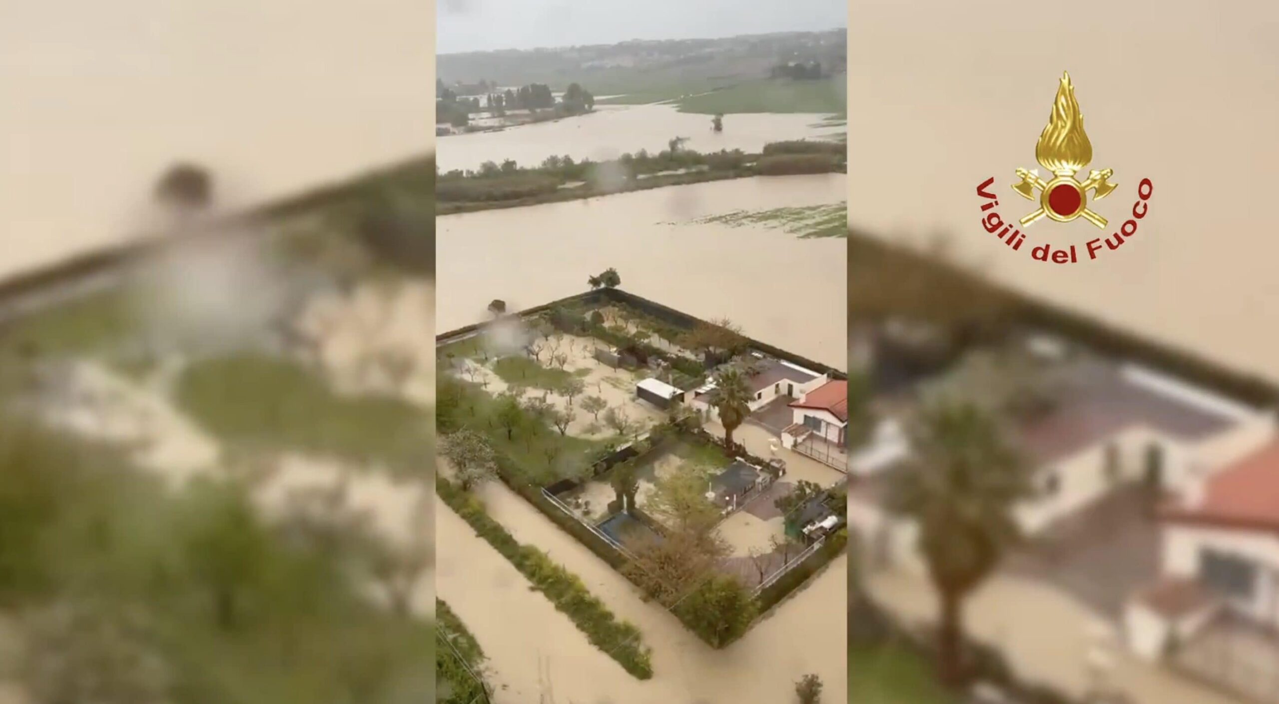
During the night the Fire Brigade saved a motorist in Termoli, who was stuck after theflooding of the Sinarca torrent: meanwhile the Pescara river, in Abruzzo, it has exceeded the alarm limitwith the Municipality deciding to close the northern and southern floodplains. In Molise the emergency plan for the Liscione damwhich had already increased the discharge downstream, with the evacuation of homes and structures located close to the dam.
According to forecasts, the bad weather will last at least until Friday 3 Aprilwhen cyclone Erminio definitively moves to Greece and Italy, an anticyclonic promontory will begin to emerge, which will bring stable weather to almost the entire peninsula for Easter and Easter Monday.
What’s happening from a meteorological point of view
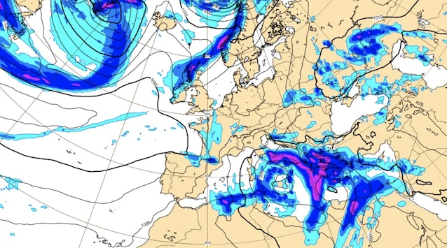
As also confirmed by the Civil Protection, the cause of this bad weather in the Center-South is a low pressure centerwhich is moving from the Tyrrhenian Sea towards the Ionian sectors and which continues to attract cold currents from the Balkans, with the minimum depression which will reach values around 992 hPa.
This disturbance, renamed “cyclone Erminio”, is causing heavy showers across the entire Central-Southcombined with gale force winds that will also reach the northern regions and islands, with peaks of 90km/h on northern Sardinia and 70-80km/h in the Prealps.
At the same time, several storm surges are being recorded along the most exposed coasts, while in Abruzzo and Molise there have been widespread snowfalls above 700-900 metres: in this regard, snow accumulations beyond one and a half metres on Gran Sasso, Majella and Matese.
Will the bad weather last until Easter and Easter Monday? The forecast for the next few days
But, therefore, how long will this bad weather last? According to forecasts provided by 3bweatherthe most acute phase of the bad weather will be concentrated between today and tomorrow, Wednesday 1st and Thursday 2nd April. The effects of Cyclone Erminio, therefore, should last until Friday 3 Aprilwhen the vortex will gradually move over Greece. At that point, an anticyclonic promontory will enter our country which will bring sunshine and stable weather to almost the entire peninsula for Easter and Easter Monday. Just up Calabria and Sicily There could be some thunderstorms in the afternoon.
More specifically, tomorrow, Thursday 2 Aprilthe situation will begin to improvealbeit slowly: the showers on the Adriatic side will ease and the sun will return to the Tyrrhenian regions and Sardinia, while in the South further rain is expected in Puglia, Basilicata, Calabria and Sicily. From Friday 3 AprilInstead, the vortex will move away towards the Balkans, leaving only residual instability in the extreme South, while the sun will prevail in the North and Center.
As for the Easter weekend e Easter Monday (5 and 6 April), the forecasts are decidedly more favourable. In fact, the Azores anticyclone is expected over Western Europe, which will bring conditions stable and sunny over much of Italy. In general, the maximum temperatures they will return to values more in line with the period: it is expected to reach i 23-24 °C in the Northi 22-23 °C in the Center hey 18-20 °C in the South.