When we think about the sea levelwe tend to imagine it as a perfectly uniform surface all over the Earth. In reality this surface is irregular, with depressions and bulges that depend on many factors: gravity, winds, chemical-physical characteristics of the water. One of the best known cases, documented by decades of observations, and best documented is the difference in height between the Pacific Ocean and the Atlantic Ocean: the former is on average higher than the latter by approximately 20 centimetres. The most important reason lies in density difference between the two waters, which in turn depends on the temperature and salinity of the two oceans.
The density of sea water depends on two factors: temperature and salinity. The colder and saltier the water, the denser it is. The denser it is, the less volume it occupies for the same mass. On the contrary, warmer and softer water is also less dense, and therefore – always with the same mass – will occupy more volume. This, incidentally, is also the underlying fact thermohaline currents in the Earth’s oceans.
The surface waters of the Pacific are on average hotter and less salty than those of the Atlantic, therefore slightly less dense. The Atlantic, on the contrary, has average water colder and saltier. This causes the Atlantic to be denser, and therefore “takes up a little less volume” than the Pacific.
However, density is not the only factor at play. Also winds and ocean currents they play a role in moving and distributing large masses of water within the oceans, leading to their accumulation in some areas rather than others. As evidenced by a 1953 historical study published in Deep Sea Researchthis mechanism acts – together with the density gradient – also in the southern interface between the Pacific and the Atlantic, the Drake Channel between the tip of Patagonia and Antarctica, “raising” the water level on the Pacific side of the Strait compared to the Atlantic side.
Finally, there is a more physical question, linked to distribution of land mass: continents, islands, underwater mountain chains and different concentrations of material in the Earth’s mantle produce locally higher gravitational acceleration, which in turn affects sea levels in various areas of the world.
All these mechanisms produce, in the case of the Pacific and the Atlantic, a small but measurable difference with the tools we have available. The PSMLS (Permanent Service for Mean Sea Level) of the National Oceanography Center, which is the reference body at an international level for monitoring sea level, measures 20 centimetres approximately difference in height compared to the average surface of the two oceans.
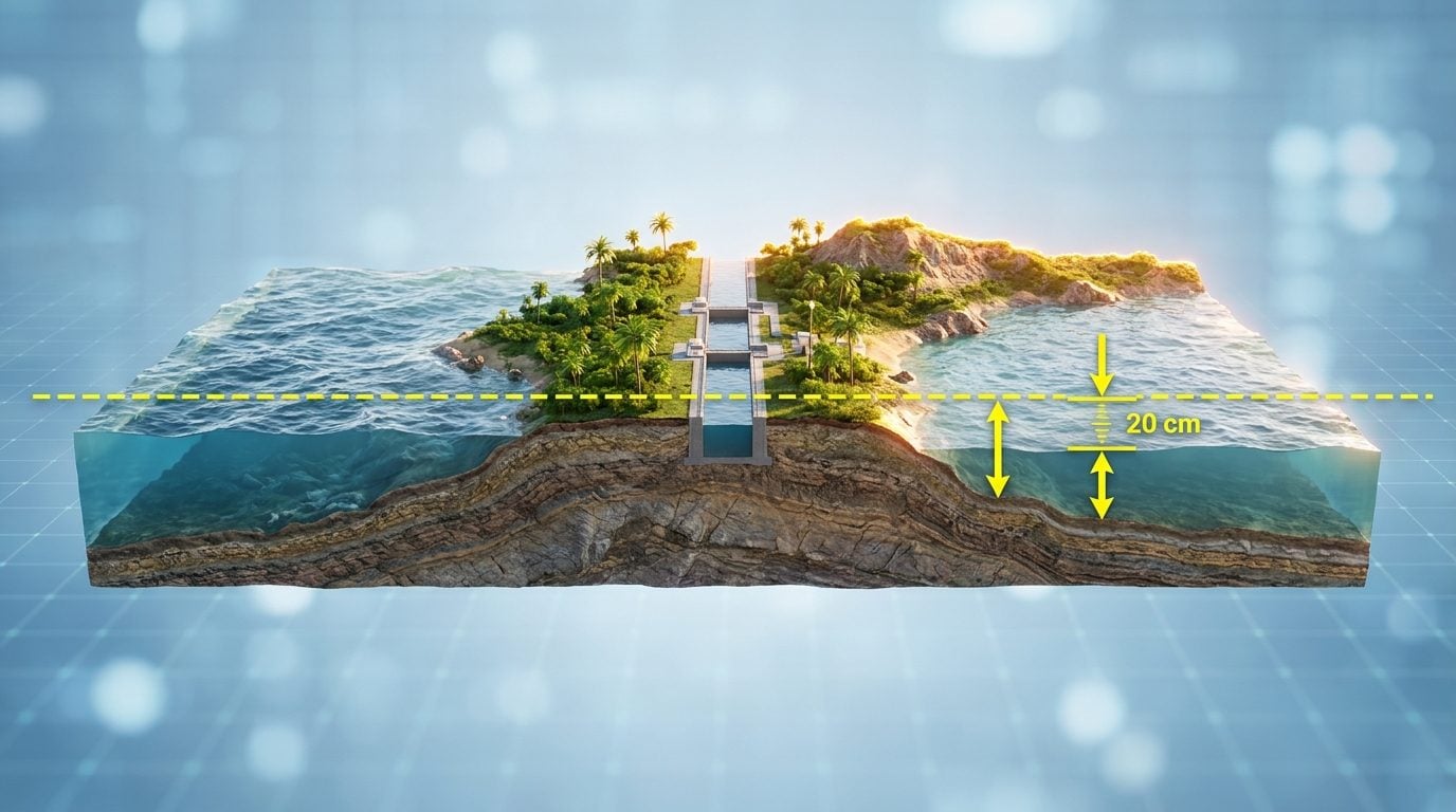
The most emblematic confirmation of this difference is on the two sides of the Panama Canalin the isthmus of the same name which separates the two oceans by only about eighty kilometres. Measurements taken at the ends of the canal show a difference in height of 20 centimetres. This is the best-known case where the sea difference between two oceans was measured using geodetic leveling.
If the channel were an open cut at sea level, then without the closed which are instead present in the channel, there would be a permanent current which would flow from the Pacific to the Atlantic and could have a concrete effect on navigation within the canal. The locks, however, isolate the canal from this difference in level, effectively rendering it irrelevant for navigation.