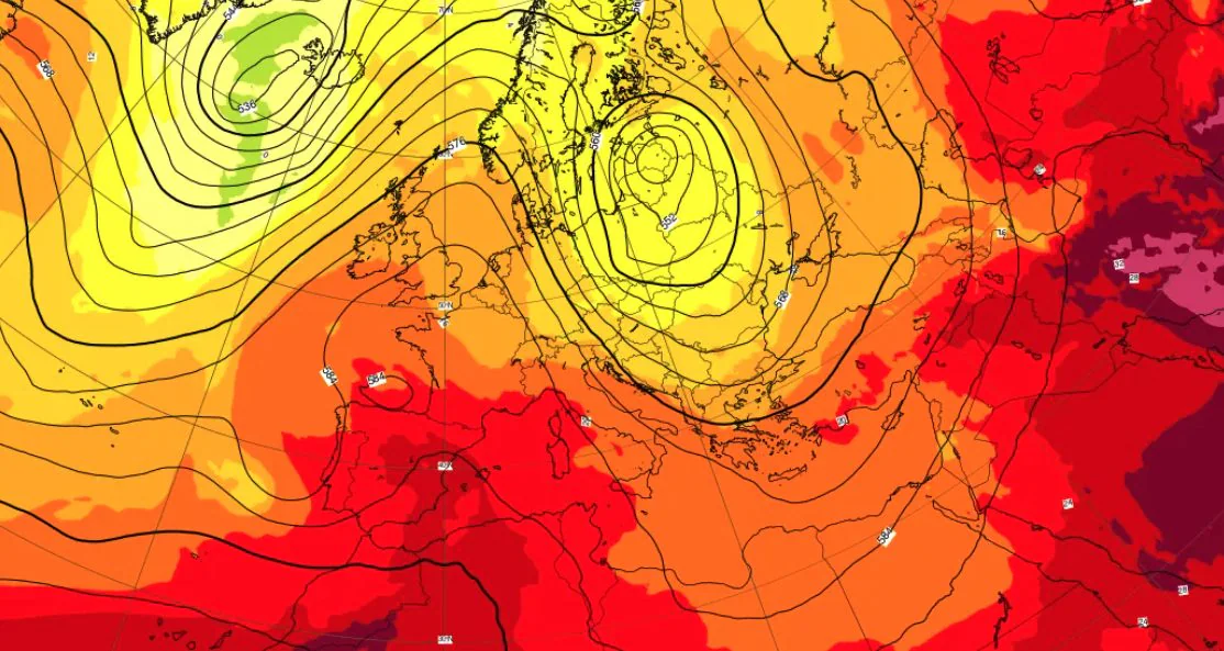
From Wednesday 8 July Italy has officially entered the grip of third heat wave of the summer season. The expansion ofAfrican anticyclone it is already causing high temperatures, with maximum temperatures reaching i 38-39°C over much of the central-northern plains. Medium-term forecasts indicate that this will not be a passing phenomenon: the current extreme meteorological phase is on its way prolonged and, despite a very slight temperature drop expected over the weekend, the heat will intensify again from Monday. Atmospheric stability will persist over the Mediterranean basin at least until July 18-20 depending on the areas.
What will also make the meteorological scenario particularly severe will be the phenomenon of tropical nightsi.e. those nights in which the minimum temperature recorded by the weather stations it never drops below 20°C. The persistence of the high pressure cover will prevent the natural nocturnal radiation of the heat accumulated by the ground during the day, maintaining high humidity rates and temperatures even in the evening and night hours, increasing the perception of bioclimatic discomfort.
Most affected Italian regions and expected temperatures
The first part of this wave is widely affecting the northern and central plains, but the second and more intense phase expected for the next week will move its main axis towards the Central-South and the major islands. In these areas the rise of warm subtropical air will determine exceptional values: attention shifts in particular to internal areas of Sardinia and Puglia but in general of the Centre-South, where the thermometer can exceed the threshold of 40/41°C.
Looking at the maps of the main models you can see how extraordinary isotherms are predicted up to +24°C and locally +28°C at the reference altitude of 850 hPa (approximately 1500 meters) in the period July 13-17. This structural thermal surplus means that the same dynamics that twenty years ago would have brought a normal heat wave with values of +20°C or +22°C at 1500 meters, today translates into extreme peaks on the ground due to global warming and increased heat stored in the lower atmospheric layers.
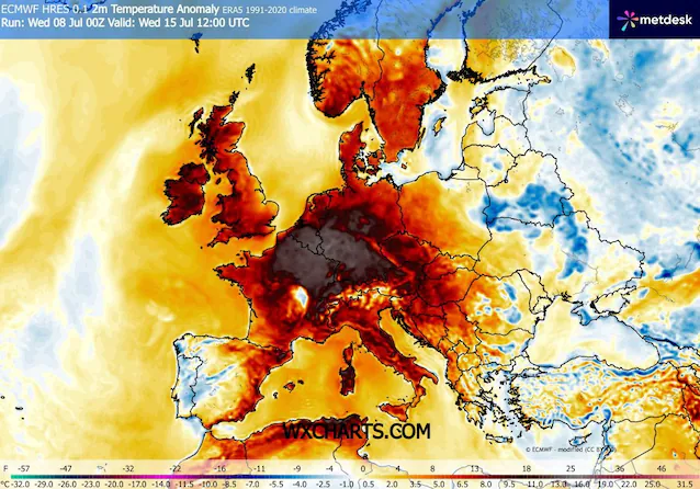
Europe once again affected by an anomalous heat wave, temperatures above 44°C in Spain
The climate anomaly will not spare the rest of the European continent and the basin area of Western Mediterranean. The synoptic cause of this configuration lies in the placement of a large, defined, isolated low-pressure area cold dropon the Atlantic Ocean, west of Portugal and the Bay of Biscay. The counterclockwise rotation of this depression structure will work like a real one thermal catapultdrawing and pushing hot air directly from North Africa towards Europe.
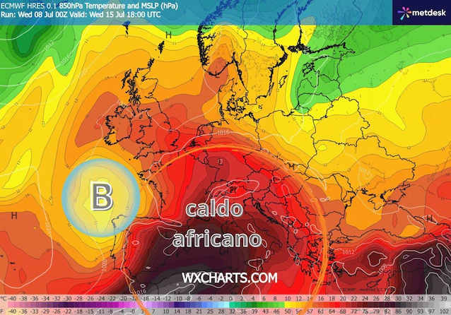
The subtropical flow will first fully hit the Iberian Peninsula with maximum temperatures ready to touch i 42-44°C between Andalusia, Castile-La Mancha and Aragon. From the weekend this boiling air mass will also move towards France and Germany: Paris could once again experience values of 37/38°C for several days with the peak expected on Monday 13th, while in the area around Bordeaux and central French areas the temperatures will once again exceed 40°C. Further south, the very source of this air mass, between Morocco and Algeriawill record the highest temperatures in the entire area, with maximum peaks ready to go up to 48°C in the Saharan and sub-Saharan areas before the flow rises towards the European mid-latitudes.
The health impact and the WHO statement
The consequences on the ground of this prolonged atmospheric and thermal stability have pushed theWorld Health Organization (WHO) to issue a very clear official statement. The WHO has highlighted the serious public health risk associated with this widespread weather phenomenon, warning that even more lethal weeks could arise for the European region if prevention measures are not promptly activated.
Epidemiological data indicate that prolonged exposure to temperatures consistently above 35-38°Cassociated with high humidity levels which generate conditions of intense sultrinesssignificantly increases the cardiovascular stress and mortality rates, especially among vulnerable people such as the elderly, newborns and people with chronic conditions. The daily bulletins issued by Ministry of Health they are based precisely on the translation of these physical parameters (temperature, humidity and solar radiation) into indices of bioclimatic discomfort, in order to alert the local health systems before the anticyclonic block structure is definitively broken.
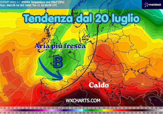
How long will the heat wave last and when will it end?
For a change of scenery overall and a return to milder temperatures will perhaps have to wait for the start of third ten days of July, approximately from 19-20 onwards. In fact, long-term modeling projections show a possible change in the general circulation: those same Atlantic depressions that will remain isolated to the west of Europe until mid-month – acting as a heat pump – could finally break through to the heart of the Old Continent. If this trend were confirmed, the entry of these baric distortions would bring about greater atmospheric dynamismwhich would translate into an initial marked drop in temperatures and the return of rain and thunderstorms across Europe and Northern Italy.
