
Unlike what happens with land vehicles, the speed of boats and gods planes is not measured in km/h but in knots1 knot is equivalent to approximately 1.85 km/h. This particular choice has its roots in the maritime tradition, when the speed of ships was calculated using a particular instrument called log.
The rope, the “log” and the 28 second hourglass
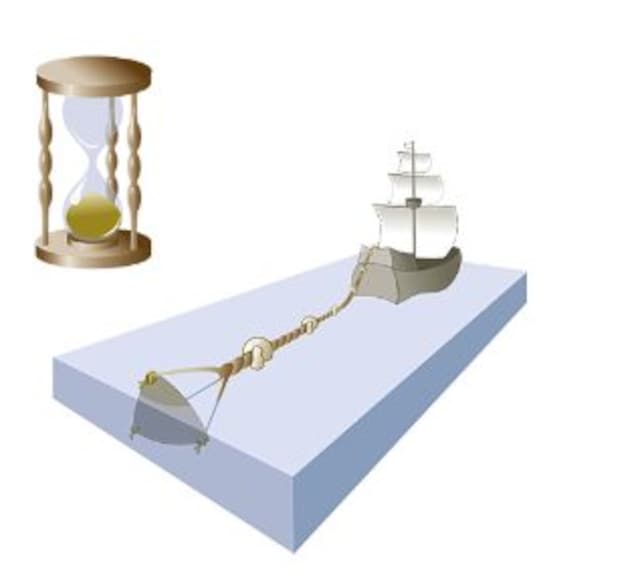
The log it is a rather simple device consisting of a top with gods knots arranged at regular intervals and at the end of which a was fixed wooden float.
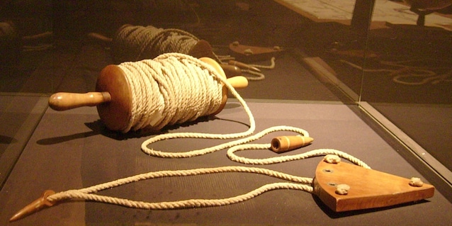
When this was lowered into the water the rope began to unwind and by counting how many knots flowed within a certain time interval it was possible to deduce how fast the ship was going: the more knots passed, the greater the speed of the vessel.
Over time, faster and more precise logs were also developed, consisting for example of an immersed propeller connected to an on-board tachometer, but the knot tradition was so strong that it remained stable over time. To date, therefore, 1 knot is equivalent to a speed of 1 nautical mile per hourwhich in turn is equivalent to approximately 1.85 km/h.
Given this explanation, however, a problem could arise doubt: boats are ok, but why is this measurement system also used for planes?
Why are knots also used for airplanes?
The reasons behind this choice are mainly geometric: the mile nautical – which is the basis of the node system – corresponds to a minute of arc along a terrestrial meridian. And what does it mean?
Simplifying, we can imagine our planet as an orange: each terrestrial meridian is as if it were the edge of a segment and, like any circle, can be measured in degrees (from 0 to 360°). Each degree, in turn, can be divided into 60 even smaller parts called minutes. Here, imagining you are projecting a minute of arc on the earth’s surface, we would obtain exactly a length equal to nautical mile!
From here it is clear how the node system is closely connected to meridians and – consequently – to latitude. Precisely according to this logic, the nautical mile is also considered perfect for navigation aerialallowing you to simplify route calculations.