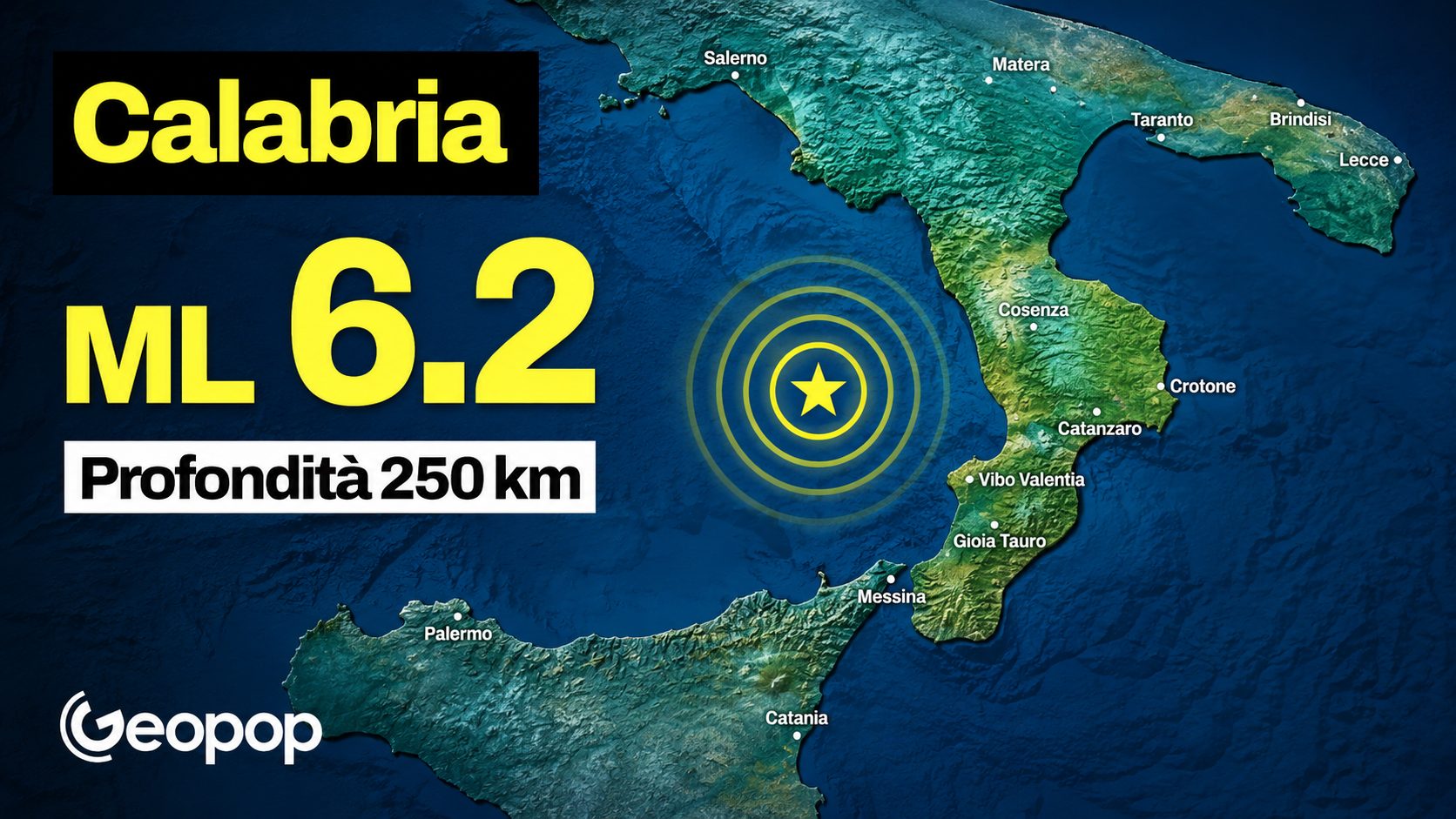
At 00:12 on 2 June 2026 the stations of the National Seismic Network recorded a magnitude earthquake ML 6.2equivalent to MW 6.1, as confirmed by INGV. The epicenter was at sea, about 20 km from the north-western Calabrian coast, near Amantea, in the province of Cosenza.
Many woke up with a start, from Lazio to Sicily. The earthquake was also felt in Rome, Naples, and Sicily. And the first question was the same for everyone: how is this possible? The answer lies in a number: 250 kilometers. It is the depth at which the earthquake occurred, what seismologists call the hypocentral depth. And that depth changes everything.
Why can an earthquake 250 km deep be felt over a very large area?
A shallow earthquake, 5 or 10 km deep, releases its energy in a limited area. This is why it can cause enormous but localized damage. The energy of an earthquake a 250 km deephowever, is distributed over a much larger area, reaching up to hundreds of kilometers away. The perceived intensity in every single point it is minorbut the area of resentment is huge.
That’s exactly what it showed SHAKEMAP map calculated by INGV and DPC (Civil Protection Department), visible below: shaking levels widespread in all southern regions, with maximum values up to grade IV-V of the MCS scale (Mercalli-Cancani-Sieberg).
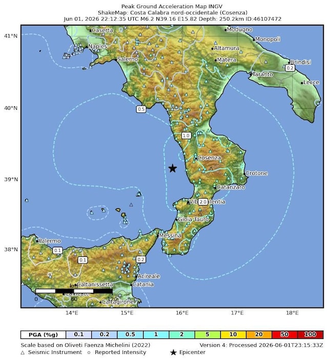
It’s not structural damage, but it’s enough to wake you up in the night and give you a stroke.
What caused the 6.2 earthquake in Calabria?
To understand why Calabria generates these deep earthquakes we need to take a step back, or rather, several million years back.
Under the Southern Tyrrhenian Sea one of the most fascinating geological processes in the Mediterranean area is taking place: the subduction. The Ionian lithosphere, i.e. that portion of the crust and upper mantle that constitutes the bottom of the Ionian Sea, is slowly descending under Calabriaslipping into the earth’s mantle.
As it descends, this slab of rock heats up, deforms and fractures. And when it fractures, it produces earthquakes.
At 250 km deep, the pressures and temperatures are so high that the rocks normally behave in a “plastic” way, almost fluid so to speak. The fact that they still produce earthquakes at that depth tells us that the ion plate is still stiff enough to break, rather than simply bend.
It is a geological system in constant motionfor tens of millions of years. And we live above.
Have there been similar earthquakes before?
The area off Amantea this is nothing new in seismic catalogues Italians.
The Parametric Catalog of Italian Earthquakes CPTI15 v. 4.0 (source: INGV) records historic earthquakes in this area with magnitudes between 4 and 5. Among these is an event of 2 October 1743with an estimated magnitude of Mw 5.1, also in that case with an epicenter near Amantea.
Looking at the instrumental seismicity from 1985 to today, we see two particularly significant events in the same area: an earthquake of magnitude ML 5.1 on December 17, 2008 and one of equal magnitude the May 18, 1998. Both with deep hypocentres, between 270 and 310 km (source: INGV). Same mechanism, same system. Ionic subduction does not stop.
Should I worry? What does this data really tell us?
The honest answer is: no, not in the sense of an imminent emergency. Deep earthquakes associated with ion subduction are a structural feature of this area, documented and studied for decades. They do not indicate an increase in short-term seismic risk in populated areas. This doesn’t mean ignoring them. It means reading them for what they are: the geological signature of a process which has shaped the whole of Italy and will continue to do so. Calabria, among the Italian regions, is the one with the highest seismic hazard precisely because it is located at the center of this system.
Knowing him isn’t scary. Understanding it, however, allows us to live mindfully in a country that is literally built on top of the most dynamic geology in Europe.