Satellite images of the Nasa (National Aeronautics and Space Administration) have highlighted the formation of a new island in Alaska. The island, however, is not located in the open sea, as we could have imagined at first, but a glacial lake originated from the fusion of an imposing one stands in the heart glacier.
But how did this island appear from a ground covered until a few years ago from a mass of perennial ice?
We are now used to hearing about change climatic And collection of glaciers. Phenomena capable of transforming the landscape over a few decades, giving rise to new formations and morphologies. And the curious case of our island starts right from here.
The glacier Alsekon the south-eastern coast of Alaska, is gradually withdrawing due to the merger determined byIncrease in global temperatures.
This phenomenon has a dual consequence. On the one hand, the mass loss of the extensive body of the glacier due to the continuous thinning of this; on the other, a continuous Accumulation of fresh water resulting from the melting of the ice.
When a glacier melts, in fact, it may happen that the melting water accumulates near its terminal part, forming what, in geology, is called proglaciale lake.
And it is precisely this double combination of factors that has generated our island.
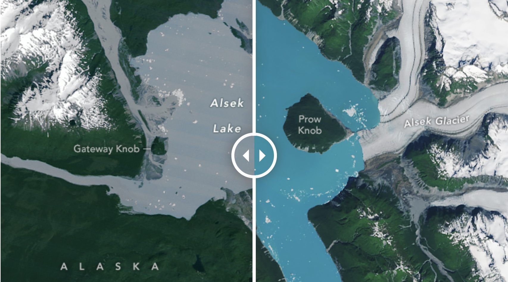
Until a few years ago, a small rocky relief called Prow Know -how It was surrounded by the ice of the Alsek. But with its progressive retreat, the glacier has slowly lost contact with the formation leaving it free, gradually, by its close embrace and retreating around it by releasing a large amount of melting water into the wake originated from its movement.
In the summer of 2025, the glacier definitively separated from the Mount leaving it completely enclosed by a proglaziale lake: the Prow Knob has thus turned into the island.
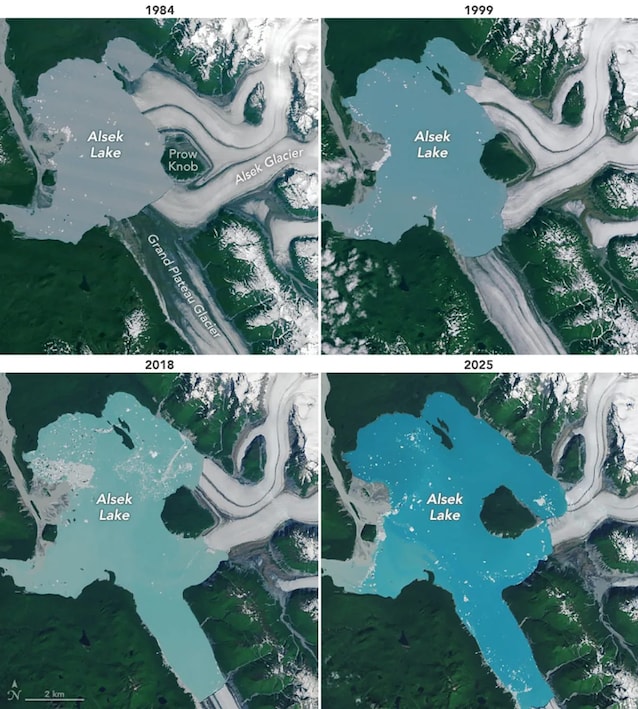
The event was documented through images taken after several years, between 1984 and 2025, with tools such as the Thematic maper (TM) of the Landsat 5 satellite and theOperational Land Image-2 (Oli-2) of the Landsat 9 satellite. These satellite photographs clearly show how the glacial front has retired to the east and south side of the relief, leaving room for the expansion of a lake, whose volume went from 45 km² to 75 km² in about 40 years.