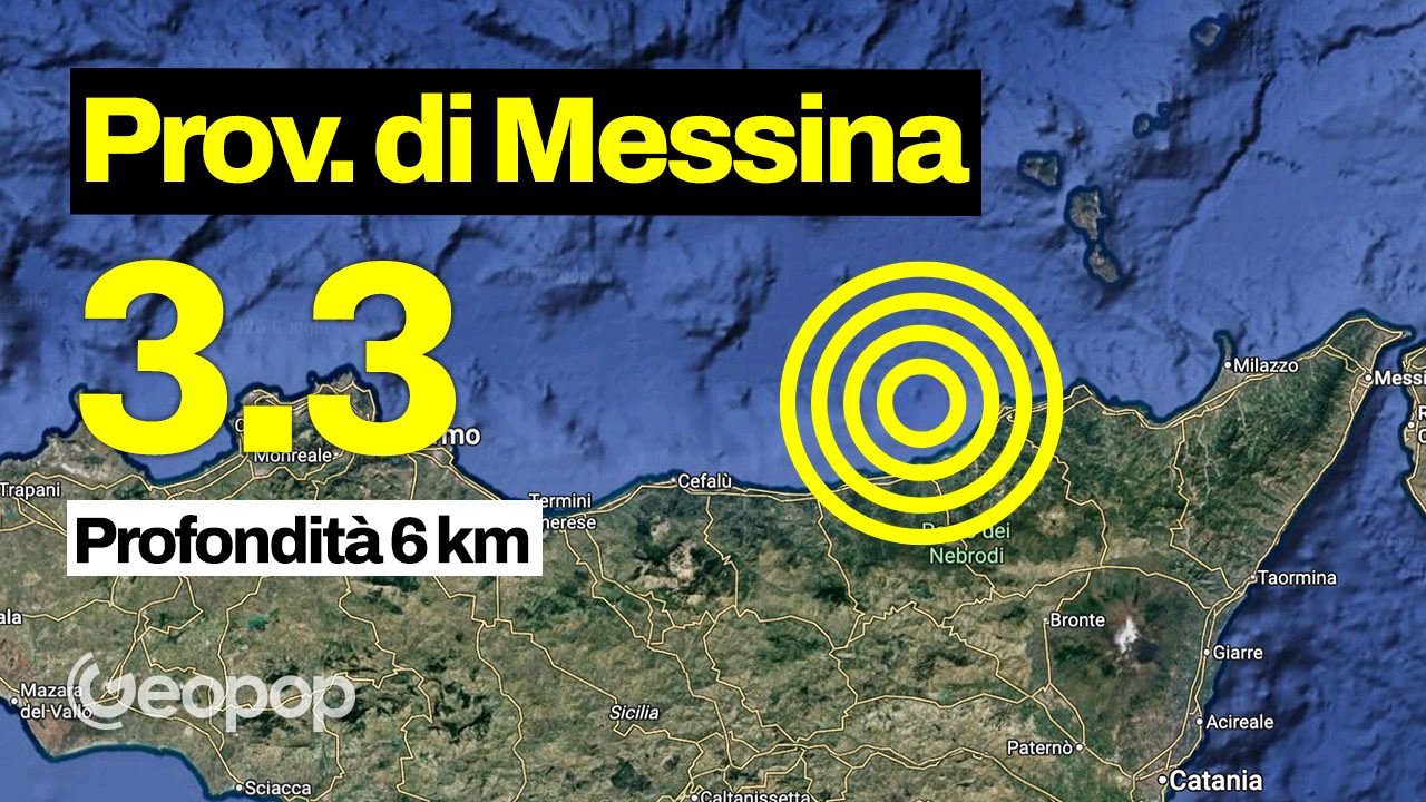
A shock of earthquake Of magnitude 3.3 hit the province of Messina at hours 2.49pm today, April 24th. According to what was recorded by INGV, the epicenter was located in the sea, about 10 km from the coast of Sant’Agata di Militelloa town of approximately 12,600 inhabitants located approximately 87 km from the city of Messina. The hypocenter, however, was detected at 6 km deep.
The first earthquake was followed by a second earthquake of magnitude 2.3detected at 3.03pm, with the same epicenter and a depth of 6 km.
There would have been earthquakes be warned in various areas of the Messina areaespecially in the municipalities closest to the coastal strip, from Sant’Agata di Militello to Capo d’Orlando – located 16 km from the epicentre. At the moment, however, no damage was reported to buildings or people.
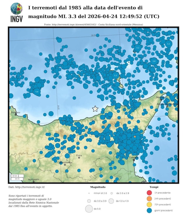
From a geological point of view Sicily is considered a highly seismic area due to the clash between two tectonic plates, namely the African and the Eurasian ones. It is precisely this clash that generates complex fault systems which, in some cases, can give rise to very intense earthquakes.
The map below, created by INGV, confirm visually this phenomenon: in the image all the earthquakes register in the area from 1985 to todaywith the star symbol indicating the epicenter of today’s shock.
Article being updated.