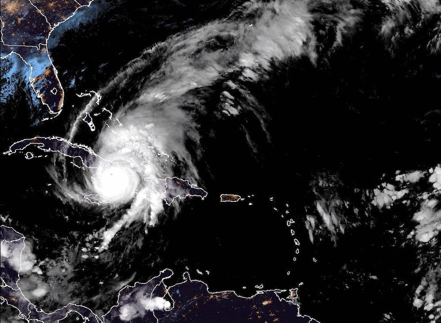
After devastating Jamaica, theHurricane Melissa hit Cuba: the landfall it occurred today, Wednesday 29 October, in Chivirico, in the province of Santiago de Cuba, at 03:10 local time (08:10 in Italy): the Atlantic cyclone hit the Caribbean island after weakening to a category 3 hurricane, but still remains dangerous due to sustained winds up to 185 km/h.
According to the National Hurricane Center, Melissa is moving at a speed of 19 km/h towards the eastern coast of Cuba, where up to 640 mm of rain is expected, with storm waves of up to 3.6 metres: over 900,000 people have been evacuated and a state of alert has been declared in 6 provinces of the island. Meanwhile, in Jamaica the damage caused by the u.s. is being countedstrongest storm ever recorded in the countryat least since records began 174 years ago: more than 500,000 people remained without electricity and the Prime Minister declared the island a “disaster zone”.
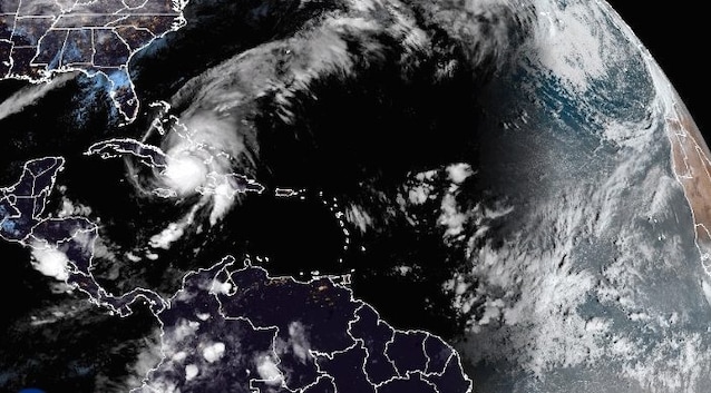
Meanwhile, the alarm has also been raised for the islands Bahamas and the Bermuda, which will be hit in the next few hours with winds expected at 144 km/h and rain accumulations of up to 254 mm.
After Jamaica and Cuba, alarm for the Bahamas and Bermuda: where Hurricane Melissa is going
The trajectory of Hurricane Melissa is constantly visible thanks to the various live trackers: after having strengthened rapidly in recent days, the Atlantic cyclone began to lose intensity once it hit Jamaica and was first downgraded to category 4 on the Siffer-Simpson scale and subsequently to category 3, the current one.
Currently, Melissa is moving in a northeasterly direction towards the east coast of Cuba at a speed of 19 km/h, bringing sustained winds up to 185 km/htorrential rains with accumulations between 254 and 508 mm e waves of storm that could reach the 3.6 meters high.
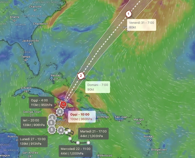
In the next few hours, however, the hurricane will hit Bahamasweakening further to category 2, while by Thursday it will be found near the islands Bermuda. Despite being downgraded, Melissa will still retain its destructive potential, bringing with it winds of up to 177 km/h and rainfall accumulations of between 127 and 250 mm in a few hours.
Meanwhile in Jamaica the damage is starting to be counted: for the moment, the information available is still scarce and communications remain difficult, given that on the Caribbean island 500,000 people have been left without electricity or water due to falling trees and severe flooding. So far we know that the hurricane has 4 hospitals damagedforcing the authorities to evacuate numerous patients, while 15,000 inhabitants are still stuck inside the shelters. On the island, among other things, the authorities also issued a “crocodile alarm”, given that the reptiles could abandon their natural habitats and move closer to inhabited areas after the recorded floods.
Satellite images of Hurricane Melissa
From a wind speed point of view, Hurricane Melissa, initially characterized by sustained winds of 297 km/h, was classified as the second most intense hurricane in the history of the Atlantic Oceanmuch more violent thanHurricane Katrina of 2005: only Hurricane Allen beat it, which in 1980 reached peaks of 305 km/h.
As can also be seen from the satellite image above, Melissa’s destructive potential also depends on its own extension: according to NOAA, in fact, i hurricane-force winds (i.e. above 119 km/h) extend up to 45km from the eye of the storm, while i tropical storm winds (between 62 km/h and 118 km/h) reach up to 295km from the center of Melissa. To be clear, it is as if hurricane winds hit an area as large as the area included between Milan and Bergamowhile those from a tropical storm over an area extending from Bologna to Rome.
Among other things, the hurricane that will make Atlantic history was even photographed by the Sentinel-3 satellite of the European Copernicus mission.
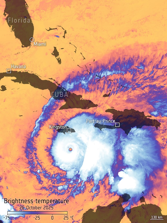
In the image, released by ESA, it is clearly visible how the closer you get to the center of the hurricane, the more the temperature drops, until it reaches -75 °C. On the contrary, inside the eye of the storm (i.e. the most central area of the hurricane) the temperature rises.
As for Melissa, the interior of the storm’s eye was even recorded by hurricane hunters: as you can also see in the video below, theeye of the storm (which forms when the storm system that gives rise to the hurricane begins to rotate faster and faster), is an area that is apparently very calm and clear to the eye, characterized by very low air pressure into which cold air enters from above.