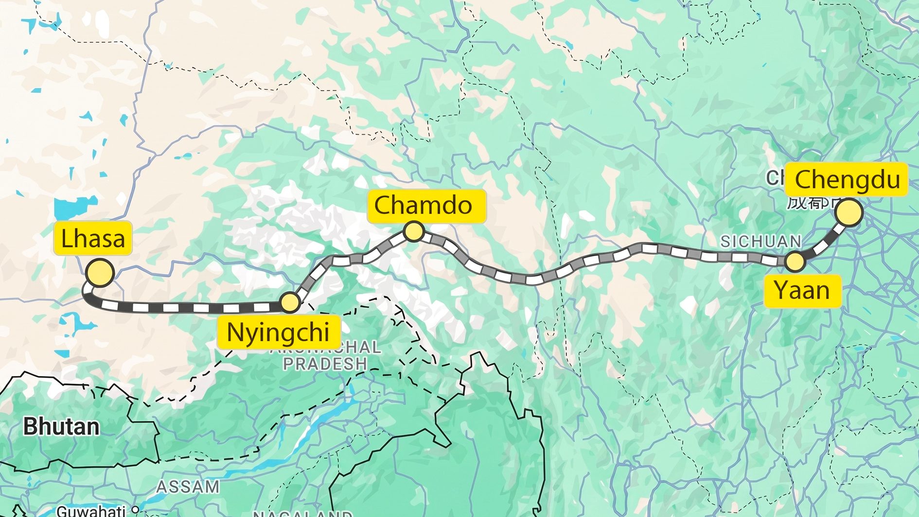
The railway project of Sichuan-Tibet Railway it is considered one of the most difficult ever built in engineering terms. A project that connects Chengdu (500 m above sea level) a Lhasa (3,650 m asl), covering approx 1,629 km. The route, however, rises and falls for thousands of metres, making it one of the most varied routes in the world. The $50 billion infrastructure project will reduce travel times between the two cities from the current 48 hours to just 13-16 hours, with the aim of giving a decisive boost to tourism and economic development in the region and will be operational by 2032.
The Sichuan-Tibet high-speed railway project and route
Conceived to connect the city of Chengdu (500 m above sea level) to Lhasa (3,650 m above sea level), covering approximately 1,629 km, the Sichuan Railway route is one of the most particular and unique in the world. This forces railway trains to climb peaks that can easily reach 4,000 meters in height, and then descend into river valleys that reach little more than sea level. In particular, crossing well 14 major rivers in the region, such as for example Yangtze and the Mekongand crossing well 21 mountains with a height exceeding 4,000 m. Consider that the cumulative difference in altitude of the route is around 14,000 meters!
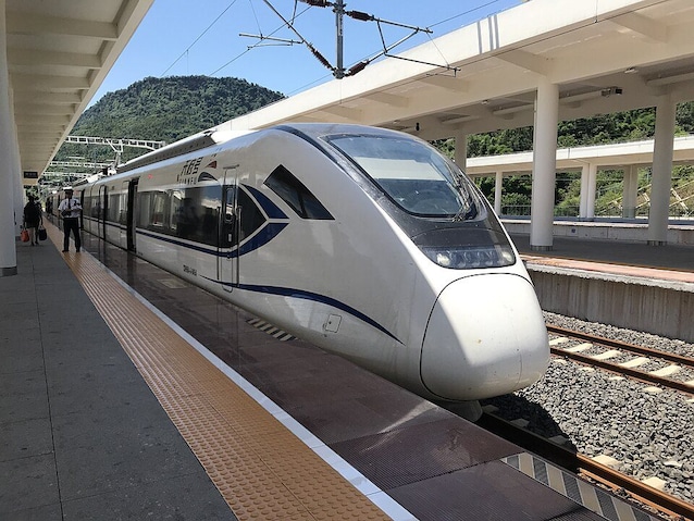
In the central Ya’an-Nyingchi section (the most complex), the 94.8% of the route is viaduct or tunnel. In practice, the train will travel almost entirely “inside” the mountain or “suspended” over very deep valleys. For obvious safety reasons, the maximum speed, also considering the steep slopes of the track, is reduced to just 200 km/h. Construction is expected to be completed by 2032.
Extreme engineering challenges
As anticipated, this very particular project brings with it a series of enormous engineering challenges. First of all, by digging in tunnels located at great depths, geologists and engineers found themselves having to work and design infrastructures capable of withstanding the temperature of the rock which, at those depths, touches the rocks without any problem. 80°, making the work environment very hostile indeed. The route also crosses many collision zones between plates Indian and Eurasian, one of the most active areas, at a seismic level, on the entire planet. The tunnels are designed with flexible joints in shape memory alloys (SMA) to resist possible dislocations of the fault without collapsing.
The economic and political aspects: a 50 billion dollar infrastructure
The project, with a total cost of over 320-400 billion Yuan (~45-55 billion €), has a cost per km of 200 million Yuan. The primary advantage, despite the cost and intrinsic difficulties of the project under construction, is to reduce the journey between the two cities located at the two ends of the route, bringing it from the current 48 hours to just 13 hours.
However, what we can say about this project is certainly related to its important political value, and not just strictly economic. The route, in fact, runs parallel to the “Line of Actual Control” (LAC), the disputed border with India. It therefore allows China to move troops, heavy equipment and supplies in a few hours, where previously it took days on landslide-prone roads.
Furthermore, the physical integration of Tibet with the central provinces is seen by the Chinese government as the main tool for “Sinicization” and social stability, thus drastically decreasing the geographical isolation of the region.